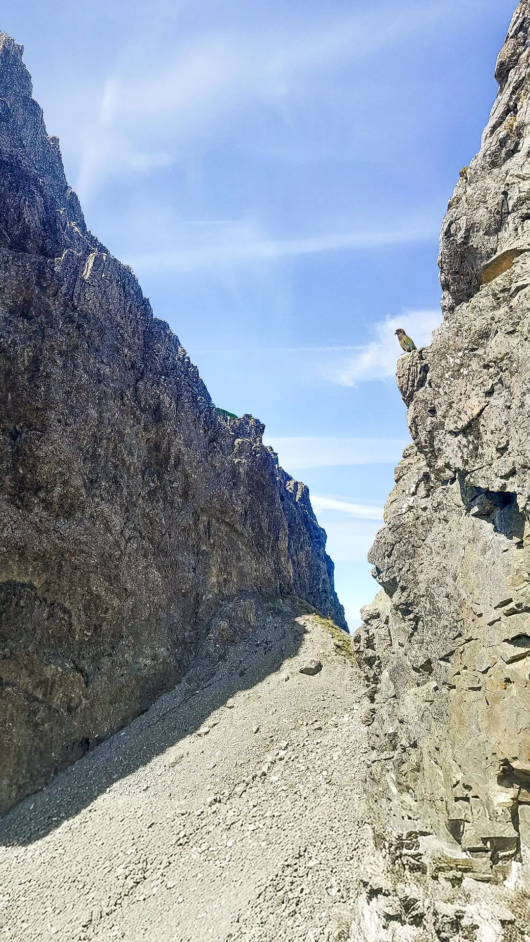
The distinct, rugged rectangular incision or large ‘missing tooth’ in the skyline of the Torlesse Range known simply as ‘The Gap’ is a very popular area for trampers in Canterbury. Because The Gap is easily visible from the Canterbury Plains, the Port Hills, and the Craigieburn Range, its striking silhouette only adds to the allure of this classic South Island ridge tramping route that highlights the incredible diversity of the area without the need for a heavy overnight pack.
There’s also plenty of options for other day walks nearby: Benmore-Annavale Loop & Sugarloaf Summit; Mt Izard; Mt Cloudsley; Nervous Knob & Hamilton Peak Loop.
And in multi-day options in Arthur’s Pass, the Poulter Valley-Binser Saddle Loop or Craigieburn Forest Park, the Cass Saddle-Lagoon Loop.
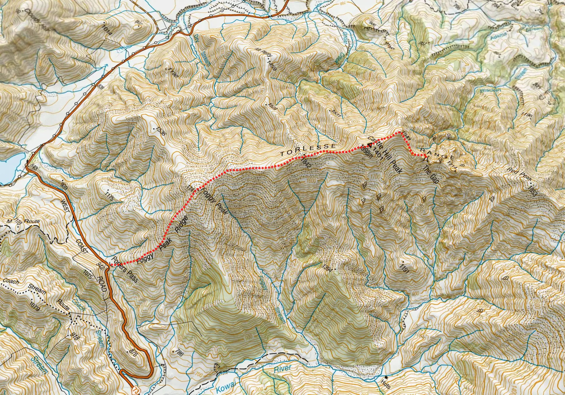
Route Overview
- Time: 4–5 hours (one way) / 8–10 hours return (note: I completed the return trip in under 5 hours with fast walking and some jogging)
- Distance: 14 km (return)
- Elevation Gain: 1,715 m
- NZ Topo Map: B21 Springfield
- Difficulty: Moderate.
- Navigation: Marked only by rock cairns
- Gear: Pack a high-quality windproof jacket, a beanie, and gloves, even if it feels warm at the car park. The weather can change very quickly and there is no shelter on the ridgeline. Particularly in winter, it is a good idea to take a bothy bag shelter to give yourself shelter from the elements during a break or in case of an injury. Gaiters are recommended due to the scree descents
- Best time to go: Summer/autumn (for those experienced in alpine trips – winter/spring)
- Parking: Gravel Lay-by at top of Porters Pass on SH73. Usually there is enough parking here. There is more parking further down the road on the Craigieburn side of Porters Pass.
- Car Security: While parking is on a busy road, it has been known as a spot for opportunistic vehicle break-ins. Do not leave any valuables or extra tramping gear in your vehicle and ensure you lock it.

Section 1: Porters Pass to Foggy Peak (1,741m)
The route begins at the gravel lay-by at the top of Porters Pass (State Highway 73).
The track starts with a few marker poles and rock cairns, quickly transitioning into a well-established foot trail that leads steadily up to Foggy Peak. Keep an eye out for a small false summit along the way—it provides a brief, welcome break from the constant uphill climbing.


Section 2: Foggy Peak to Castle Hill Peak
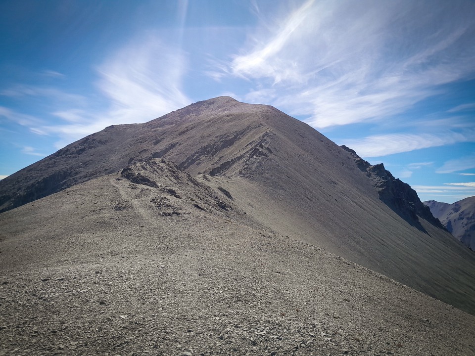
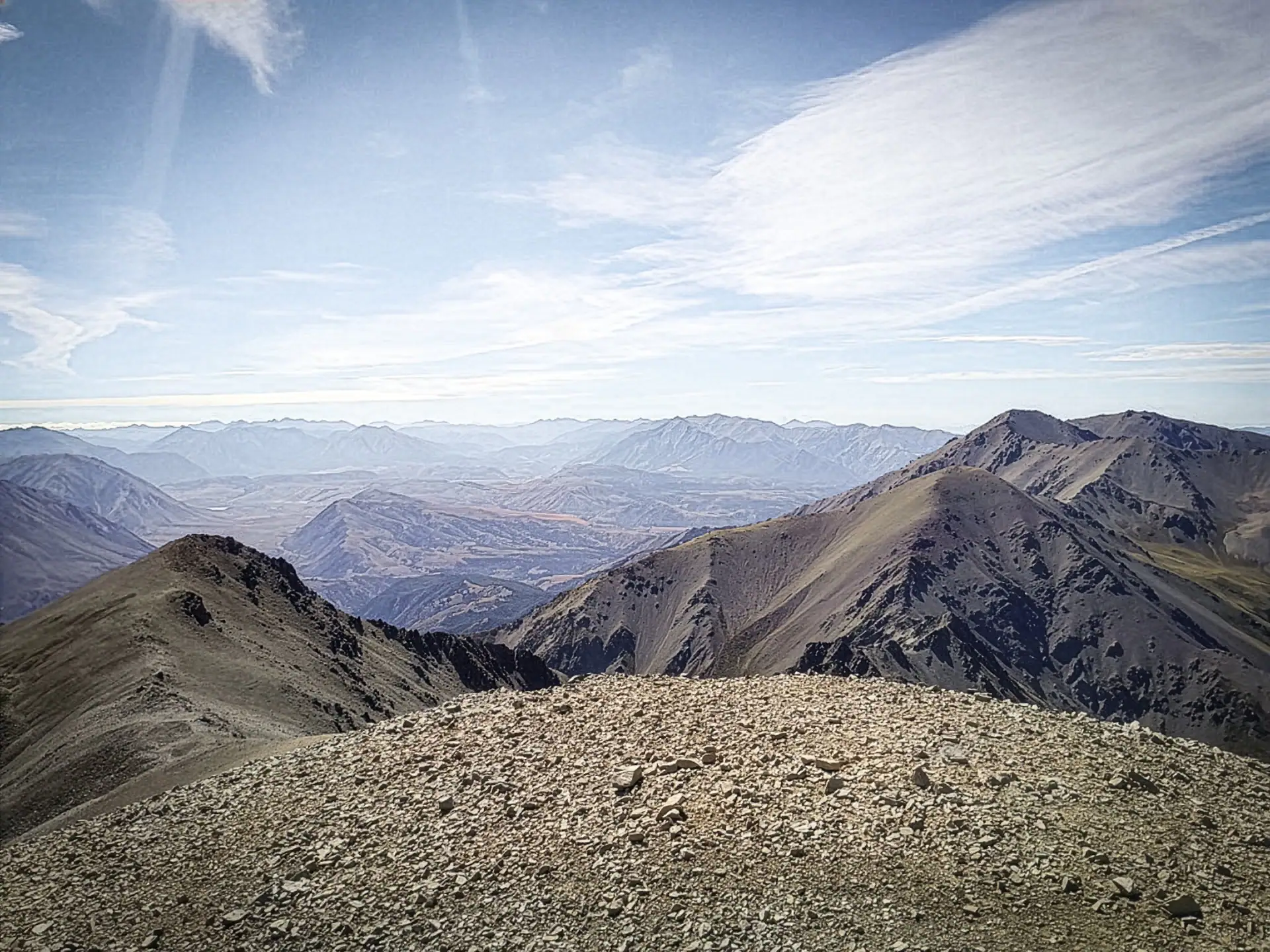
After reaching Foggy Peak, the terrain opens up. A wide ridge leads you over a few gentle undulations to point 1842 which is approximately 1.5km from Foggy Peak. After point 1842, there is a short descent to a saddle before the final climb to Castle Hill Peak about 1km away. The ridge narrows significantly for this final, steep climb to Castle Hill Peak (1,998 m) with drops off on either side that might be more challenging for those less confident. This section is well-marked by cairns and has a clear foot trail. From Castle Hill Peak, there are panoramic views over to the Craigieburn Range, along the Torlesse Range and down to the Kowai River Valley.
Section 3: Navigating to ‘The Gap’
From Castle Hill Peak, the most straightforward route is to climb directly over point 1941, though you can choose to sidle around it if conditions allow.
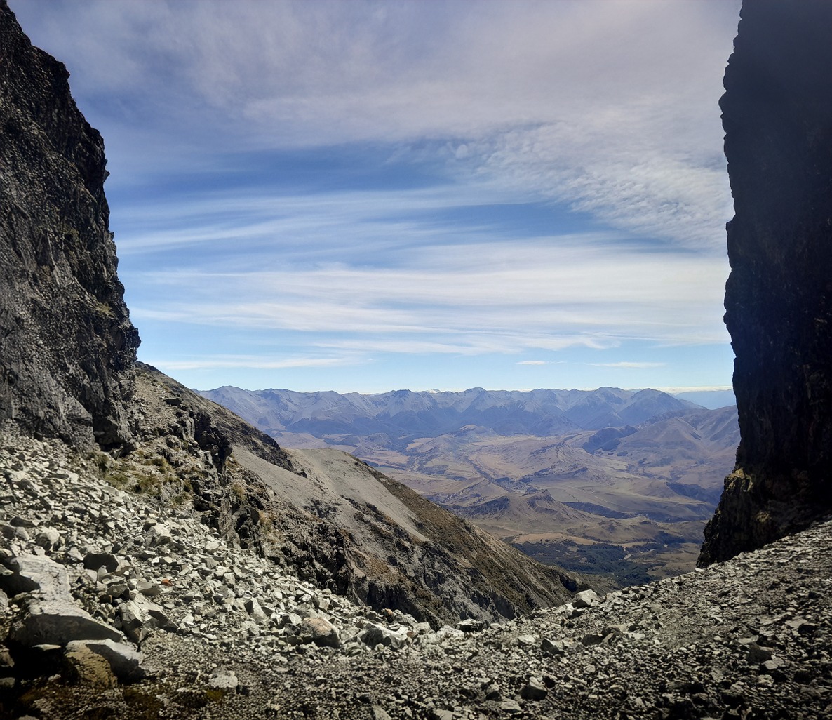
Once past pt 1941, there is no obvious foot trail or cairns and it requires more careful navigation. After point 1941, the ridge follows a south-easterly direction. The easiest route is to sidle just off the north side (left side) until you reach the imposing bluffs safeguarding The Gap as to the right are sheer drop-offs so be careful to stay away from the edge of the ridgeline. To bypass the bluffs, descend roughly 50 meters down the scree slope to a narrow shoulder directly under the bluffs. This shoulder leads you right back up into the heart of The Gap. Standing in the middle of The Gap dwarfed by imposing bluffs on either side while admiring the views out to the Craigieburn Range and Kowai Valley is an unforgettable experience.
Return Options
Here there are two options: return the same way or drop down into the Kowai River. Due to doing this trip solo with my car parked at Porters Pass, I returned the same way.
To drop down to the Kowai River from the Gap, a scree slope and rocky ridge provide a good route down into the valley. It’s then simply a matter of following the Kowai River and 4-wheel-drive road back to SH73. Prior permission must be gained from Brooksdale Station if taking this route and as it is a working station, all gates must be left as found.