Lake Chalice and the Old Man Circuit in Richmond Forest Park is a fantastic weekend tramp. The route goes past the peaceful Lake Chalice before climbing up to Old Man peak that is part of the Richmond Range Alpine Route.
Our trip involved clearing road blockages, navigating swollen rivers and a surreal summer snowstorm. It became a lesson in having flexibility in the mountains and how alternative plans can still be just as fun as the original one.
This guide covers the route, huts, road access, distances, hazards, best season and practical information you need to plan the trip.

Fast Facts Planning Information
- Location: Richmond Forest Park, Marlborough, New Zealand
- Topo50 Map: BR 26 Mt Patriarch & BR 25 Tophouse
- Best Direction: Walking via Old Man Peak (anticlockwise) gets the most climbing and exposed ridgeline done on day 1 with fresh legs
- Difficulty: DOC describes this as an advanced tramping track. It is all well marked. However, the Goulter River is not bridged and could be impassable after heavy rain.
- Start / Finish: Staircase Road (From Northbank Rd, turn onto Top Valley Rd)
- Huts: Lake Chalice Hut, Old Man Hut
- Best Season: Summer-autumn (November – April)
- Dogs: With DoC permits only
- Other tramping trips in Richmond Forest Park: Pelorous Track, Richmond Range Alpine Traverse,
Our Lake Chalice – Old Man Circuit Overview
We had originally planned to do go to Tarn Hut via an off-track route but we quickly realised the rivers were too flooded and instead walked to Mid-Goulter Hut where we decided to do walk back to do the Old Man Circuit as an alternative.
We could have completed this circuit in 3 days but instead stayed the night at Lake Chalice Hut due to the timing of ferry booking.
| Section | Time (hr) | Elevation Gained (m) | Distance (km) |
| Lake Chalice Carpark → Mid Goulter Hut | 5 – 6 | 340 | 16 |
| Mid Goulter Hut → Old Man Hut | 5 – 6 | 986 | 12.7 |
| Old Man Hut → Lake Chalice Hut via Old Man peak | 5 – 6 | 904 | 13 |
| Lake Chalice Hut → Lake Chalice carpark | 1.5 | 414 | 2.4 |
Day 1: Lake Chalice & Mid Goulter Huts
A Blocked Road
Mount Richmond Forest Park wasn’t originally on our radar—this trip was a Plan C. Weather had already canned Plans A and B. As we drove up Staircase Road toward the Lake Chalice carpark, we discovered a 10-meter pine tree had fallen down in the recent storm and was entirely blocking the road. For a second, it felt like Plan D was calling.
Fortunately, we were both made of sterner stuff and determined not to let a mere 10m fallen tree stop us. After plenty of pushing and heaving, we cleared just enough space to squeeze the car past. We reached the carpark safely, and a swift 30-minute downhill walk brought us to the shore of Lake Chalice. We were finally underway.


Flooded Rivers
Our obstacles weren’t over yet though. Heavy overnight rain had sent the rivers into full flood, making a crossing of the Goulter River to reach Tarn Hut far too risky (I later made it to Tarn Hut during my Richmond Range Traverse). We modified Plan C and set our sights on Mid Goulter Hut instead, keeping the option open to bush-bash past Mt Edelweiss and Purple Top towards Tarn Hut later.
After a hearty dinner and toasted marshmallows for dessert, we settled in for a cozy night as light rain pattered on the tin roof.


Day 2: Mid Goulter Hut to Old Man Hut
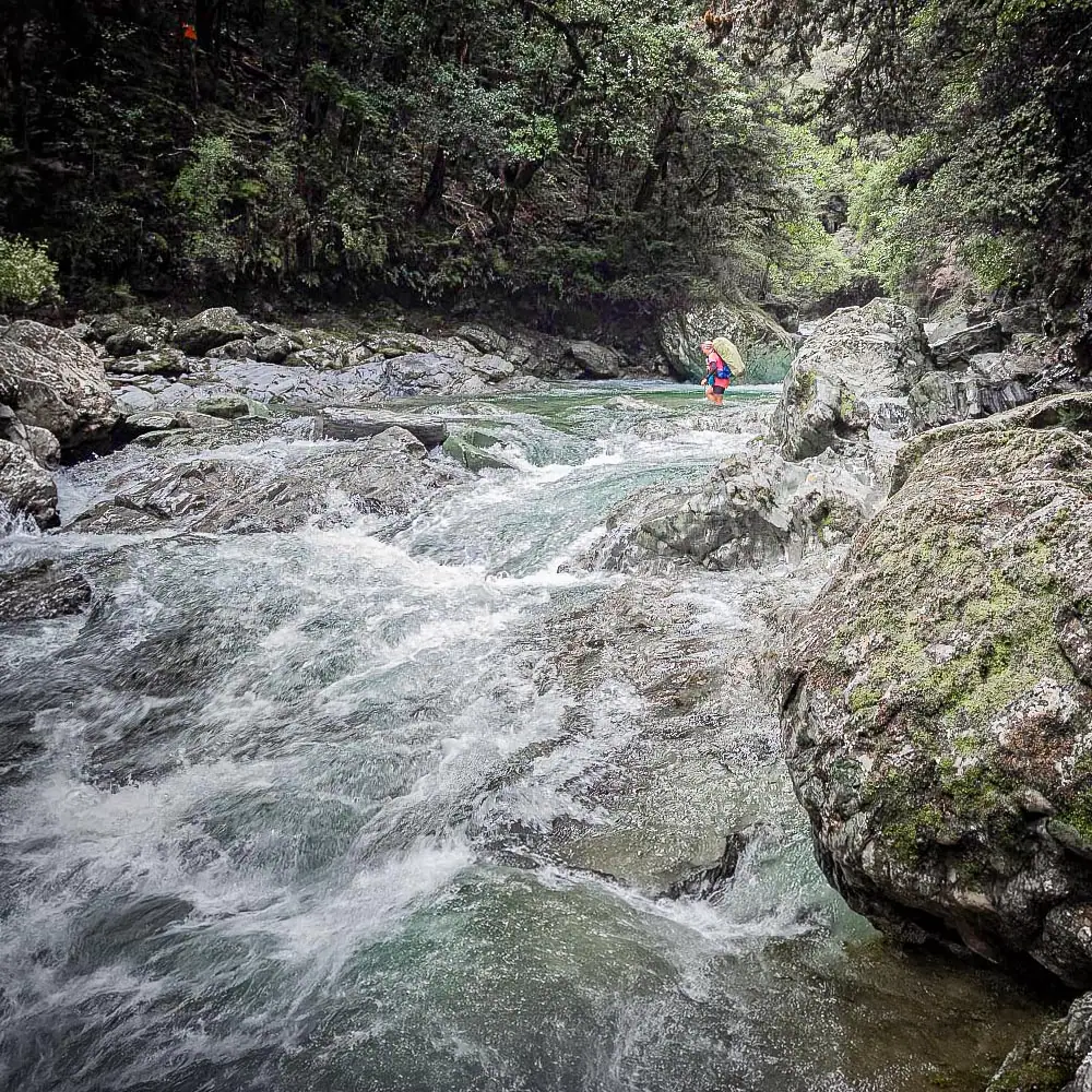
The next morning, we backtracked 45 minutes along the track from Mid Goulter Hut. We bush bashed down to the Goulter River to scout a safe crossing point. Though the water level had dropped slightly, the current was still roaring—and the only potential crossing point sat directly above a set of fearsome rapids. The run out was far too dodgy.
Refusing to take a dangerous risk, we pivoted once again and modified our plan C yet again to head towards Old Man Hut. This route allowed us to cross the Goulter River above the Old Man tributary, where the water flow was significantly lower and safer to navigate.
Climbing Mt Rintoul
By the time we arrived at Old Man Hut, the afternoon was calm and sunny. We brewed a hot cup of tea and relaxed outside at the hut’s picnic table. The torrential rain over the previous few days had caused a little lake to form behind Old Man Hut, testament to the massive flooding in the area.


Resting didn’t last long, though—Sarah soon set off to summit Mt Rintoul and do some recce for completing a Richmond Range Traverse, while Tony opted for the relaxing route: taking photos and sawing firewood.
When Sarah returned, heavy wind and mist were right on her heels. That evening, a massive lenticular cloud swept across the sky, painting the horizon in streaks of black, grey, and fiery red. It was equal parts beautiful and intimidating. We fully expected that it promised a change for the worse in the weather. Inside the warm hut, we enjoyed another fresh veggie meal and toasted the last of our marshmallows.
Day 3: Old Man Hut to Lake Chalice Hut via Old Man Peak
Despite our fears of a storm, the morning broke fine and clear. Our revised plan for the day was a manageable walk back toward Lake Chalice via Old Man Peak.
As we climbed toward the ridge, dark clouds rolled in, the wind whipped up, and gentle snowflakes began to fall. Along the ridge, we bumped into two southbound Te Araroa trail walkers emerging through the mist—the only other trampers we encountered on the entire trip.


Old Man Peak
The snow became heavier as we approached the summit of Old Man and as we started down the other side, we found ourselves inside a blurry world of big falling snowflakes. But we were loving it—there is something crazy and exhilarating about an unexpected summer snowstorm.
Once back under the canopy of the beech trees, we were sheltered from the wind. We climbed up to Point 1522 just as the clouds parted, allowing a tepid sun to warm us up while we ate lunch with panoramic views reaching all the way to the snow-dusted Nelson Lakes peaks.


We wandered back down to Lake Chalice Hut for our final night. Sarah dominated the firewood sawing competition, and we enjoyed our final evening surrounded by quiet beech forest.


Day 4: Lake Chalice Hut to Staircase Road
A Stunning Inversion Layer
The final morning involved an easy one-hour climb back up Staircase Road to the vehicle. Mount Richmond Forest Park had one last surprise waiting for us: as we rounded a bend on the drive down Staircase Road, we were treated to an incredible inversion layer with low cloud stretching all the way to the Cook Strait.
It was a stunning way to end our trip and we are both certain we will be back to explore more of Richmond Forest Park.

Frequently Asked Questions
road access
The Staircase Road (18km) is an unsealed & very rutted forestry road so a 4wd is recommended. A low clearance car could easily get damaged on this road. The road is narrow in places with a lot of sharp corners and has some steep drop-offs. DoC has a great resource here with current road conditions/closures/vehicle recommended. There is plenty of parking space at the Lake Chalice Carpark.
route
The Old Man Hut Route involves crossing the Goulter River. However, the track crosses the Goulter River above the confluence of the Old Man tributary, so the water flow is significantly lower here. It could easily become impassable after heavy rain for those less confident with river crossing skills.
We found the crossing was knee deep and fast flowing after significant flooding in the area.
The track to Mid Goulter Hut has no major river crossings but it does have a number of stream crossings that could be impassable after a significant amount of heavy rain. However, we went after flooding in the region and found none of the crossings to be impassable.
There may be areas of patchy phone reception along Old Man peak or on Mt Rintoul.
huts
No, all of these huts are standard huts ($15 or annual hut pass) that operate on a first come, first served basis. Lake Chalice Hut (8 bunks) has the potential to get busy since it’s so close to the carpark and a very easy walk. Old Man Hut (5 bunks) could get busy over summer due to being on the Te Araroa Trail. Both these huts have plenty of camping space around them.
Mid Goulter Hut (8 bunks) is not a busy hut.