
Planning to tramp the Pelorus Track & climb Dun Mountain in Mount Richmond Forest Park? Spanning Mount Richmond Forest Park between Marlborough and Nelson, this 3-4 day backcountry route combines clear emerald swimming pools of the Te Hoiere / Pelorus River, native beech forest, stream crossings and panoramic views of Tasman Bay with the option of a side trip up Dun Mountain. It’s an achievable trip with easy to organise logistics and many different route options and huts.
This guide covers the route, huts, transport, distances, hazards, best season and practical information you need to plan the trip.
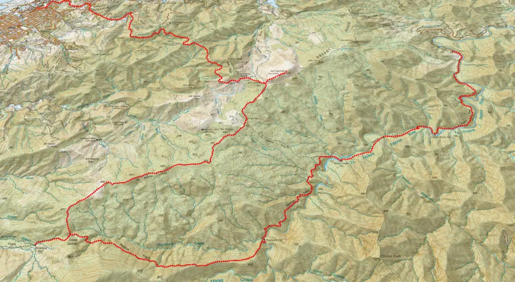
Planning Information
- Location: Richmond Forest Park
- Topo50 Map: BQ 26 Nelson, BQ 27 Rai Valley,
- Duration: 3-4 days
- Difficulty: Advanced overall. The first section to Middy Creek is relatively moderate, but the track becomes considerably rougher and more demanding between Middy Creek and Roebuck Hut, with steep sidles, tree roots, stream crossings and tree fall. The Roebuck–Tōtara Saddle section is more challenging.
- Direction: Can be walked in either direction but my preference is walking from Mt Richmond Road towards Nelson – this means not being constrained by having to meet transport at a certain time as you can simply walk into Nelson on finishing.
- Start / Finish: Mt Richmond Rd (At Pelorus Bridge turn onto Maungatapu Rd before it becomes Mt Richmond Rd). Brook Street (Nelson East)
- Huts: Captains Creek Hut (standard, 6 bunks), Middy Creek Hut (standard, 6 bunks), Roebuck Hut (standard, 6 bunks), Browning Hut (standard, 8 bunks), Rocks Hut (standard, 16 bunks)
- Best Season: Summer due to when it will warm enough for swimming in the river
- Dogs: With DoC permits only
- Other Richmond Forest Park Tramps: Richmond Range Alpine Traverse, Lake Chalice
My 3-day Pelorus Route Overview
Duration: DOC recommends allowing 3–4 days for the Pelorus Track. My three-day itinerary was at the faster end of that range, involving long days and a favourable weather window. If you’re unfamiliar with the route, allow more time rather than using my itinerary as a template.
| Section | Time (hr) | Elevation Gained (m) | Distance (km) |
| Mt Richmond Rd → Roebuck Hut | 7 | 1,064 | 22.4 |
| Roebuck Hut → Rocks Hut via Browning Hut | 8 | 1,387m | 20 |
| Rocks Hut → Nelson CBD | 7 | 405 | 25 |
A Spontaneous Start: Wellington to the Pelorus Track
The idea for tramping the Pelorus Track hit me while cycling home after a string of night shifts over the New Year period. Most people had already left Wellington for the holidays meaning this spontaneous trip would be a solo mission. While I love tramping in a group, solo adventures are equally as fun as they offer a completely different rhythm—pure freedom, complete self-reliance, and plenty of room for personal growth.
On Sunday morning—when I should have been sleeping after my shift—I snagged a last-minute ticket on the Interislander ferry departing in less than four hours. Packing was a frantic blur.
By Monday morning, I was in Picton being picked up by Helen from the Link Bus. Helen had helped me with transport back in 2018 when a friend and I ran the Queen Charlotte Track in a single day, and she surprisingly remembered me as “one of the crazy runners.” She dropped me off at the Pelorus Track trailhead at the end of Mt Richmond Rd by 10:00 AM.
Day 1: Mt Richmond Rd to Roebuck Hut
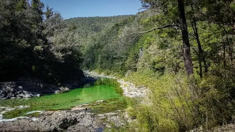
Emerald Pool on the Pelorus Track
The track follows the crystal-clear Te Hoiere / Pelorus River up the valley. Just 40 minutes in, I reached the famous Emerald Pool. There I met Sarah and Andrew, two Te Araroa (TA) through-hikers taking a leisurely morning after camping. They pointed out the best swimming spot—a deep blue-green pool fringed by a sandy beach. I gladly took a dip to cool off under the mounting summer heat. I kept an eye out for blue ducks (whio), though this section of the river was likely a bit too calm for them.

“You’ll Never Get There”: The Man with the Bike
Dragging myself away from the swimming hole, I continued up the track, climbing along a ridge. It was on the trail here that I bumped into a man pushing a vintage road bike loaded with heavy saddlebags.
Given the dense tree roots, steep terrain, rim brakes, and complete lack of suspension, it was no surprise he was pushing it. When he asked me where I was heading, I told him I was on my way to Roebuck Hut. “You’ll never get there.”
I thanked him politely for his warning. I was quietly confident that with my experience, good fitness, determination and a tent in my pack, I had all the flexibility I needed.
By 1:00 PM, I reached Captains Creek Hut for lunch. Another quick river swim later, I was back on the trail.
Captains Creek Hut to Middy Hut: Swingbridges and ‘Night Shift Brain’
From Captains Creek Hut, it was an easy undulating 1.5 hour-long walk across picturesque swing bridges across Captain Creek, Fishtail Stream and the Te Hoiere / Pelorus River itself to Middy Creek Hut. At the junction just past Middy Hut, most Te Araroa walkers take the track directly up to Rocks Hut but I was continuing along the Pelorus track towards Roebuck Hut.

Middy Hut to Roebuck Hut
The trail after Middy Hut became noticeably more technical, featuring steep sidle tracks, stream crossings and fresh tree-fall. Sleep deprivation from night shifts caught up with me at some messy tree fall: I lost the trail markers and spent ten minutes picking my way around all the tree falls, only to realize I had completely circled back on myself. Classic night shift brain. Laughing at my own idiocy, I got myself back on the track to Roebuck Hut.
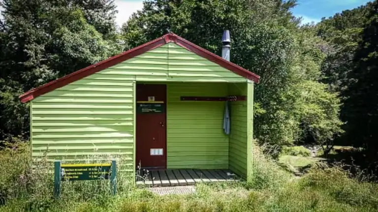
After a final descent, I crossed the Te Hoiere / Pelorus River on the swingbridge to reach Roebuck Hut. I gave the door a push, startling the sole occupant inside who had already bolted it for the night assuming no one else was going to turn up.
Instead of pitching my tent, I opted for a cozy, bug-free hut bed, finished the evening with one last starlight swim, and called it a day.


Day 2: Roebuck Hut to Rocks Hut via Tōtara Saddle
Roebuck Hut to Tōtara Saddle
Day 2 started with a steep climb up a ridge between Roebuck and Mates Creeks to get my heart rate elevated instantly, before leveling off into a high sidle above the valley with a number of fallen trees to scramble over. Just before Tōtara Saddle (690 m), the track descended into some gullies before a short and steep climb to the saddle.
Detour to Browning Hut
Although Browning Hut was a 30-minute detour from my direct route, I decided to head down for a midday break. Along the way, I passed two mountain bikers on e-bikes who had ridden in from the Hackett road-end. I soaked up the midday heat over lunch at the hut before gearing up for the climb back up to Tōtara Saddle.
⚠️ Route warning: DoC advise that sections of the track between Roebuck Hut and Tōtara Saddle have been washed out. The ground is unstable and caution is required at all times. Do not attempt this section in or after periods of heavy rain.
Tōtara Saddle to Rocks Hut
The steep climb up toward Rocks Hut involved a lot of stopping and chatting. I met several southbound (SOBO) Te Araroa hikers pushing hard to beat a heavy weather front predicted for Thursday.
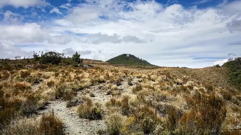
As I broke out of the bush into an open patch of tussock land associated with the mineral belt, the views opened up dramatically along the Richmond Range and Nelson area. The track continued through bush and rock outcrops. This section has a lot of tree roots and can be slow with tree fall. I finally arrived at Rocks Hut just as my water bottles ran dry. Despite expecting a packed house, there were only 8 of us in the hut for the night. After dinner, I took the short side-trip up to Rocks Lookout to watch the golden hour light spread across the Richmond Range and Tasman Bay
Day 3: Rocks Hut to Nelson CBD on Dun Mountain Trail
My final day was a scenic walk out to Nelson via the Dun Mountain Trail. I had run the Dun trail back in 2014 and always promised myself I’d return to summit Dun Mountain which forms part of the Bryant Range. I’ve since returned to the Dun Mountain Trail when I completed the Richmond Range Traverse.
Dun Mountain (1,129m)
At Dun Saddle I dropped my pack and made the easy climb up to the summit of Dun Mountain (1,129). This high point offered incredible panoramic views. I could see down to Nelson City and across Tasman Bay toward Abel Tasman National Park. It is most definitely worth the extra 169m of climbing and 1 hour return detour.


Dun Mountain Trail
From Coppermine Saddle I was on an easy gentle downhill gradient track on the Dun Mountain Trail around Windy Point before the trail entered the bush. This track follows the old Dun Mountain Railway which served the chromite and copper mines in the area until 1866. It felt like rush-hour traffic compared to the quieter Pelorus Valley. E-bikes have made the Dun Trail immensely popular, and it was fantastic seeing so many families out enjoying the trail.
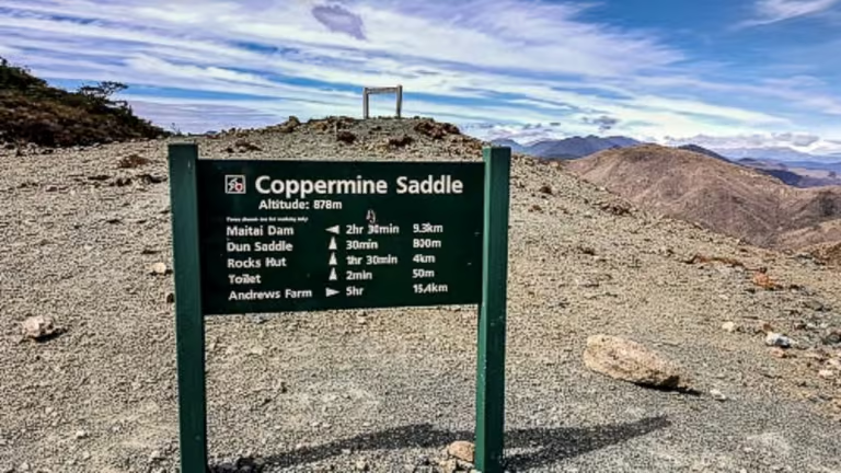
The track dropped me down into Brook Street where it was a short 3km walk back into Nelson CBD.
Top Tip: There are a variety of tracks you can take down to Brook Street that are marked on the map.
This trip was the perfect way to reset after a busy run of work. The easy logistics, crystal-clear Pelorus River and numerous opportunities for a swim made it an unusually enjoyable summer tramp. And, after first thinking about it back in 2014, I finally got to climb Dun Mountain.
Frequently Asked Questions
Route
The Department of Conservation (DOC) classifies the Pelorus Track as Advanced (Tramping Track). While the first section from the trailhead to Emerald Pool and Captain Creek Hut is relatively easy-to-moderate and all major river crossings are bridged, the upper sections toward Roebuck Hut and Tōtara Saddle feature rougher terrain, steep sidles, tree roots, and unbridged stream crossings. Allow more time for this section. It is still very much achievable with careful planning and a good weather window.
Major river crossings across the Pelorus River and larger tributaries (such as Captain Creek and Fishtail Stream) have swing bridges. However, smaller side-streams are unbridged. Do not cross a stream in flood or a stream that you are not confident you can get across safely.
Yes! The Pelorus River is famous for its crystal-clear emerald waters and deep swimming holes. The most popular spot is Emerald Pool, located about 1hr (3 km) in from the Mt Richmond Road. Pristine swimming spots can also be found near Captain Creek Hut, Middy Hut, and Roebuck Hut.
Eels live in the river in this area so if you are swimming remember you are in their home. If they feel threatened, they have been known to bite people (only a very small graze). This is very rare though as eels usually avoid people and are mostly active at night.
HUTS
No. The huts are standard DOC huts and do not require bookings. Carry hut tickets or a Backcountry Hut Pass. They are first-come, first-served, and huts can fill during busy summer periods especially as the track is part of the Te Araroa Trail.
Huts along the Pelorus Track include Captains Creek Hut (6 bunks), Middy Hut (6 bunks), Roebuck Hut (6 bunks), Browning Hut (8 bunks), and Rocks Hut (16 bunks).
Yes, but not all of the Pelorus Track forms part of the Te Araroa route. Te Araroa follows the Pelorus River to Middy Creek Hut before climbing to Rocks Hut, while the Pelorus Track continues to Roebuck Hut.
Logistics
There is no public transport up Mt Richmond Road to the start the Pelorus Track. The best way is to organise a shuttle and use the providers listed in the Te Araroa Notes.
At the Nelson end, it is a 3km walk from Brook Street into Nelson CBD