
Identifying the Forgotten Highpoint: Point 2757
While Paretetaitonga is widely recognized as the second-highest peak on Mt Ruapehu in Tongariro National Park, a higher point on the summit ridge often goes unnoticed. Located further south lies Point 2757, informally known as Te Ātaahua—meaning “the beauty.” To those looking up from the Turoa skifield, this sharp spike is frequently called the “Shark’s Tooth.”

The Ascent: Autumn Conditions on Turoa
Having already climbed Tahurangi and Paretetaitonga, the goal for this trip was to summit Te Ātaahua. We timed the mission perfectly, catching a fine weather window in early May following a fresh autumn snowstorm that had stuck around on the southern side of the mountain. Our first adventure with crampons for the year!
Starting from the Turoa skifield, we initially aimed for the Mangaturuturu Glacier, putting crampons on at around 1,900m. However, seeing the exposed rocks caused by the glacier’s recession, we pivoted to a direct westward ascent. The snow remained firm for most of the climb providing fantastic cramponing conditions, though it softened significantly as we neared the crater ridge, slowing our progress. Due to it being autumn, there was simply not enough snow for there to be an avalanche risk.


Top Tip: Always use the NZ Avalanche Advisory to assess the avalanche risk and assess the route for safety. This route is not marked and will require alpine gear in autumn, winter & spring.
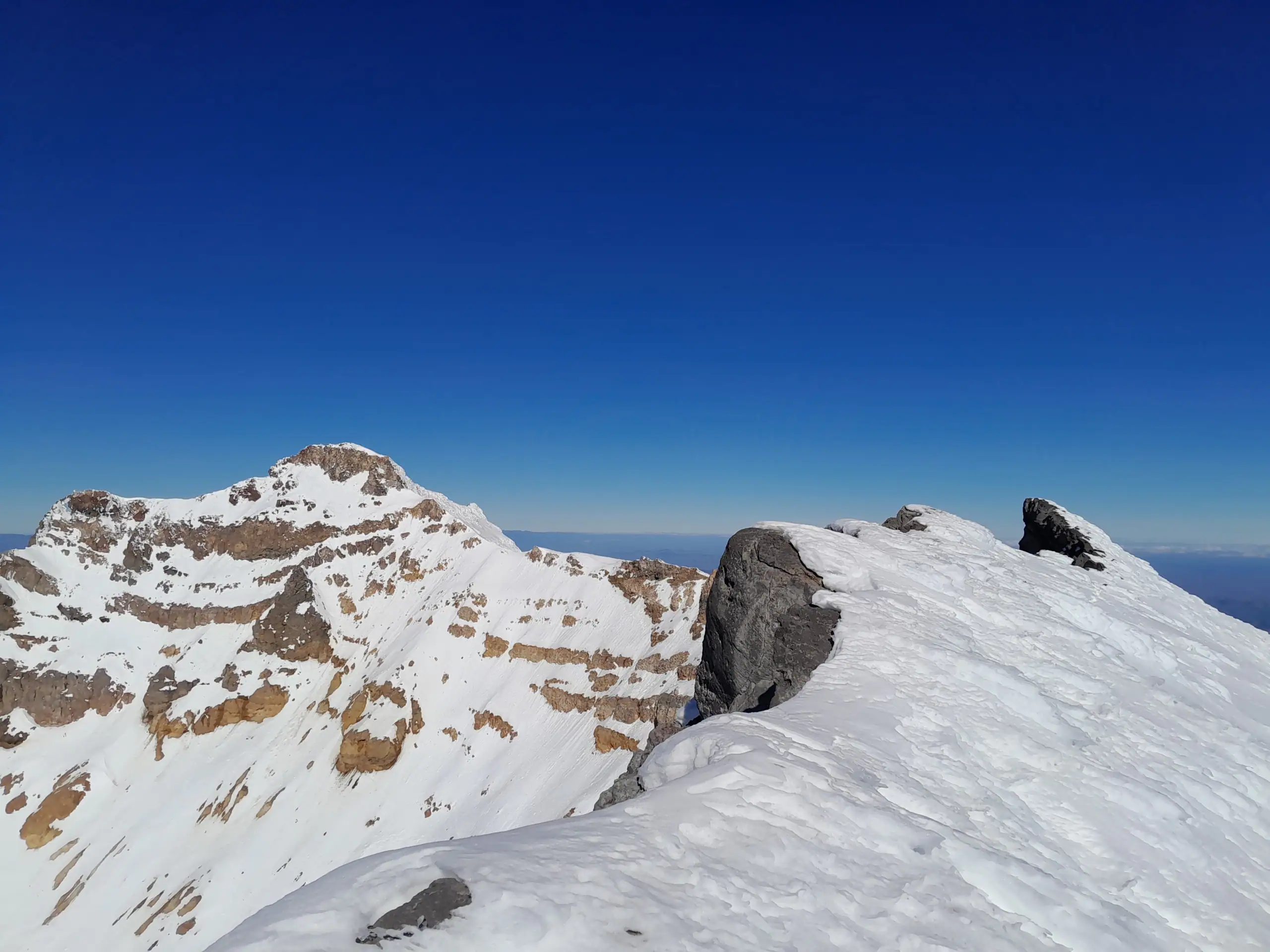
Once on the ridge, a short sidle south led us to Te Ātaahua, stopping just short of the physical summit out of respect. Interestingly, the “spike” seen from the skifield is barely discernible once you are standing on the high point. Despite its subtle profile, it offers a unique perspective of the Crater Lake outlet and stunning views stretching across to Mt Taranaki and along the ridge to both Tahurangi and Paretetaitonga.


Views and the Descent
The descent was very straight forward, while it can feel a bit intimidating due to looking steep, it’s actually a very manageable grade 1 slope. Descending is always fun (for more descending fun see here).


Topo Map BJ34 Mt Ruapehu
Te Ātaahua: 6-8hr | 9.2km | 1,234m elevation
In Autumn, Winter & Spring alpine gear including crampons, ice-axe and helmet will be required as well as a knowledge of the avalanche advisory and alpine navigation skills. A bothy bag should be carried as shelter in case of injury or for protection from the elements during breaks.
Trip completed May 2026