
When the Tongariro National Park map was updated recently, Tony noticed a new marking north of the Upper Tama Lakes track: Ngā Puna a Tama / The Springs of Tama.
These springs are named after the Māori Chieftain Tamatea, captain of the Tākitimu canoe, who explored the area six centuries ago. Our goal for the day was to investigate these springs.
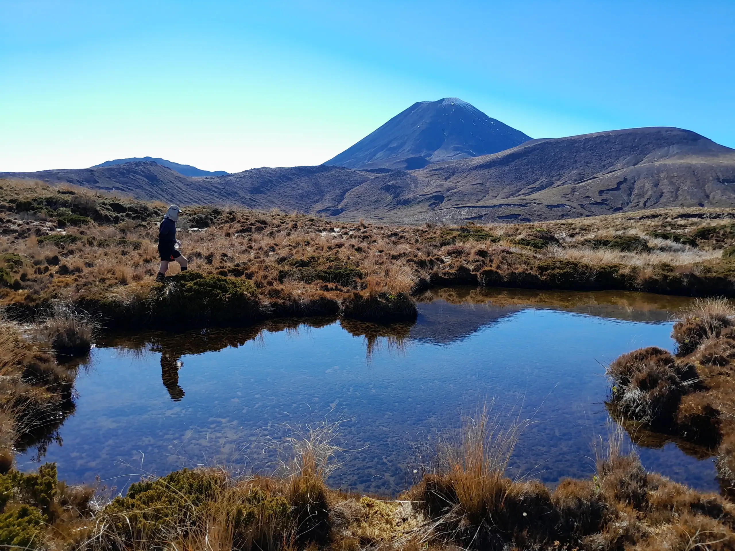
Hunting for Ngā Puna a Tama / The Springs of Tama
The initial walk along the standard Tama Lakes Track follows a well-graded trail for about 8.5km. Ngā Puna a Tama are located off the track. The springs sit roughly 800 meters north of the Upper Tama Lake Track. They are very easy to navigate to through the sub-alpine scrub.
On a calm day you will be rewarded with a beautiful reflection of Mt Ngāuruhoe on the surface of the spring.

From the springs, we pushed onwards north-east toward a small saddle at point 1431, before making a steep descent into a quiet valley. We stopped for lunch right next to a pristine tributary of the Makahikatoa Stream.
Solo on Pukekaikiore: Scree, Scrambles, and Wildfire Scars
After lunch, Tony sent me off on a longer loop to summit Pukekaikiore to burn off excess energy. He would take a more direct route to our planned rendezvous at point 1650. I sped off, knowing I had a fair amount of ground to cover.

I’ve climbed Pukekaikiore a few times before—both from the Mangatepopo Track and traversing around from the Upper Tama Lake—but never from the south-west. The terrain required crossing a few straightforward gullies before I finally gained the ridgeline leading to the summit.
Environmental Note: Even on a hazy day, the demarcation line in the landscape was stark. The devastating 2025 wildfires burnt through more than 3,300 hectares here. From the summit, I could see Mt Tongariro and Pukeonake. Pukeonake, the lowest named volcanic peak in the park that I climbed a few years back, was heartbreakingly one of the areas worst hit. While the fragile native flora and fauna will take decades to fully recover, invasive weeds risk aggressively taking over the landscape in the meantime.
Navigating the Razor-Sharp Lava Fields
Dropping off the summit, I followed the obvious ridge line until the route dropped me straight onto the volcanic rocks beneath Mt Ngāuruhoe
Walking on this loose scoria is like trying to balance on razor-sharp marbles. Having walked this section before, I used that knowledge to choose an easier route. I dropped down to the 1,560m contour line and maintained that level across multiple gullies. This route had me spending far less time on the sharp volcanic rocks that had greatly slowed us down on the previous trip to Pukekaikiore.

I sidled under point 1651 and took a cheeky shortcut straight down into a gully, before climbing up to the ridge toward point 1650.
During the climb, I spotted Tony making his way up. I waved frantically multiple times, but he missed me entirely in the terrain. I backtracked to wait for him at 1650. When he finally topped out, he was completely stunned to find me already sitting there waiting for him! He had sidled around 1651 and the top of the gully after deciding it looked too steep. I had admittedly lucked out and found one of the safe descent options into the gully.

A Sunset Finish
We made it back to Upper Tama Lake just as the sun dipped below the horizon, stopping to enjoy the incredible golden hour. Hauhungatahi, Mt Ruapehu and Mt Taranaki were all on display.


As we walked out in the dark, a thick, localized alpine fog rolled in. Visibility dropped to just a couple of meters. It felt like we were navigating inside a tunnel with the light of our headlamps bouncing back at us. But in typical alpine fashion, just as quickly as it had closed in on us, we eventually walked right out of it into a clear evening. It was back up to the WTMC lodge where a dinosaur escaped into the kitchen to make chocolate chip cookies…..


Topo Maps BJ 34 Mt Ruapehu & BH34 Raurimu
9 – 10hr | 1,375m elevation | 28km
Trip Completed May 2026