New Zealand’s 14 National Parks offer world-class tracks, but “true wilderness” areas intentionally devoid of huts, signs, or bridges—remains a rare find for the North Island tramper. Most of our designated wilderness areas are buried deep in the Southern Alps, yet one of the most accessible sits right on the western slopes of Mt Ruapehu in Tongariro National Park. For the tramper with reliable navigation skills and a taste for cross-country travel, the Hauhungatahi Remote Experience Zone (Wilderness) provides a raw, solitary alternative to the crowded Great Walks, starting just a short distance from Whakapapa Village.
NZ’s Wilderness Areas
New Zealand has 14 National Parks (counting Te Urewera) that cover over three million hectares, or about 11 percent of our land area. Together with numerous conservation parks, including forest parks, we are fortunate to have many of those scenic and bio-diverse areas that remain under some form of protection.
But we have relatively few true wilderness areas—areas that do not have huts, tracks, bridges, signs or mechanical access. And those we do have are mostly extremely remote, such as the Adams, Hooker and Olivine Wilderness Areas that are all on the western side of the Southern Alps and difficult to get to.
Hauhungatahi Remote Experience Zone
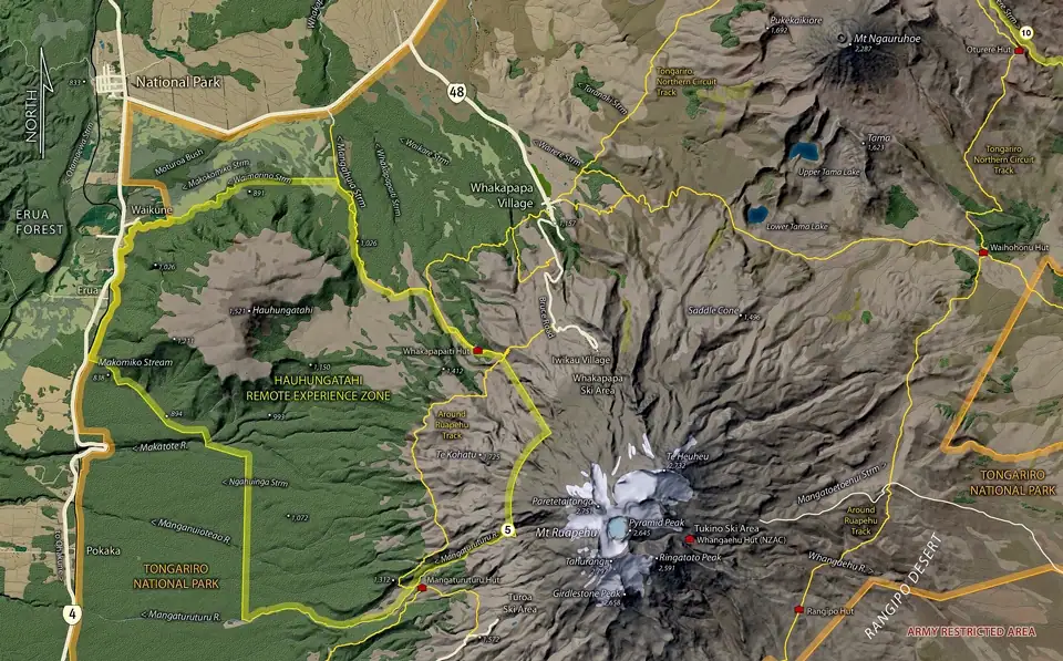
However, for the tramper with basic navigation and cross-country travel skills there are two designated wilderness areas (now termed Remote Experience Zones) that are relatively easy to access—and they are both in the North Island in one of our most visited parks—Tongariro. Te Tatau Pounamu is on the eastern side of Mt Tongariro, while Hauhungatahi is on the western slopes of Mt Ruapehu.
Both of these are small—less than 10,000 ha, and do not strictly comply with the requirements for a true wilderness such as adequate size and a well-defined buffer zone. Nonetheless they are both worth visiting with Hauhungatahi also offering a peak to climb. Hauhungatahi is the oldest volcano in the park at over 1 million years, and at 1,521m the sixth highest named volcano in NZ after Ruapehu, Taranaki, Ngauruhoe, Tongariro and Pukekaikiori.
Hauhungatahi peak is as a long day walk or better as an overnight trip. The summit track that once existed from the township of Erua is now well overgrown and difficult to find and follow (plus it involves a prohibited crossing of the Main Trunk Railway) and is very seldom used. But there is a more interesting route anyway.
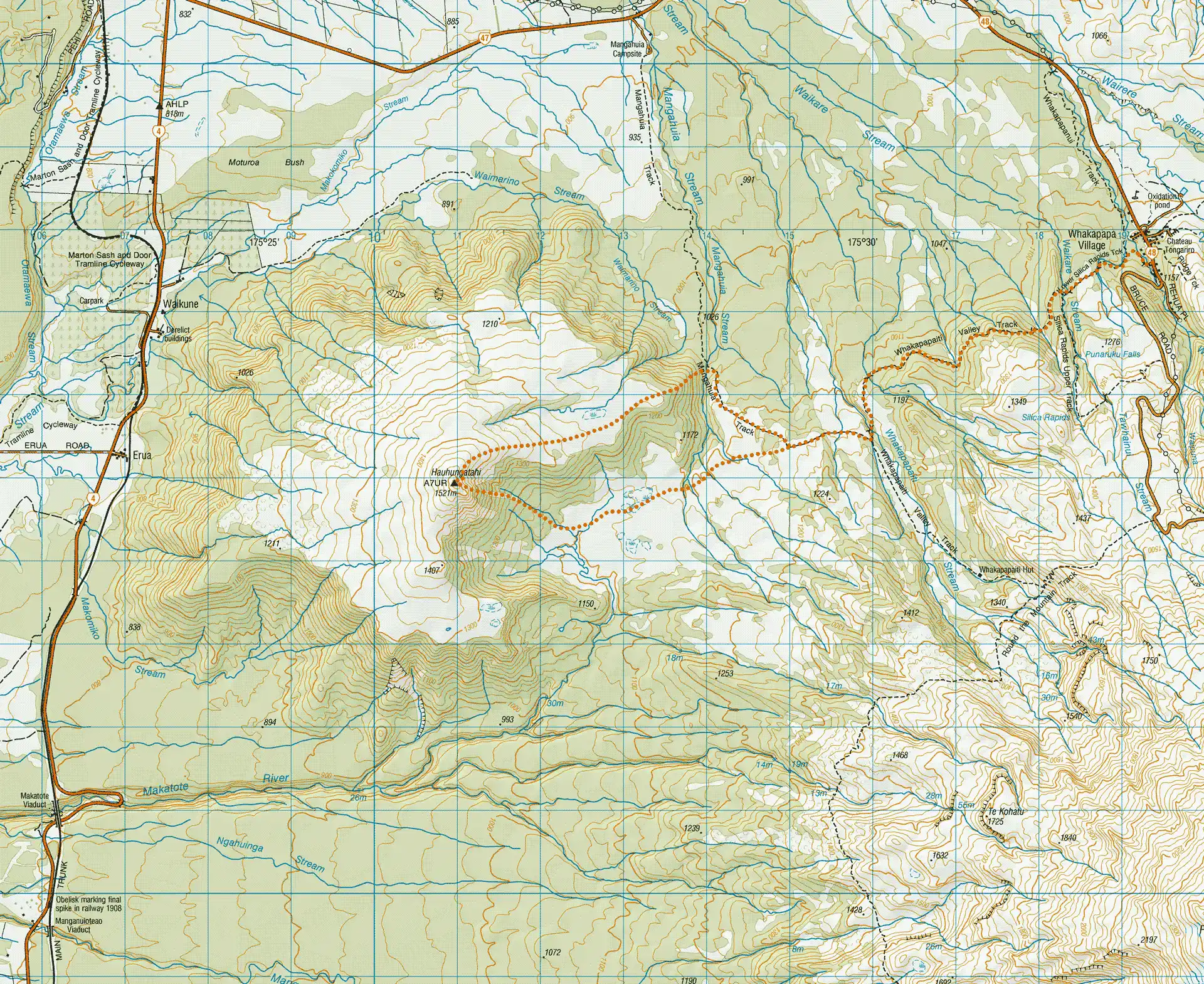
Leave your car at the Whakapapa Village carpark and head off along the track signposted to Silica Rapids and Whakapapaiti Hut. This is a very easy graded and bridged pathway that winds through charming beech forest. After about 1½ hrs there is a marked track junction with a sign to Maungahuia camp site on SH47. Follow this track for about another 20 minutes until it turns right and heads North West and another sign appears on your left.
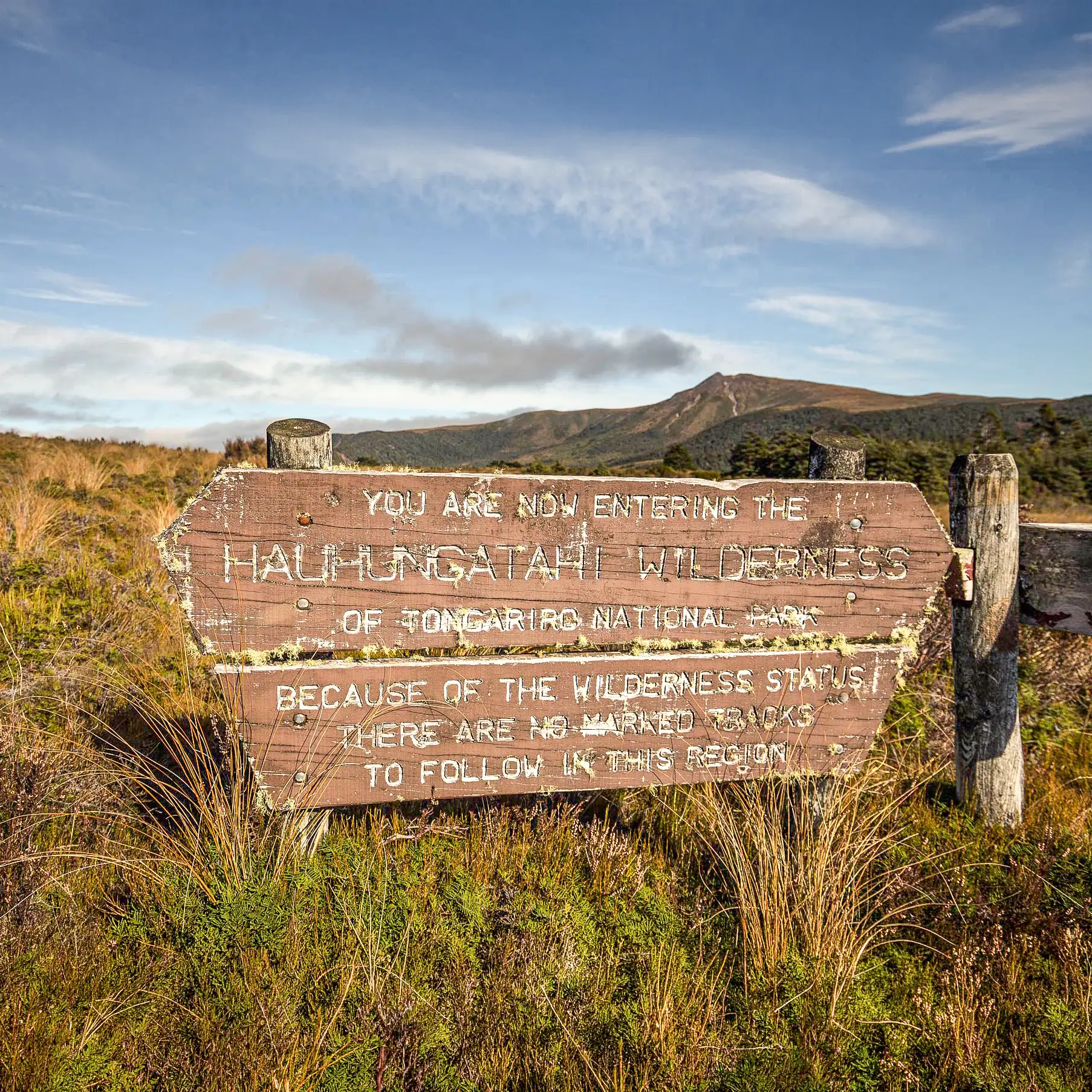
Hauhungatahi Wilderness Boundary
Stop here for a moment, because from now on you are on your own—the sign reminds you there is only wilderness where you are heading! If you have fine weather and can see where you are going then you want to head towards the far end of the wide shallow basin directly under the summit of Hauhungatahi itself. If you can’t then you need a compass bearing (or GPS) that will get you there. You should maintain roughly your same height most of the way—the altitude at the far end of the basin is almost the same as where you left the track.
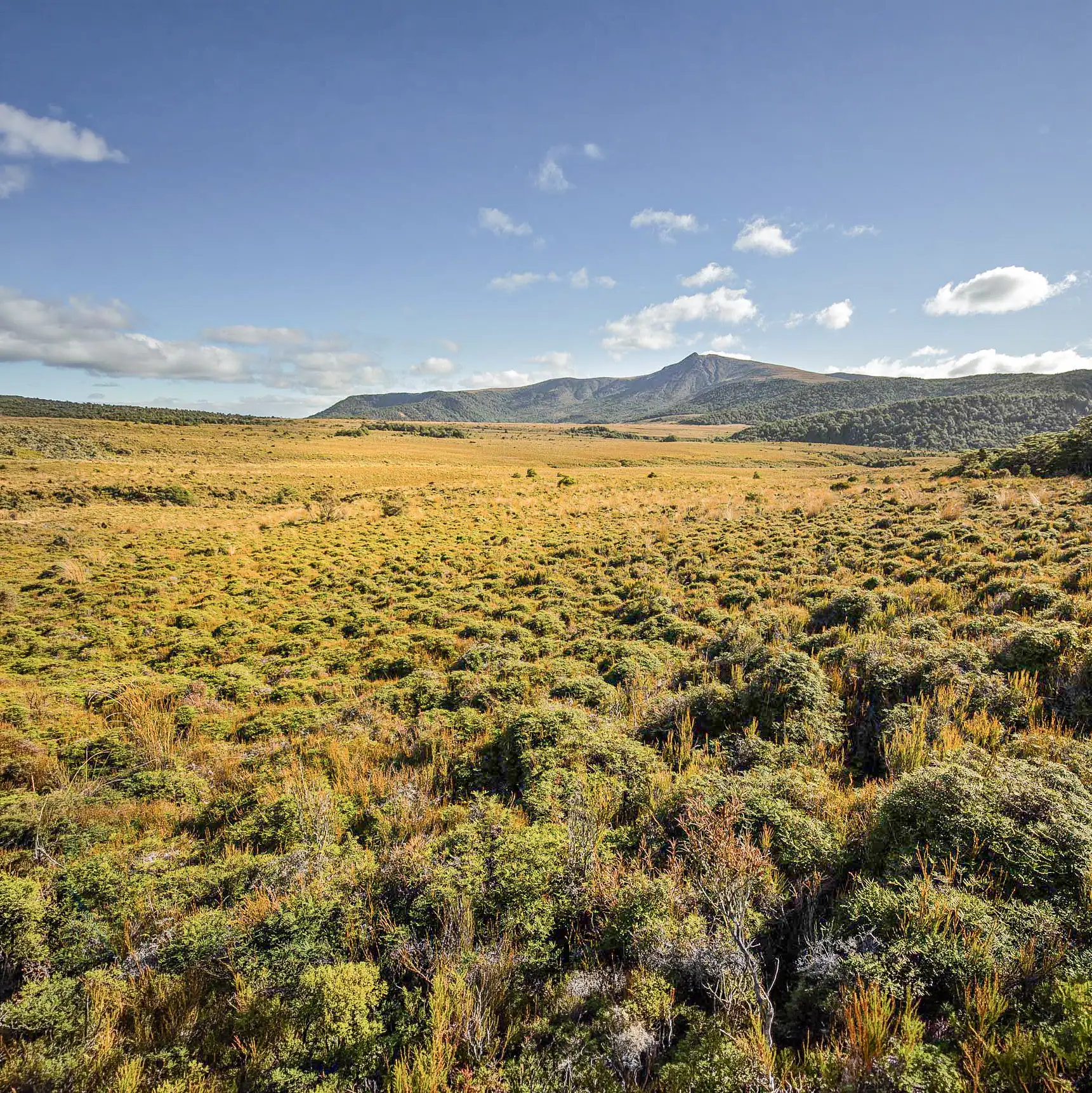
The travel is mostly reasonably easy alpine tussock—except there are about five creeks to cross. And these are interesting because they run in quite deep scrub filled gullies that are not straightforward to climb down into and then up the other side unless you are either lucky or look around a while to find the easiest crossing.
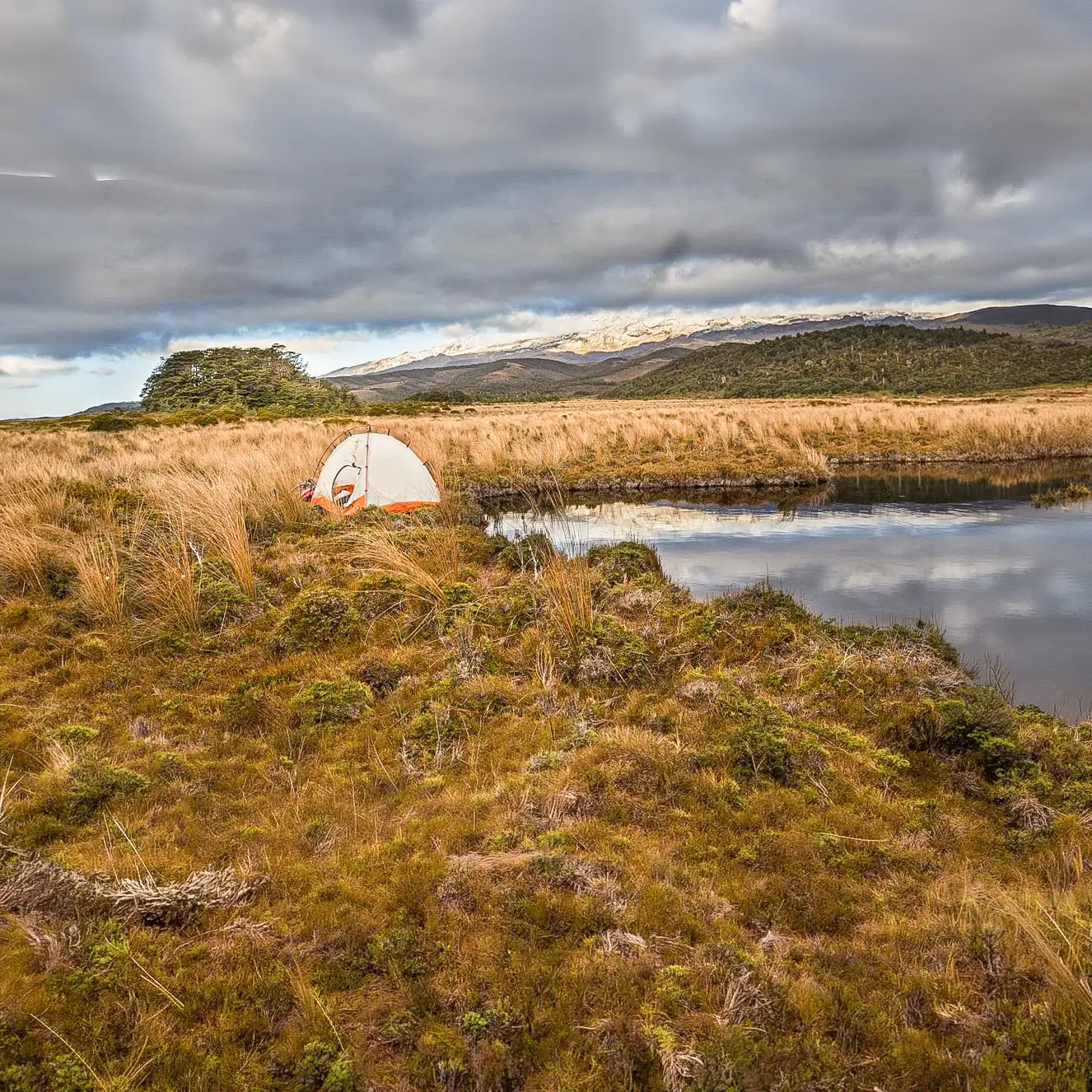
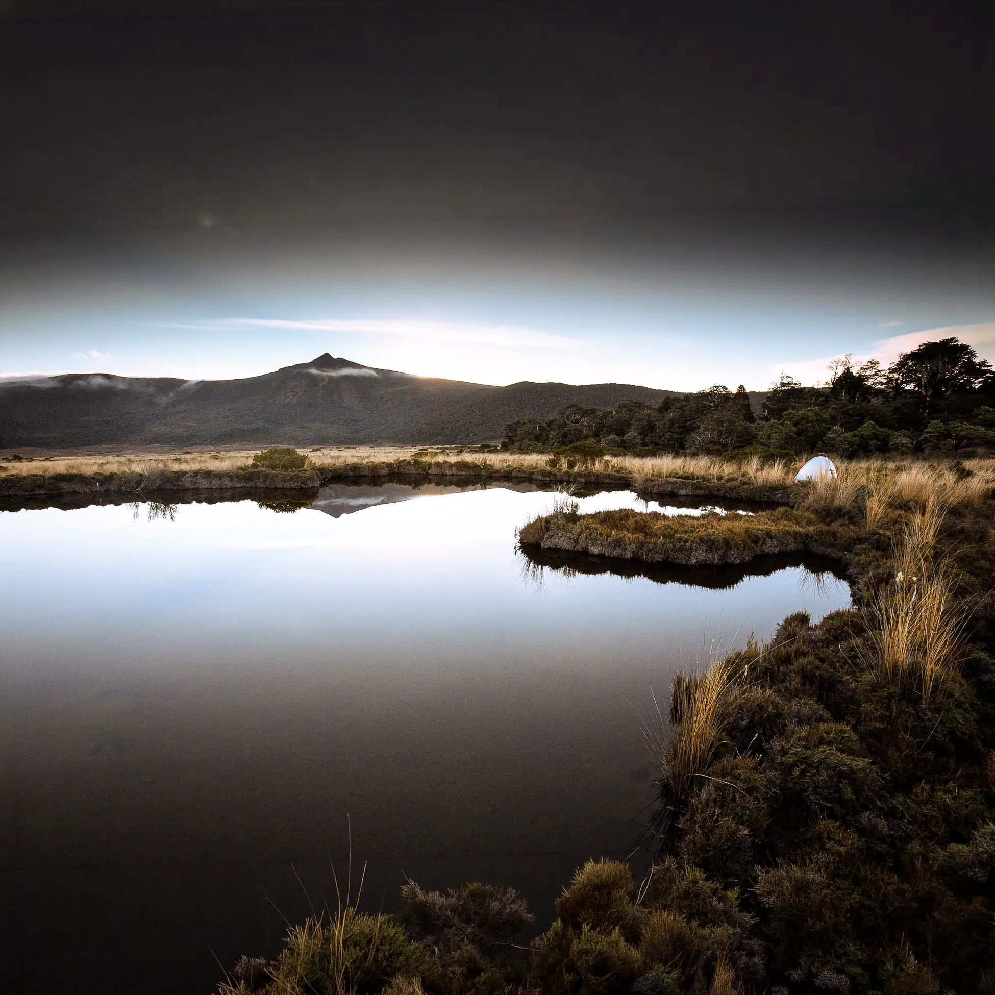
Camping by the tarns
Within the basin there are a number of attractive tarns and good dry campsites can be found on the higher ground between them. If you are camping then this the best place to stop and pitch your tent, although if you scout around in the nearby patches of beech forest there are the remains of cozy camp sites—one complete with a frying pan hanging from a tree.
To the summit of Hauhungatathi
From here to the summit of Hauhungatahi is a matter of choice and route finding ability. There are patches of scrub to push through and in places the eroded stream gullies actually make for the easiest travel—just watch you don’t send rocks down onto others below. Between two and three hours scrambling will get you to the top.
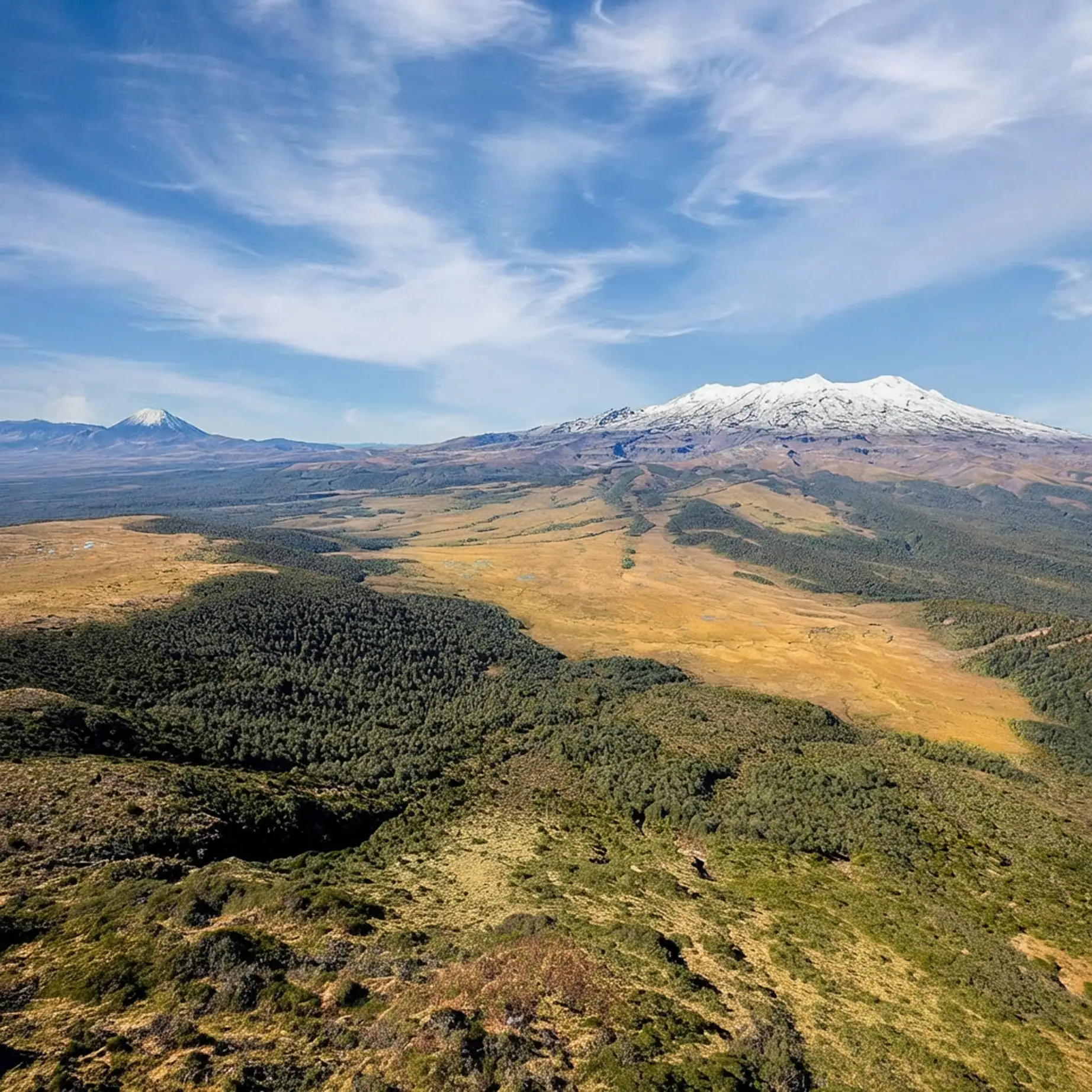
Once on the summit on a good day the view is wonderful and well worth the effort. All the highest peaks in the park, Ruapehu, Ngauruhoe and Tongariro, are visible, as well as Taranaki in the other direction. Below are the tussock meadows with their remnant patches of beech forest, and the many tarns—it certainly is a grand vista.
Tranquility of the wilderness
Then back to camp for the night with the sound of the moreporks calling from the surrounding forests. And finally return to the car by the same route the next day.
Loop hike
It is possible to make a loop by heading north-east down the broad ridge from the summit of the peak and then cross the Maungahuia Stream on the bridge to re-join the track there — although there is a short bit of fairly serious bush-bashing to get through the scrub and into the more open bush above the track. But give it a go—after all the challenge of the wilderness was why you were there in the first place.
PS (March 2020) There is now a video of a hike to the summit of Hauhungatahi.
And there is also the report of a trip through the other Tongariro National Park Wilderness Area – Te Tatau-Pounamu Remote Experience Zone.