
Climbing Mt Adams: The Ultimate Warm-up for the Garden of Eden
There’s no better way to prepare for a Garden of Eden traverse than by climbing the 2,000-metre peak that shares its name with the wilderness area. Situated on the edge of the Adams Wilderness Area in the Southern Alps/Kā Tiritiri o te Moana, Mt Adams offers a challenging but rewarding alpine experience.
The Adams Wilderness Area is one of New Zealand’s 11 gazetted Wilderness Areas. They embody the values of remoteness, challenge, solitude, self-reliance and discovery. There are no huts or tracks. The area is left untouched to preserve it in its natural state as part of our heritage. They are like a living, forever evolving museum. In a world that is constantly changing and developing, these areas make up only 3% of New Zealand but are some of our most precious and untouched places and that protection is enshrined in legislation. I am a huge supporter of Wilderness Areas and one of my favourite quotes in relation to Wilderness Areas is, “We must retain our wilderness areas where nature can develop in its own calm way & where only those humans who are prepared to walk and sweat a little qualify to go.” (Sir Edmund Hillary)
Emily’s Boulder Bash Olympics
The route begins approximately 10 km north of Whataroa, on the northern side of the Dry Creek (Little Man River) bridge. We turned off State Highway 6 onto a short farm track, parking near the first gate.
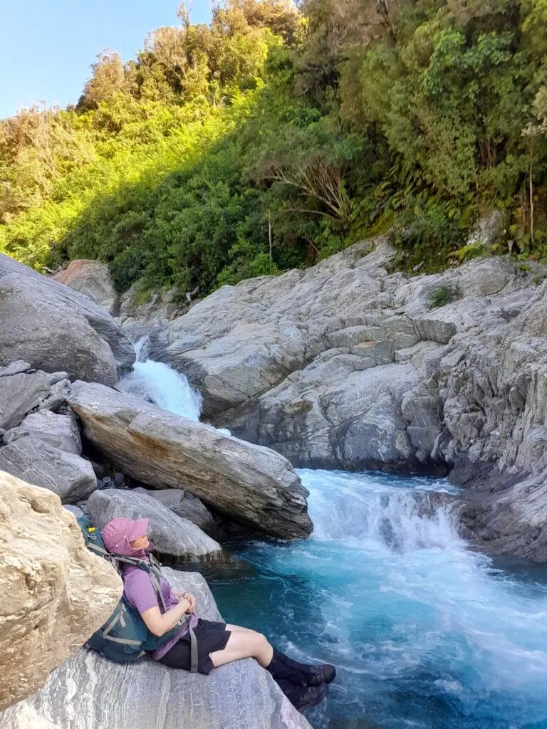
Emily and I followed the river up the valley. Despite its name, Dry Creek required numerous crossings. As the valley narrowed, the terrain shifted to technical boulder hopping. At one point, we had to work as a team to hoist our packs over a particularly large obstacle so we could haul ourselves up separately. Emily moved with impressive speed over the rocks, while I focused on keeping pace and avoiding face planting myself into these boulders. I thought I was simply slow but Emily reminded me that if there was an Olympic sport for boulder hopping, she could maybe take the gold easily.
Top Tip: Allow 2 hours walking up the Dry Creek to the base of the track climbing through the bush. Don’t attempt this route in rain, if rain is forecasted or if the river is running high as multiple crossings are required.
Top Tip: The track into the bush starts after the second major tributary joining the main river on the true right. At this point the main river cuts sharply back on itself and into a tight gorge. Look for the large orange triangle marking the route entrance into the forest on the true right, around 50 m up from the confluence.
Glowworms, Stars and Berries
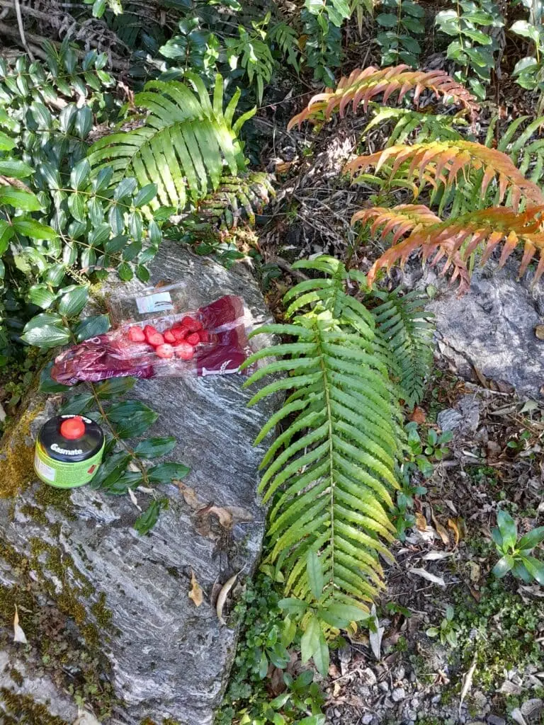
After about 1.5 hours, we reached the base of the bush track. We found just enough flat ground to pitch our two green tents. I joked to Emily that I only go tramping with people with green tents as a group of us all have the same green tent. As a surprise, I pulled out a treat of fresh strawberries I’d carried up the river.
Top Tip: This is the last flowing water source on the route to Mt Adams. However, there is often snow patches on the way to Mt Adams, even in summer.
The night was pure magic. Above us, the sky was thick with stars, and in the bank behind our campsite, a colony of glow-worms lit up the darkness.
The Tree Root Stair Master
The next morning, there was no time for a warm-up; the track started with a relentless, steep climb through tree roots. We were incredibly grateful not to be hauling full overnight packs up that incline.
Top Tips: Allow 3 hours from where the route enters the bush to the tree line.
There are several good locations to camp – between approximately 1,545 m and 2,100 m – but you will need to carry all your water up.
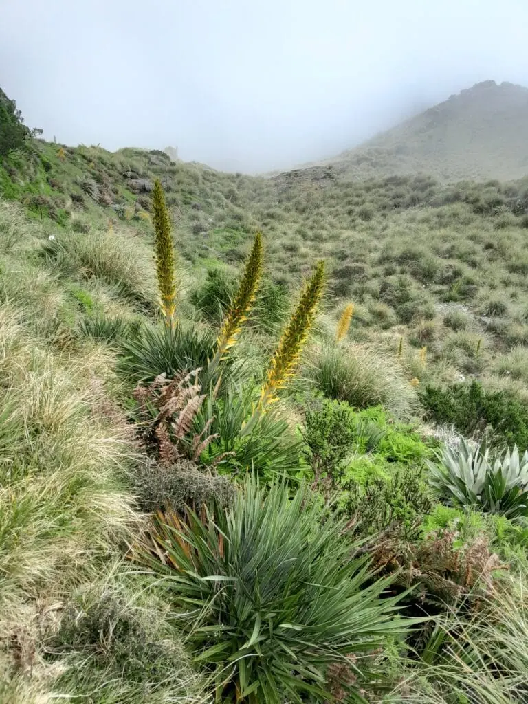
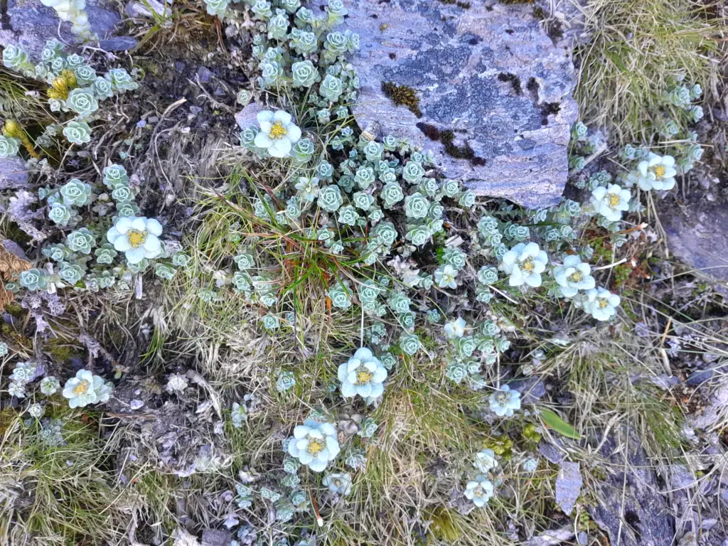
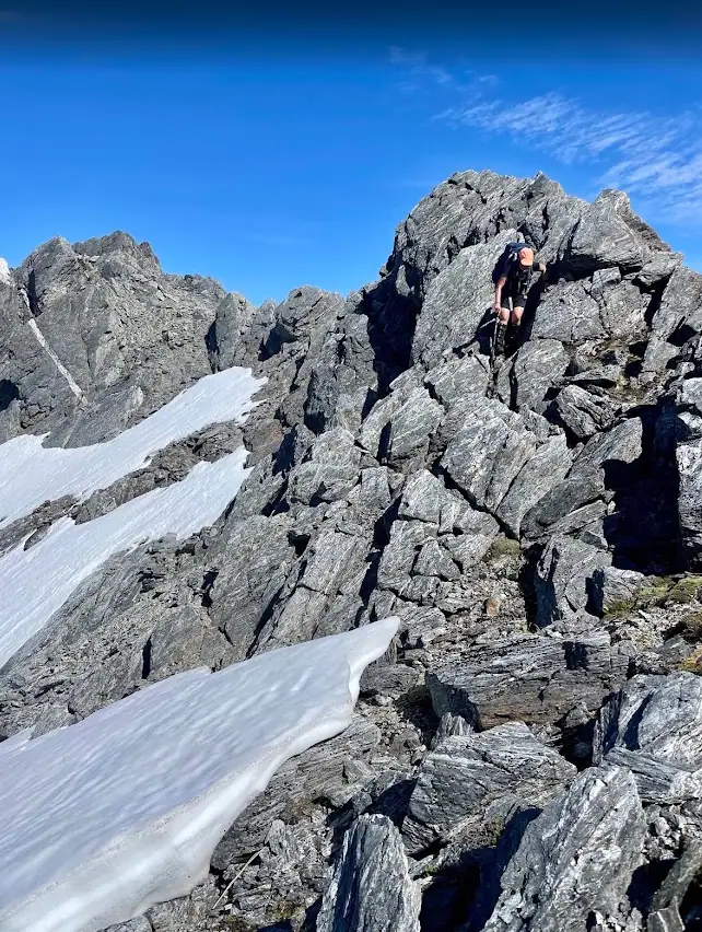
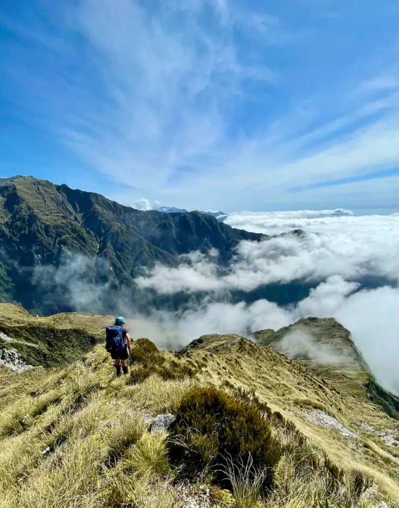
Eventually, we broke out of the bushline where the marked track ends. From there, we navigated a tussocky ridgeline, greeted by the occasional “friendly” Spaniard plant—a true South Island tramping staple! As we climbed higher, South Island edelweiss, hairy alpine buttercups, and alpine daisies appeared between the rocks. Cheeky keas swooped overhead to inspect our progress.
Top Tip: The marked route ends just past the bush line at the two yellow and orange deer posts
Mt Adams Summit
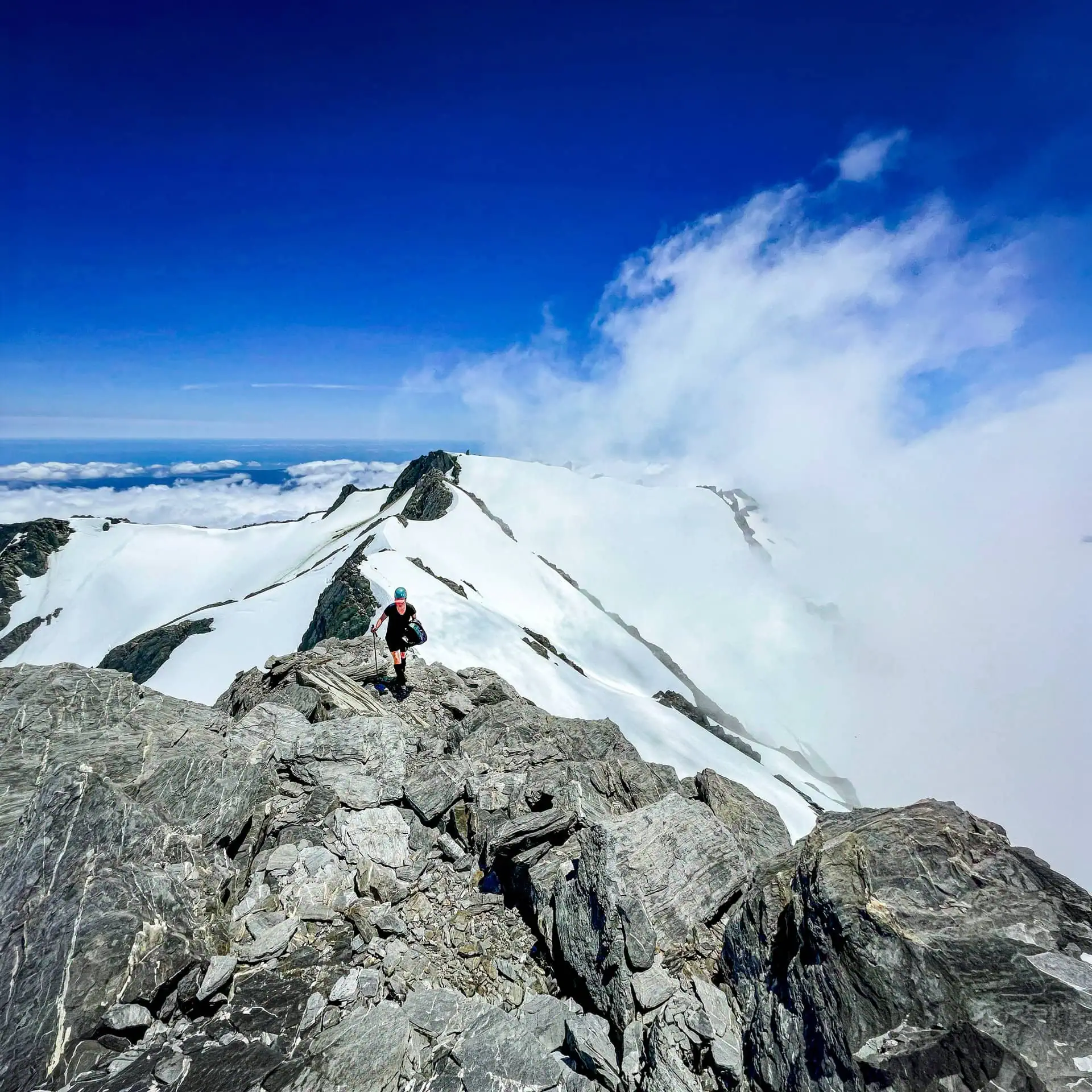
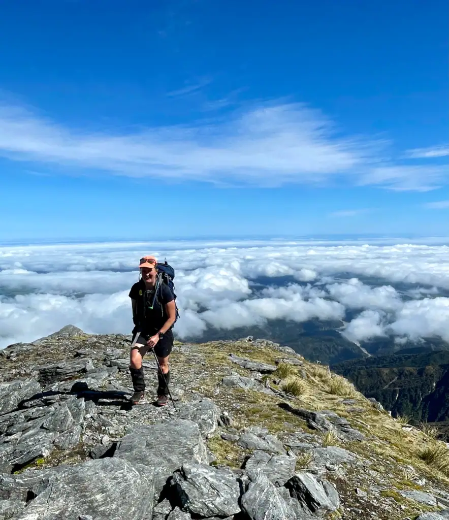
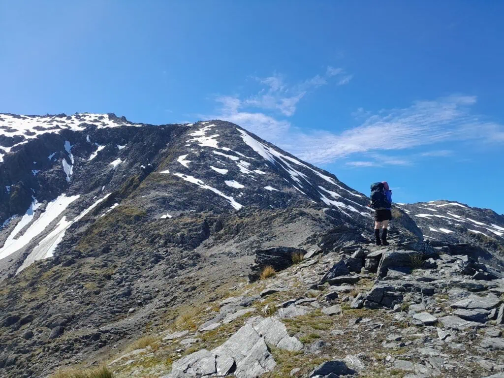
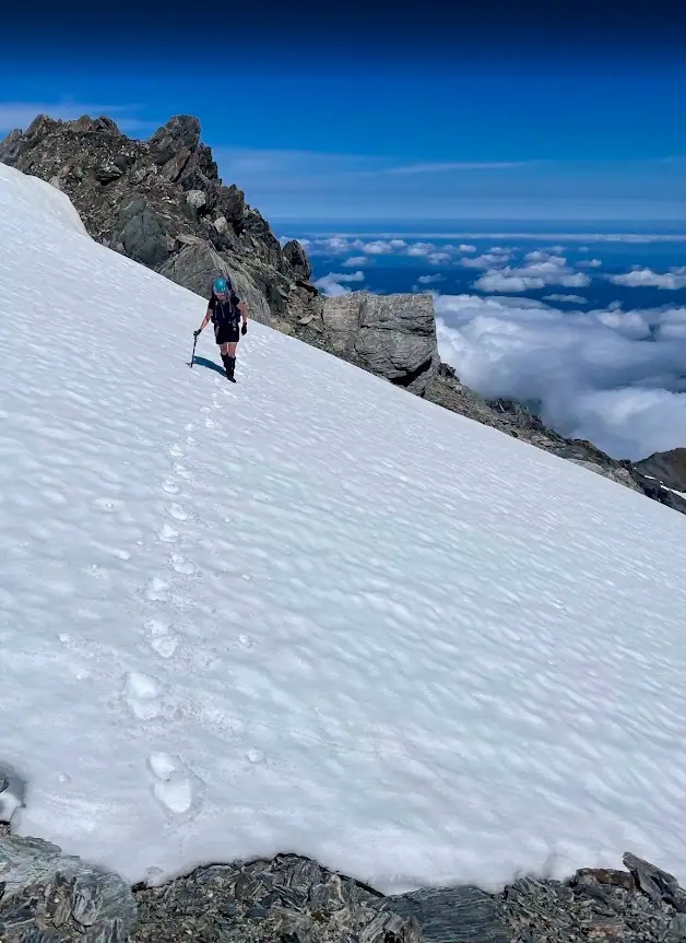
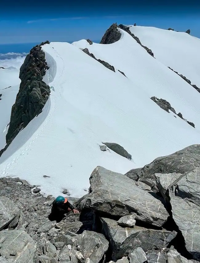
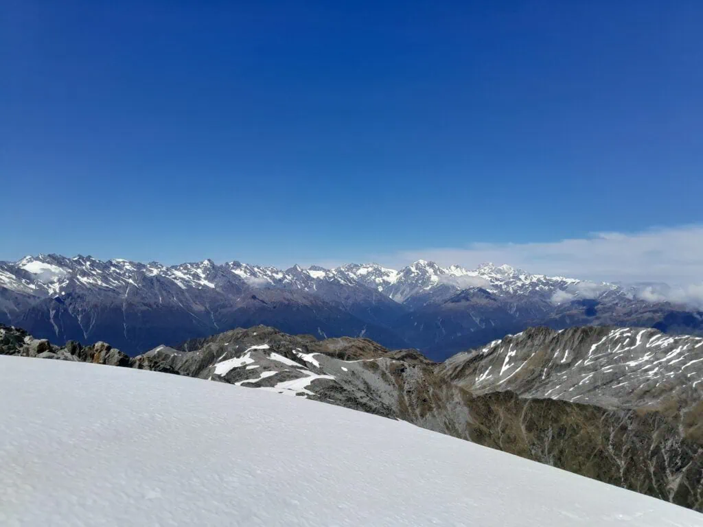
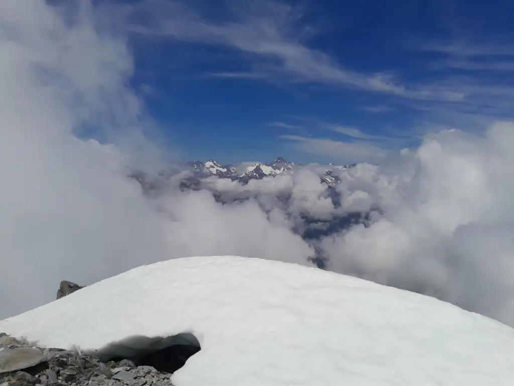
The views across the Southern Alps were breath-taking. An inversion layer sat beneath us, making it feel as though we were floating much higher than our actual elevation. After point 1767 we started crossing patches of snow and by pt 2101 we had put our crampons on.
The final push involved a traverse across the top of the Escape Glacier to reach the summit. This section was steep and exposed, requiring careful footwork to avoid the cornices clinging to the ridge.
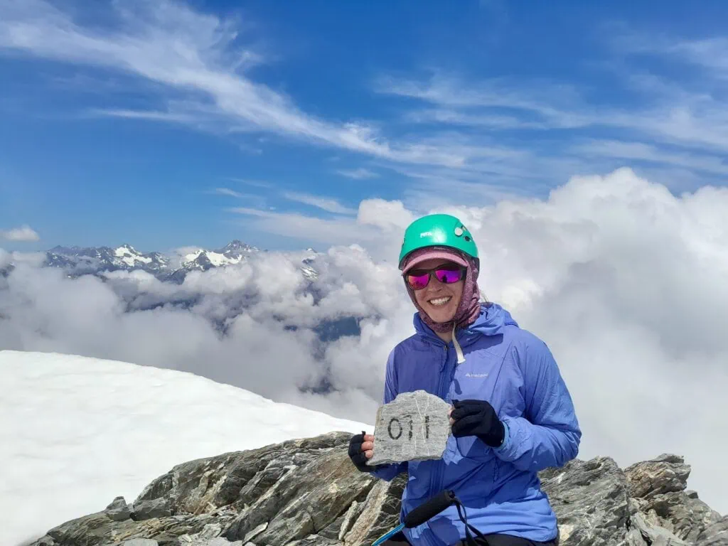
As we stood on the summit, clouds rolled in intermittently, offering fleeting, dramatic glimpses into the Adams Wilderness Area and the Garden of Eden —our home for the days to come.
The Knee Bashing Descent
The descent was a true “knee-basher” all the way back to the tents. After a long day on our feet with plenty of climbing and descending, a soak in the icy river was the perfect, much-needed therapy for our sore muscles before the walk back down the river the next morning
Important information: This route is unmarked above the bushline and requires back country navigational skills and alpine gear. River levels and avalanche ratings should be taken into account. The route is best walked in summer/autumn.
Day 1: Walk into camp spot at base of Mt Adams bush track – 1.5-2hrs, 324m elevation, 3.68km
Day 2: Mt Adams Summit & back to camp at base of bush track – 11-12 hours, 2,054m elevation, 11.64km
Day 3: Walk out – 1.5hrs, 13m elevation, 3.42km