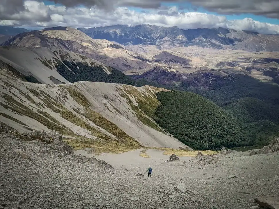
The Nervous Knob & Hamilton Peak Loop in Craigieburn Forest Park in Canterbury offers a rewarding shorter day trip complete with sweeping ridgeline views and a fantastic scree run. Other fantastic day trips in the Craigieburn Range are trips climbing Mt Izard & Mt Cloudsley; or the multi-day Cass-Lagoon Saddle Track.
Or in the nearby Korowai Torlesse Tussocklands Park: Benmore-Annavale-Sugarloaf Summit & Foggy Peak, Castle Hill Peak & The Gap.
And in Arthur’s Pass, the Poulter Valley-Binser Saddle Loop.
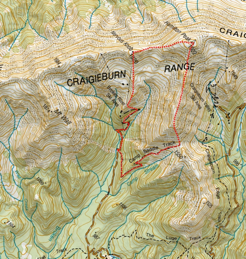
- Time: 4 hours
- Distance: 11.5 km
- Elevation Gain: 1,103 m
- Route Type: Loop (Clockwise preferable due to scree run down to Camp Saddle Track)
- Skill: Advanced/experienced due to off-track route finding
- Parking: On the side of the gravel road of the Broken River Ski Field Access Road at the locked gate. Access road is in good conditions and suitable for 2WD cars. However, the road is extremely narrow and winding, so travel slowly (20 km per hour) to avoid collisions and look for areas where two vehicles can get past each other. It is best not to drive up the road at the end of the day, especially in winter, when there will be many cars coming down it.
Route Description
Begin by walking up the access road, immediately crossing Camp Stream after the locked gate. To get to the Broken River ski field the road can be followed all the way up to the ski field or take the bush track beside the inclinator (goods lift) which zig zags directly up. From the Broken River ski field huts, there is a vehicle track that sidles up to the tussock basin. Then climb steadily through alpine tussock and scree to reach the main ridgeline. An easy way to navigate is to simply follow the ski field tow rope north-west through the ski field towards point 1820/Nervous Knob.
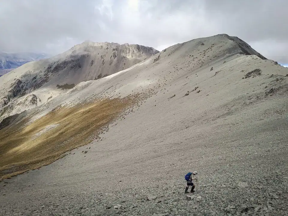
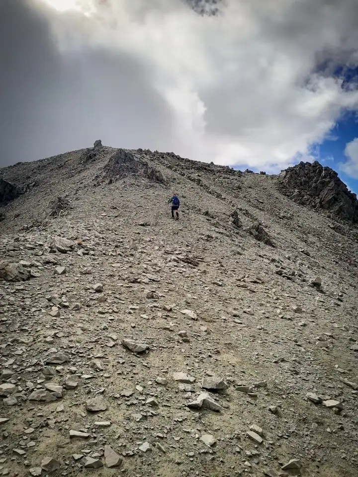
From Nervous Knob, the ridgeline descends into a saddle before climbing again towards Hamilton Peak (1922m). This peak is obvious as it has a mast and monitoring equipment on the summit. From the summit, follow the ridge southeast toward the Camp Saddle Track. This section of the ridge is a bit more technical but still very much achievable. To get to the Camp Saddle Track, there are two options. The first is to simply follow the ridge south-east to a saddle to intersect with the marked track (snow-poled and sign posted). The other option is taking a more direct line down to the track before it enters the beech forest. This is the highlight of the trip as it is a fast, fun scree run down to the bush line. Follow the Camp Saddle Track back to the Broken River Access road.
Gear, Navigation, and Safety
Because this route leaves the marked trails and enters an exposed alpine environment, a bit of extra preparation is essential for a safe and successful trip.
Navigation & Route Finding
- Off-Track Section: While the access roads and the lower Camp Saddle Track are clear and well-marked, the ridge traverse between Nervous Knob and Hamilton Peak is completely unmarked and untracked. Confidence navigating and assessing terrain is essential
- Required Maps: You should be confident navigating with a map and compass or a reliable GPS app. Carry the NZTopo50 map BW21 (Springfield) for this section of the Craigieburn Range.
- Visibility: Avoid this ridge in low cloud/visibility as it can make navigation challenging
Essential Gear
- Scree Protection: Gaiters are highly recommended. The descent down from the ridge to the Camp Saddle Track is scree that will easily fill low-cut trail shoes.
- Wind Layers: The ridge sits at over 1,800 meters and is completely exposed to Canterbury’s notorious nor’westers. Pack a high-quality windproof jacket, a beanie, and gloves, even if it feels warm at the car park. The weather can change very quickly and there is no shelter on the ridgeline.
Safety & Seasonal Considerations
- Best Time to Go: This loop is best tackled from summer to early autumn when the ridges should be mostly clear of snow
- Winter & Spring Avalanches: In the winter and spring months, this area becomes complex avalanche terrain. Do not attempt this route when snow is present unless you have specific alpine avalanche training, an ice axe, crampons, and have checked the NZ Avalanche Advisory.
- Wasps: If you are tramping between January and March, be aware that wasp numbers can be very high in the lower beech forest sections. Carry antihistamines
PLB Reminder: As with any trip in the outdoors always carry a registered Personal Locator Beacon (PLB) and leave your intentions with a trusted emergency contact.