An epic 5 day traverse from Wangapeka over the Matiri Range to the Haystack, Needle and 1000 Acre Plateau. Involves plenty of travel off track, time above bushline and a challenging bush bash.

Tony assured me that I would be able to find the Needle in the Haystack easily – he wasn’t wrong but our bush bash to get to the Haystack to find the Needle was absolutely legendary.
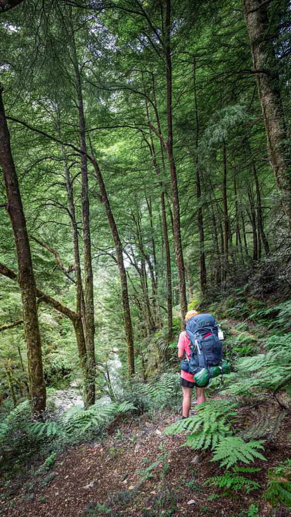
The Wangapeka
Starting from the Wangapeka River Road, Tony nearly lost me in the carpark as I got distracted by a gorgeous 12-week-old golden retriever puppy. Finally dragging myself away from the puppy to start tramping up the Wangapeka Track, we headed in the direction of Kings Creek Hut.
Top Tip: Access up Wangapeka River Road involves crossing the Dart Ford. Constant gravel migration is causing conditions at the ford to change and a 4WD would be ideal but not absolutely necessary. The ford can only be crossed at low levels – less than 40 cumecs. A good indication is the Wangapeka river flow at Walter Peak that is available on the Tasman District Council website. However, the Dart River may be flowing higher than the Wangapeka River or there may be a time lag on the recorded level. An assessment must be made at the ford itself in terms of flow, type of vehicle and driving skill. Keep in mind the weather for the return across the ford.
Whio & Wily Weka
Two whio floated down the Wangapeka River as we crossed over it on the swingbridge. Whio, most commonly known for their appearance on the NZ$10 note, are endangered, so seeing them is pretty special and an indication that all the efforts into their conservation is working. We could tell these 2 birds were a couple as the female has a low growl while the male has a high-pitched whistle.

The historic Cecil Kings Hut that is next to Kings Creek Hut, is one of the few surviving buildings of the depression mining in the Wangapeka. Cecil King, a well-known local, claimed that he built the hut from a single Red Beech from the clearing in September 1935. The Beech tree now standing beside the hut was planted by him as a replacement. Cecil King spent 46 summers there working his mining claim. His hut is a typical backcountry timber slab hut, common of that mining era. With a conservation plan in place, the hut still retains a lot of the original frame and furniture.

There were a few wily weka at Kings Creek Hut and we heard that one unsuspecting person had their lunch stolen by one. The weka grabbed their wrap and just took off with it. Managing to evade the wily weka, we continued onto Stone Hut. We found Stone Hut busy since it was the height of summer, so Tony and I opted to camp instead.

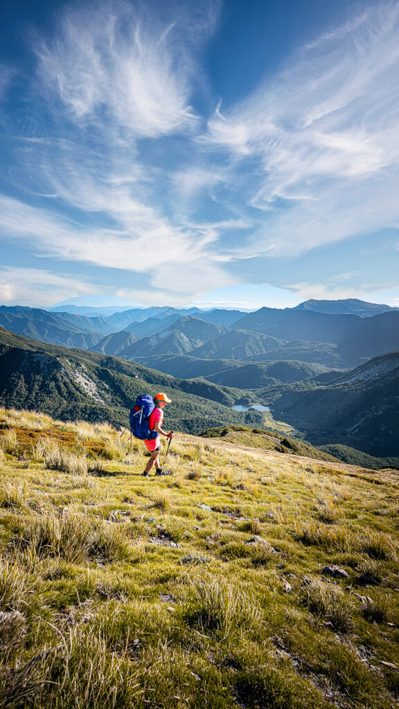
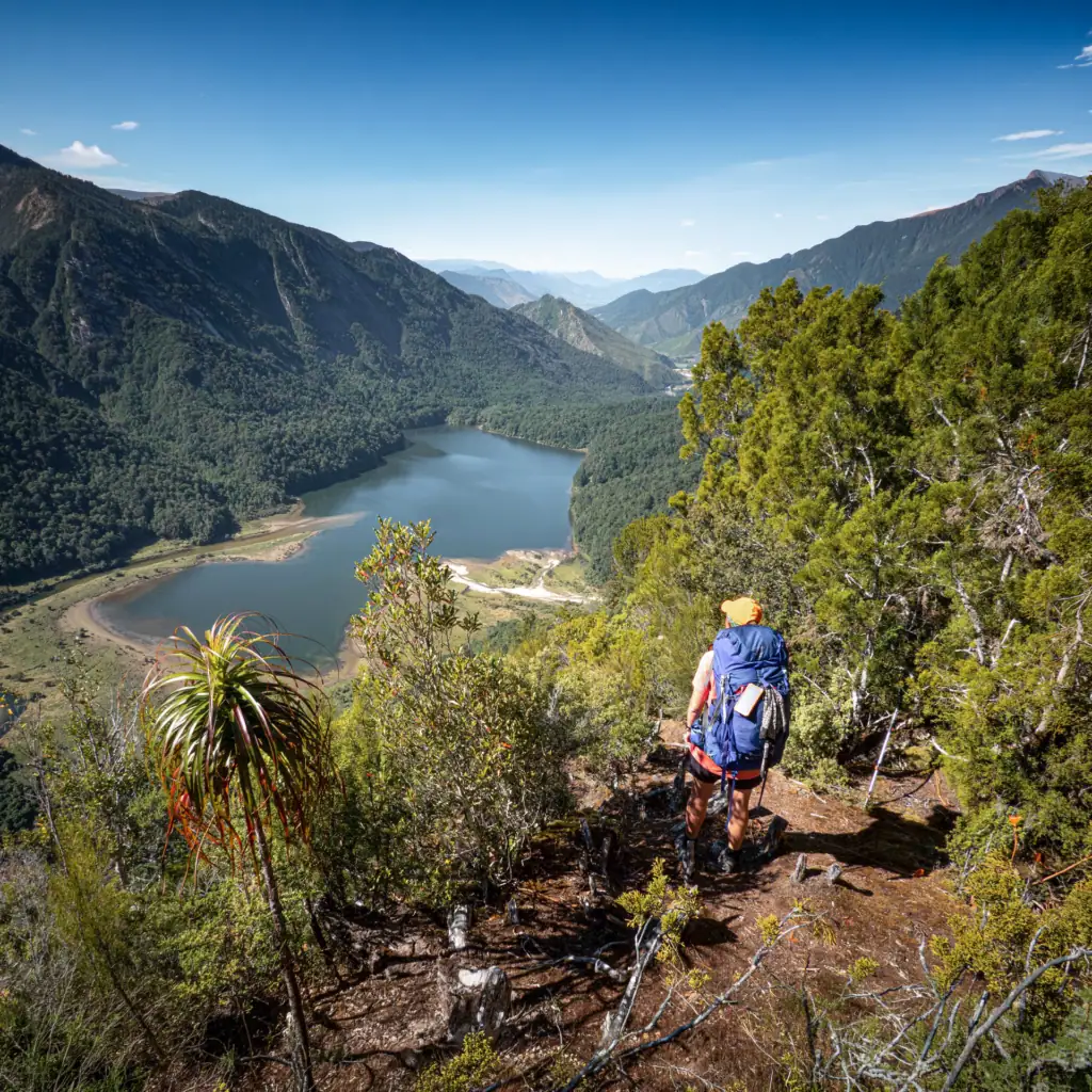
Traversing the Matiri Range
After having another two whio swim past our tents while we had breakfast, we headed up the track to Wangapeka Saddle where we were greeted by a friendly South Island Robin (toutouwai). Small but fearless, this robin pecked around our walking poles and boots to see what insects we had uncovered. From here we left behind all marked tracks and began the steep climb onto the Matiri Range. It was a beautiful day and we had what must be some of the best views across Kahurangi National Park. We could see across to Mt Owen that we had climbed on a previous trip. Every direction we looked there were endless mountains ranges and that feeling of total isolation. I love that feeling as it’s something that is more uncommon in the North Island where you can often see down to farmland or towns.
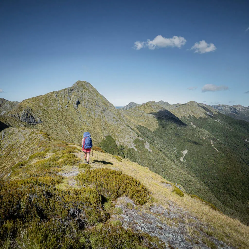


The perfect weather was exactly what we needed since we would be above bushline nearly all day. After navigating to Nugget Knob and through two beautiful groves of dracophyllum (or “Dr Seuss” trees as I call them), we reached the poled (but unsignposted) route down to Hurricane Hut. The track here was very slow due to it being very boggy and overgrown. I may have kept telling Tony the hut was just around the next corner as I wrongly thought that the hut was at 900m elevation contour but it was actually at the 800m contour.
Top Tip: The only water source on the route across the Matiri Range tops is a tarn north of point 1398. The Matiri Range ridgeline could be difficult to follow in low visibility as it has a lot of twists and turns


The Legendary (aka ‘nightmare’) Bush Bash
At Hurricane Hut that night I read multiple entries in the hut book of people who had done the bush bash, descending from point 1326 down to point 736. They all sounded fairly traumatised by it. Often things sound much worse in the hut book than reality but this time I can say that there was absolutely no exaggeration. The bushbash was all type 2 fun.


The track from Hurricane Hut down to Lake Jeanette was meant to be the easy part of the day but even that wasn’t easy. The track was pretty overgrown and sparsely marked. Interestingly, Lake Jeanette was formed by the 1929 Murchison earthquake.
At point 736 we waved a final goodbye to the track. It was very dense bush and our pace got slower and slower until it felt like we weren’t even moving. There were a few bluffs that were easier for us to avoid since we were climbing up. Amongst all the suffering, we did have great views back down back to Lake Jeanette and I saw a couple of the endangered powelliphanta snails. These carnivorous snails are the giants of the snail world.
Just when we thought we were near the top, we found ourselves benighted by impenetrable leatherwood. We had to retreat back down and haul ourselves up a different route on unforgiving speargrass….

A Fortuitous Campsite
Reality soon set in that we weren’t going to make it anywhere near Larrikins Creek Hut that night. We were also both very low in water after what had been a very long and hot day. While problem solving this, I noticed some slightly boggy ground. As luck would have it, we had stumbled across a very small stream that was not marked on the map. With our water situation now resolved, we decided to set up camp right there. We enjoyed a lovely sunset from the comfort of our sleeping bags that night.

Finding the Needle in the Haystack & the Devil’s Dining Table
Day 4 was all about the mudstone peaks known as the “Needle” and the “Haystack” that the Matiri Range is well known for. There were a few tomo/sink holes lurking in the scrub that we had to carefully avoid along the way. The ridgeline between the Haystack and Needle was a bit narrow and gnarly in a few places. Tony named one section “Sarah’s step” after he saw me having to back out of an exposed section where I had discovered a lack of handholds. The layers in the mudstone here is really fascinating to see.

Top Tip: The section between the Haystack and Needle should really only be attempted in good visibility due to having some exposed sections that involve a bit of scrambling

Tony continued down to Larrikin Creek Hut while I did a solo trip up the Needle to see the 100 Acre Plateau (also known as the Devil’s Dining Table).
Top Tip: To get to the Hundred Acre Plateau, climb the bushy gully north of Larrikin Creek Hut to a tussock basin with tarns. Sidle west out of the basin onto the plateau. The Needle can be climbed either from the plateau or by continuing to the ridge above the tarns.
The Orchestra of Frogs & Weka
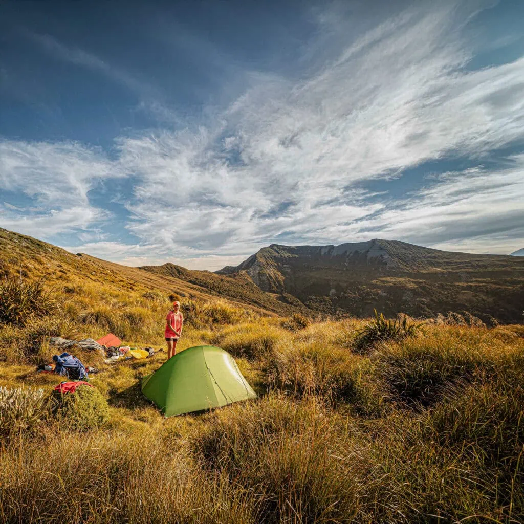
Tony found an idyllic campsite on the 1000 Acre Plateau next to a tarn. We had “beachside” views with reflections of both the Haystack and Needle in our tent. Tony was hoping to fall asleep listening to frogs that night. At first, we only heard a weka. I teased Tony that the weka was rounding up all its mates to do a sneak attack on us. Eventually the weka wore themselves out and the chorus of frogs began.
Top Tip: There are plenty of tarns on the 1000 Acre Plateau but the ground can be quite boggy. Select camping spots carefully


The Misty 1000 Acre Plateau

The 1000 Acre Plateau was blanketed in mist when we woke up, giving it an ethereal atmosphere. We enjoyed seeing sun’s rays hitting the water droplets on the spider webs and alpine flora including the alpine sundew. Near the edge of the Plateau was Poor Pete’s Hut which is a cute little 2-person hut. From above the hut looks like a child’s tree house.

The descent to Lake Matiri Hut had great views down to the Lake. However, there were some wasp nests next to the track that we had to carefully avoid. Our trip ended with a fascinating tour of the Matiri Hydroelectric Scheme courtesy of the Pioneer Energy site manager, who even gave us a lift to the road end.
This 5 day trip across the Matiri Range to the Haystack, Needle and 1000 Acre Plateau will always be one of my favourite trips.

Day 1 Wangapeka River Road to Stone Hut: 21km | 5h | 695m elevation.
Day 2 Stone Hut to Hurricane Hut via Matiri Tops: 19km | 7 – 9h | 1840m elevation
Day 3 Hurricane Hut to Campsite north of point 1333: 10km | 8h | 687m elevation
Day 4 Point 1333 to 1000 Acre Plateau Campsite via Needle: 14km | 8h | 775m elevation
Day 5 1000 Acre Plateau Campsite to Lake Matiri Hut: 10.5km | 4h | ~350m elevation (approximation due to low watch battery)
Trip completed Jan/Feb 2021