
Paretetaitonga (2,751 metres) is widely recognized as the second-highest peak on Mt Ruapehu in Tongariro National Park. It sits just below Tahurangi (2,797m). While Point 2,757 further south, known informally as Te Ātaahua, is technically higher, it is not officially recognised as one of Ruapehu’s peaks. The name Paretetaitonga translates to ‘a wall or parapet, on the southern side.’ This perfectly describes how this dramatic peak stands sentinel over Ruapehu’s active Crater Lake.

The Climb: Bruce Road to the Paretetaitonga Summit
On a pristine, bluebird day, our objective was to climb safely up Paretetaitonga. The ascent is remarkably straightforward if you break it down into key navigation points:
1.The Whakapapa Skifield Ascent: First 2km.
Start from the carpark at the top of the Bruce Road and head up through the Whakapapa Skifield. Keep the Sky Waka gondola to the east, ensuring you stay safely above the bluffs of the Tawhainui Stream. Taking the SkyWaka gondola is an option to reduce the climb by 400m and instead start climbing from 2,000m.
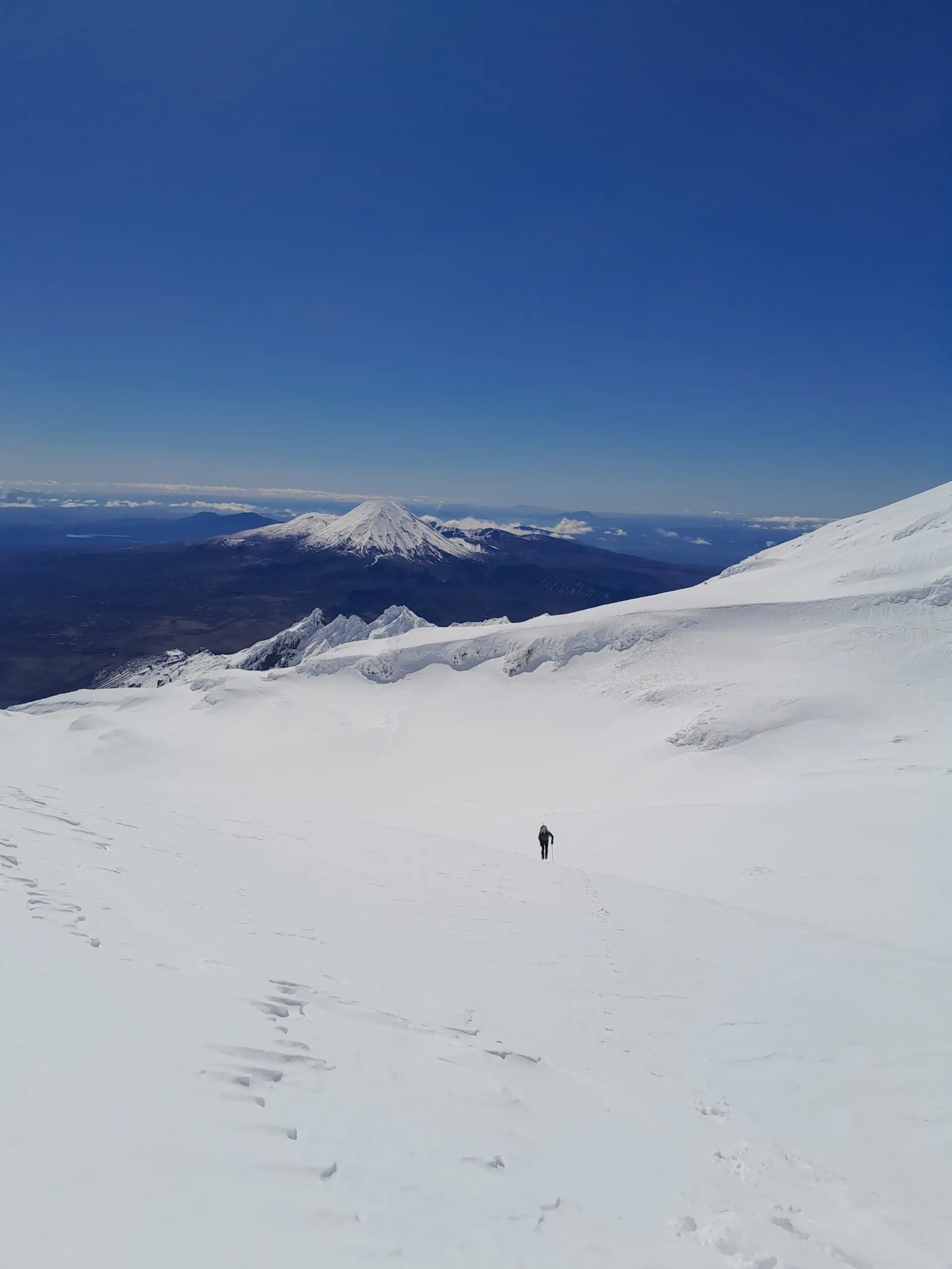
2.Gaining the Whakapapa Glacier: Approaching the Ridge, approximately 2.5km
Continue climbing steadily toward the Far West T-bar and then south-west to the Whakapapa Glacier. Aim directly for the obvious saddle between Dome and Paretetaitonga.

3.The Ridge Traverse: Technical Section, approximately 300m
Push up the steep slope leading from the saddle onto the Paretetaitonga ridge, just south of Point 2580. Once of this ridge, it features an awkward, icy section that demands precise footwork and solid crampon confidence.
4.The Final Summit Push: 2,751m.
Once past the icy crux, it is a straightforward, rewarding crampon walk along the ridgeline to the true summit of Paretetaitonga.


On Top of the North Island
Standing just below the summit, the expansive views made every metre of the long climb entirely worth it. The cone of Mt Taranaki out west and sweeping north across the stark volcanic forms of Mt Ngauruhoe and Tongariro. And of course, the Hauhungatahi Wilderness Area.
On the southern side of Paretetaitonga is the Unnamed Glacier, now officially known as the Tūwharetoa Glacier. While the world watches the retreat of alpine ice, this glacier is a small but resilient survivor. The Tūwharetoa Glacier—is a scientific anomaly: it is likely the only glacier in New Zealand—and one of the few in the world—that has maintained its volume despite global warming.
An ice cave we had previously explored within the crater on a past trip was completely swallowed by a thick, pristine blanket of winter snow. We elected to descend via the same route, though the upper mountain offers a wide variety of alpine lines back down to the skifield depending on snow conditions and party experience. There may have been some silly sliding involved in the descent….


We camped at Mangahuia Campsite but another option is the WTMC Lodge at the top of the Bruce Road in Iwikau Village.

Topo map BJ34 Mt Ruapehu
6-8 hr | 1,302m elevation | 10.2km
Trip completed September 2025