Often underestimated, the Earnslaw Burn Track is a Southern Alps classic near Queenstown. While many are drawn by the towering waterfalls and hanging glacier, navigating the windfall-heavy bush and unpredictable mountain weather requires solid planning. A night in the Earnslaw Burn Rock Bivvy and more adventurous off track route make this trip more adventurous than the standard out and back hike.

Picking our adventures in the Earnslaw Burn Valley
Staying down south a bit longer after our Murchison Mountains trip, Anne, Emily and I met up with Mathew in Queenstown. Emily and Mathew were on a mission to climb “Point 2026″—a spot height matching the current year. They had conveniently located one near Mt Earnslaw, accessible from Lennox Pass. Deciding on something a bit less ambitious, Anne and I opted for a walk along the ridge from Lennox Pass.
Navigating the Earnslaw Burn Track
The track follows the true left of the Earnslaw Burn through thick bush. We encountered a fair amount of windfall on the tree rooty track. Markers were sparse in places, but we found it easy enough to navigate as experienced trampers.
However, this area is a hotspot for search and rescue operations. Many people get lost on the track here or underestimate the time required to reach the head of the valley.

The First Glimpse of Pikirakatahi
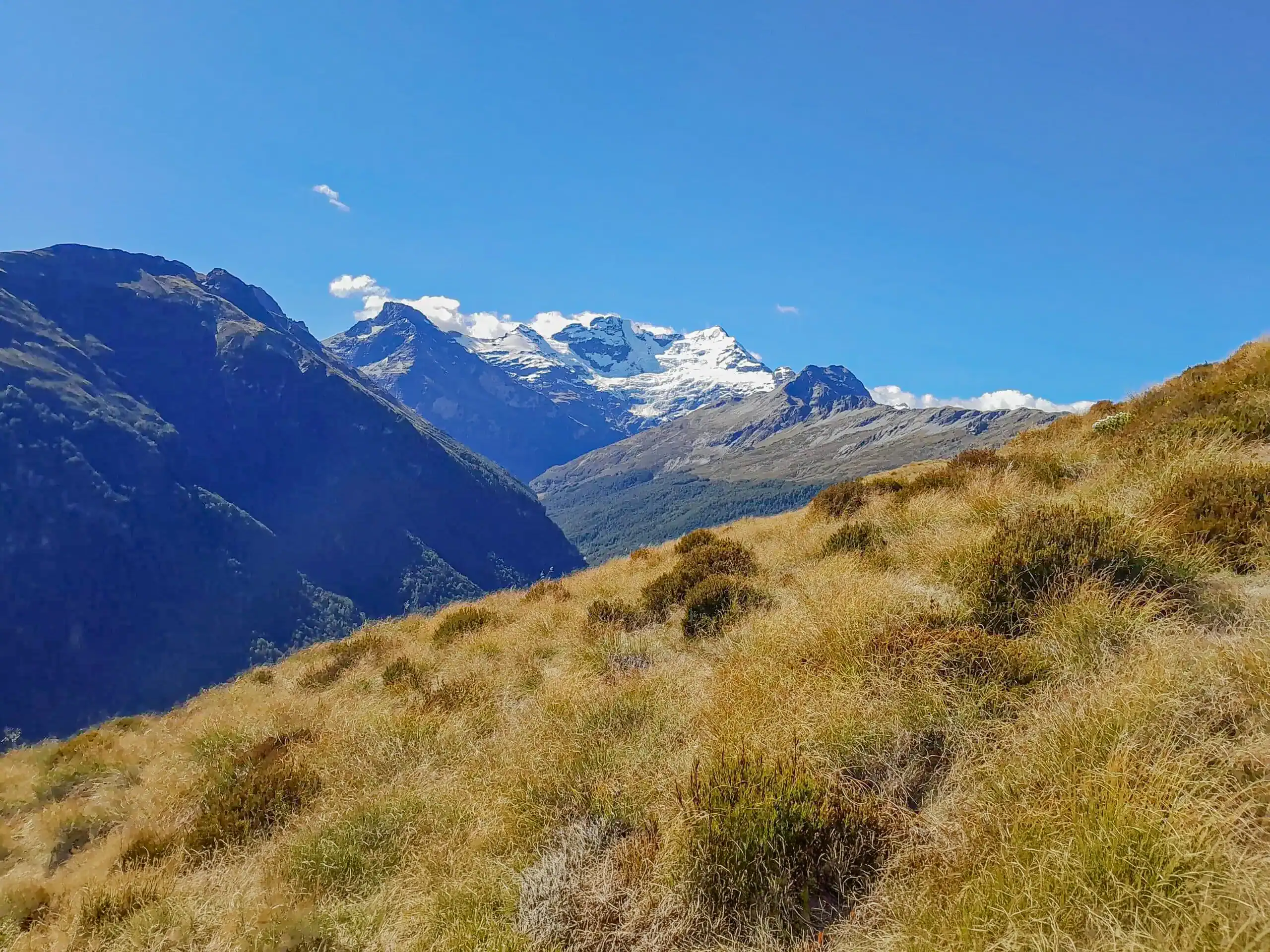
As we hit the bush edge, we were rewarded with our first view of the magnificent Mt Earnslaw/Pikirakatahi Glacier. The hanging glaciers and waterfalls looked spectacular.
Due to logistics and a later start, we decided to admire the glacier from a distance rather than walking the additional 9km return to its base. Instead, we set our sights on a relaxing evening in the valley’s large rock biv.
Top Tip: The head of the Earnslaw Valley (base of the Earnslaw Glacier) is approximately 9km return and is not marked. It requires several stream crossings and has no shelter.

A night in the Earnslaw Burn Rock Biv
The rock biv is marked on the topo map and requires crossing the Earnslaw Burn. We spotted a rock cairn on the true right marking the spot. Although the river was higher than usual, it remained easily crossable.
Top Tip: Do not cross the river if it is flooded. If in doubt, it is safer not to cross. Mountain Safety Council have some great tips here
The bivvy is a great setup, complete with a sleeping platform and a clothesline. We happily traded our tents for mattresses and sleeping bags, spending the evening over a competitive game of Monopoly Deal.
Top Tip: Camping is permitted on public conservation land at the forest edge or the Rock Bivvy. However, camping is strictly prohibited on the private land of Earnslaw Station in the upper valley. Look for the boundary signs.

Into the Clag: A Mystical Morning
We started early the next morning as Emily and Mathew headed for Point 2026. As forecasted, the clag had rolled in.
Beyond the bush edge, the track becomes an unmarked foot trail. While we found it manageable, others we spoke to found the rugged terrain slow and difficult. As we pushed up-valley, the temperature dropped significantly, accompanied by a circus of squawking kea overhead.
While the mist obscured our full view of the valley, it added a mystical, atmospheric feel to the valley with the hanging waterfalls and glacier that were visible. After tramping almost constantly on blue bird days, I enjoyed this change so didn’t feel disappointed we hadn’t come up the valley the evening before. Even in summer, the damp cold meant hats and gloves were essential.

The Spiky Alternative Route
With the misty rain set in, we decided against going up to Lennox Pass and began heading back toward the treeline. However, I wasn’t keen on backtracking the exact same way. I suggested to Anne that we climb the ridgeline above the bush track to follow it out since I had a feeling the weather was going to clear. The ascent was a vertical challenge through a village of spiky spaniards (aciphylla colensoi) and matagouri. Anne may have been questioning her life choices as the climb stretched on, but the effort paid off—by early afternoon, the clag lifted, offering stunning views back toward the Earnslaw Glacier and down into the Rees Valley.
Top Tip: The only water source once on this ridge is the tarns marked on the topo map, but they are a drop off the main ridge. It is best to fill up on water before leaving the stream during the climb up to the ridge

The Descent from Lovers Leap
The southern end of the ridge proved technical, involving large boulders and “crevasse-like” gaps that required careful backtracking to find a safe route and sometimes jumping over..
The final descent from Lovers Leap was a steep, knee-bashing scramble back to the main Earnslaw Burn track. We eventually found a small flat patch to camp on the true left of the river, with Emily and Mathew turning up a few hours later having successfully made it to point 2026.
It was a fantastic 2 day trip that we had turned a bit more adventurous by coming back out via an alternative route. A few days later I was further south in Whakaari Conservation Area and enjoyed looking across to Mt Earnslaw.
Top Tip: Topo Map CB 10 Glenorchy & CA10 Lake Williamson

Day 1 Earnslaw Rock Biv – 4-5hrs, 817m elevation, 9.3km
Day 2 Head of Earnslaw Valley, climb up to pt 1552 on the ridgeline, along to Lovers Leap & descent to the Earnslaw Burn carpark – 10-12hrs, 1,482m elevation, 24.41km