
Navigating Access: The Teme River vs. Private Land
After a trip to Ferny Gair a few months ago to find the elusive “dinosaur cave,” I was itching to return to explore the southern part of the conservation area including Lake Alexander and Ferny Gair peak itself.
Access in this region can be tricky. A long-standing dispute over a legal public paper road means the Teme River route is currently unavailable. Fortunately, the Ferny Gair Conservation Area remains accessible thanks to a generous local landowner who allows trampers and hunters to pass through his land.
Before heading toward Lake Alexander, we met with the landowner, Bernard (Bernie) Mason. Bernie’s passion for the land is evident; he has dedicated countless hours to track maintenance, pest trapping, and installing informative signage.
Top Tip: Access from Avon valley crosses private land for which permission must be obtained to ensure continued access. Contact Bernard Mason phone +64 21 181 2281 before visiting. If permission is granted, a key can be obtained from the Masons for a small donation that helps maintain the area. Access is closed late winter/ early spring due to farming activities.
The Lake Alexander Route
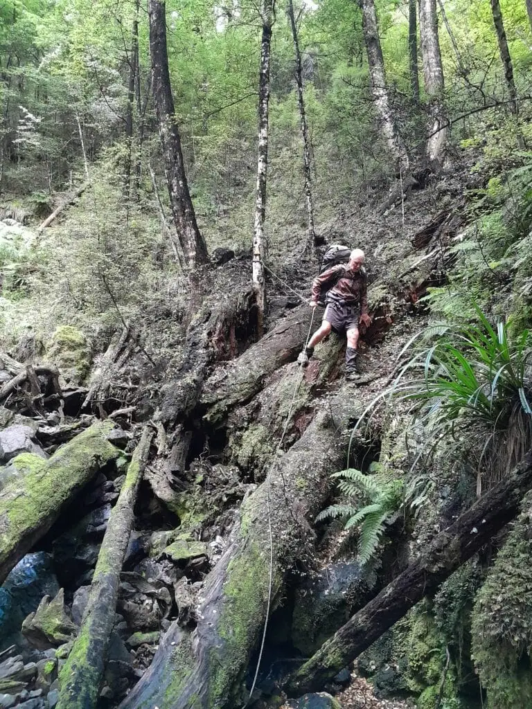
We began our walk on a sweltering morning, covering 7km on a 4WD track across farmland before reaching the cool relief of the DoC bush track. Bernie’s handiwork was immediately apparent—he’s installed ropes to assist with stream crossings and the steeper sections of the trail. In general, the trail is not very technical and easy walking.
Top Tip: You can get permission to drive this 4WD but must park in the designated area
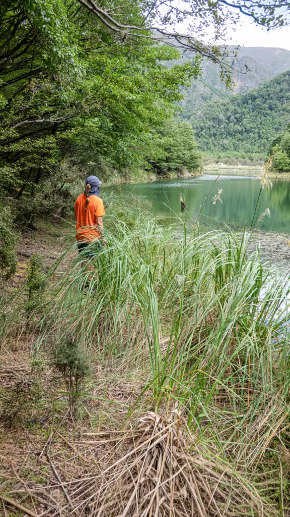
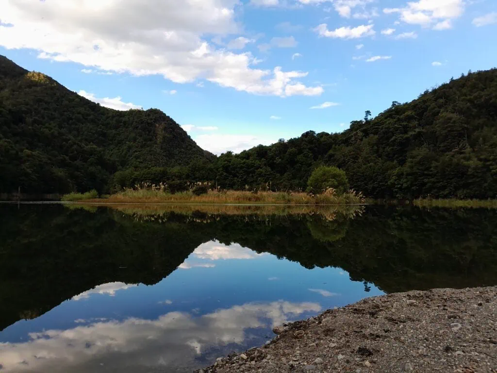
The track follows the Tummil river up through a beautiful mix of beech and manuka forest. There was plenty of hook grass along the way and we both collected a lot on our legs. After about 3 hours, we reached the northern end of Lake Alexander. It is a stunning, secluded spot, though sadly filling with gravel from the upper valley. Bernie had a sign informing us that the lake level had dropped approximately 3 metres when there was a big slip in the creek that the lake drains into.
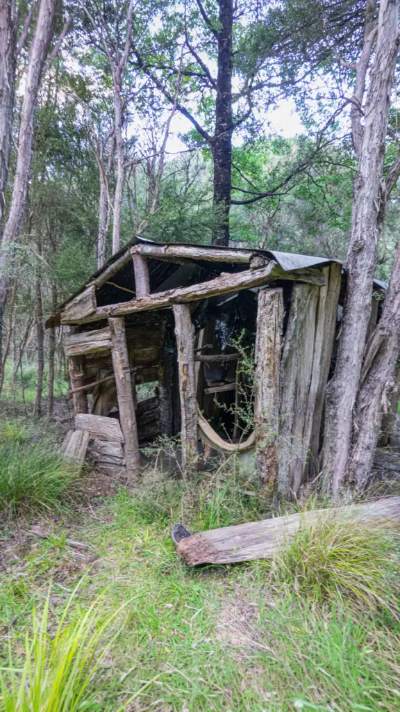
While I joked about swimming to the small island in the center to camp, Tony wisely chose the comfort of Lake Alexander Hut. Lake Alexander Hut was previously known as Tummil Hut and flown to the site in 2010. The old hut built from manuka branches is still present. From reading the hut book it seems this tidy, six-bunk hut is a favourite for families, though it could definitely use a table for a round of Bananagrams! I went for a swim and found the level of the lake drops off very quickly.

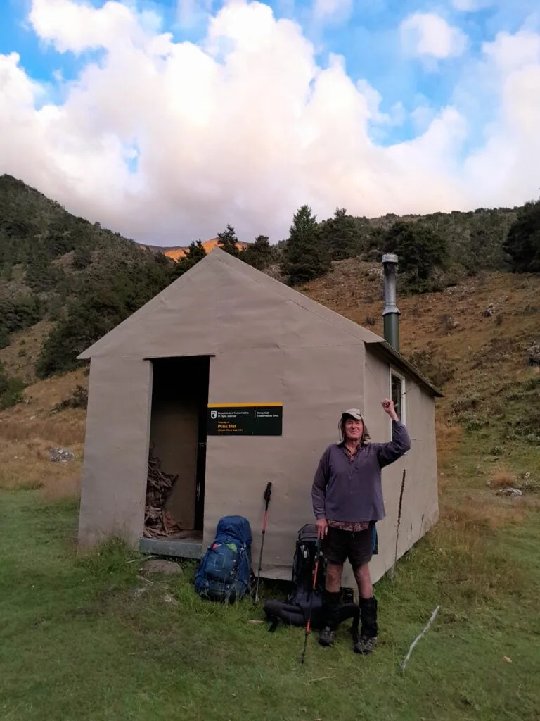
Climbing Wild Sheep Saddle to Penk Hut
The following morning involved a steep climb up the stream to Point 951, informally known as Wild Sheep Saddle. Thanks to Bernie’s ropes, the ascent was manageable, though I wouldn’t recommend descending this way.
Top Tip: The track up to Wild Sheep Saddle crosses a creek about 140m below the saddle. There is a marker from Bernie that it’s the last water for the day. There is no other water source until Penk Hut unless a short deviation is made from the spur descending to Penk Hut. The marked track is also slightly south from where the track is shown on the topo map.
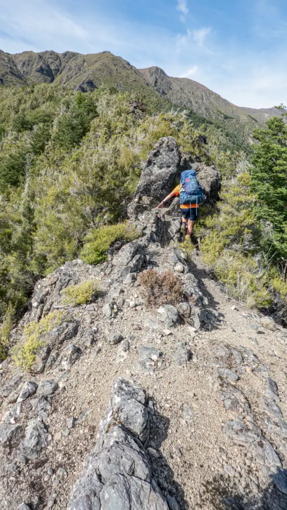
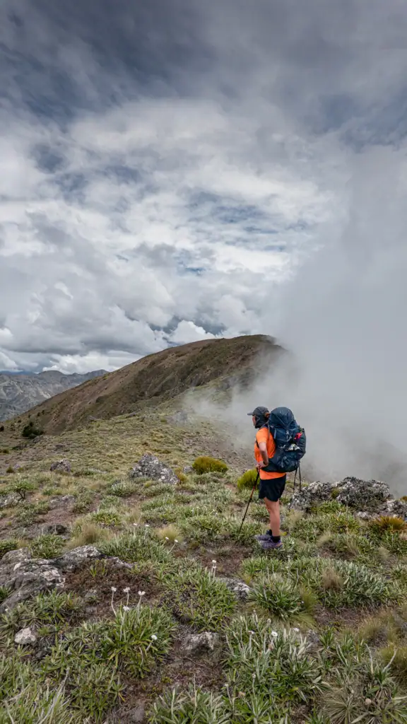
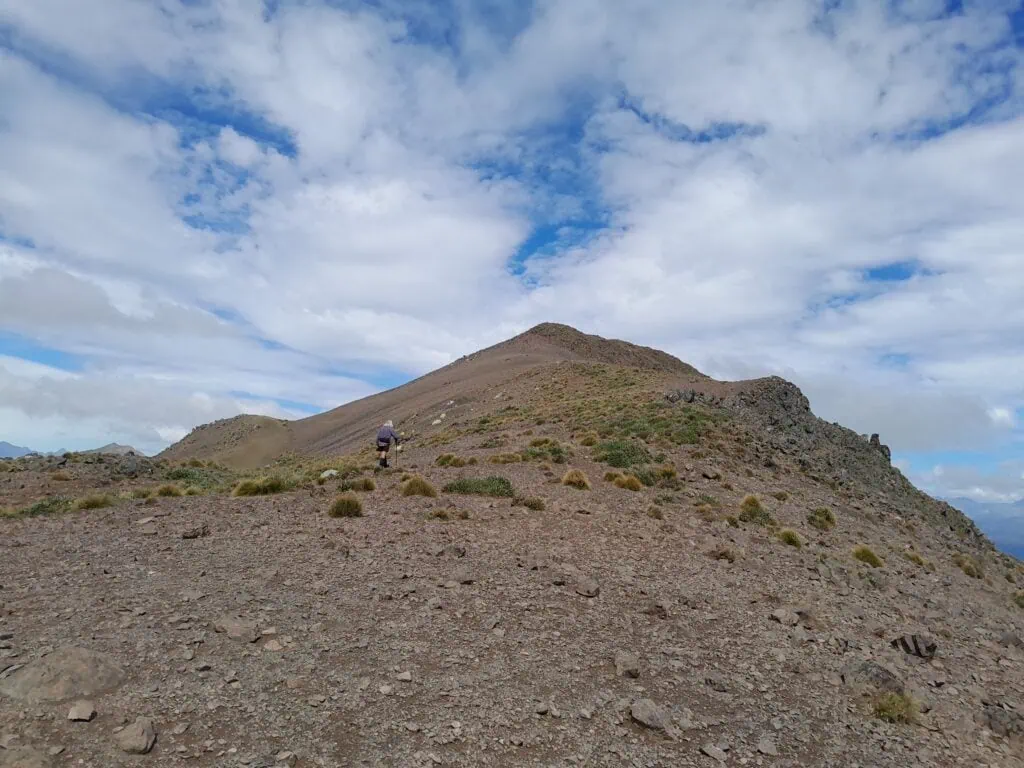
From the saddle, we climbed towards point 1411. There was a good foot trail up this ridge and even though it’s not shown as marked on the map, it was indeed marked by orange track markers and snow poles. As we watched a helicopter working across the valley, either hunting or aerial spraying wilding pines, heavy clouds began to roll in. With convective rain forecasted, we decided to bypass the summit for the day and head straight for Penk Hut.
Top Tip: After point 1411, there is no marked track.
The descent down a steep spur is marked by a large rock cairn (slightly north of pt 1517). While the trail isn’t always well-defined, the small amount of bush that has to be travelled through is open, but we were mostly on the edge of the bush. The hut can be seen from far up the spur and we had to follow the spur all the way down to the Penk River to avoid the steep drop-offs into a creek.
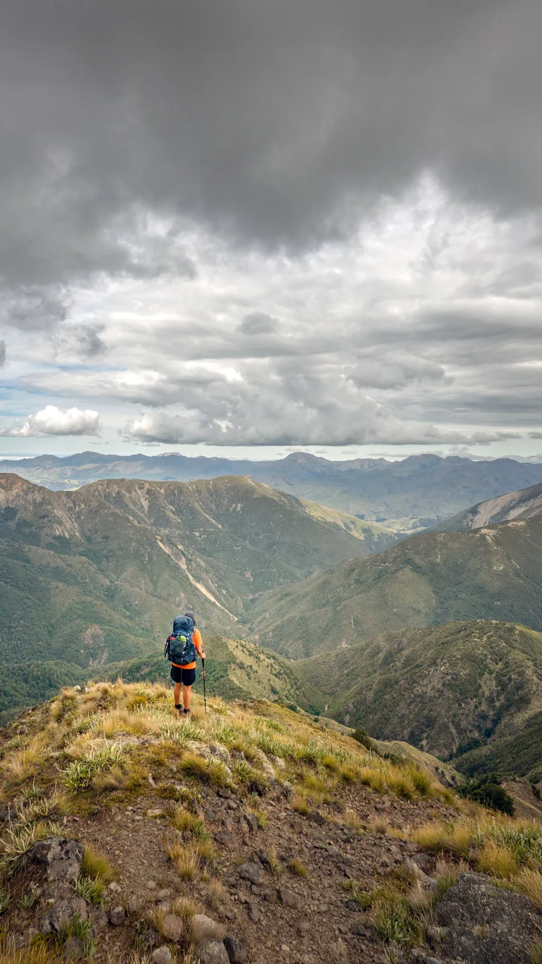
Summiting Ferny Gair Peak (1,670m)
At Penk Hut, we read in the hut book that most people were flown into the hut to hunt; and the few people who walked in came up the Penk River from Reserve Hill. There was only the odd person who had walked in the same way as us, probably due to the amount of climbing and descending involved! After a night of drying gear by the fire, we set off early to beat the heat.
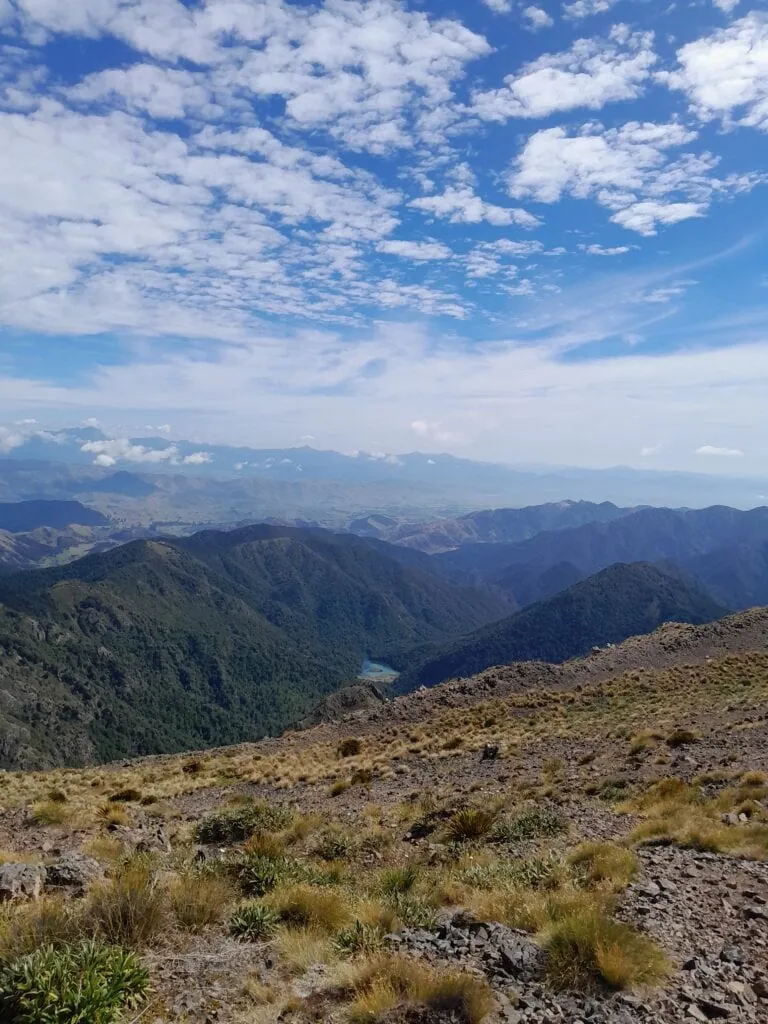
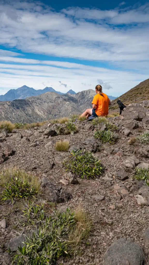
Tony wanted me to go ahead to summit Ferny Gair while he made his way up to the ridge from Penk Hut but I wasn’t going to let Tony skip the summit! I “frogmarched” him up to Ferny Gair Peak (1,670m), and the effort was well worth it. The 360-degree views were spectacular, spanning from Glenee North and South to the distant silhouettes of the Inland Kaikōura Peaks (Tapuae-o-Uenuku, Mt Alarm, and Mitre Peak).
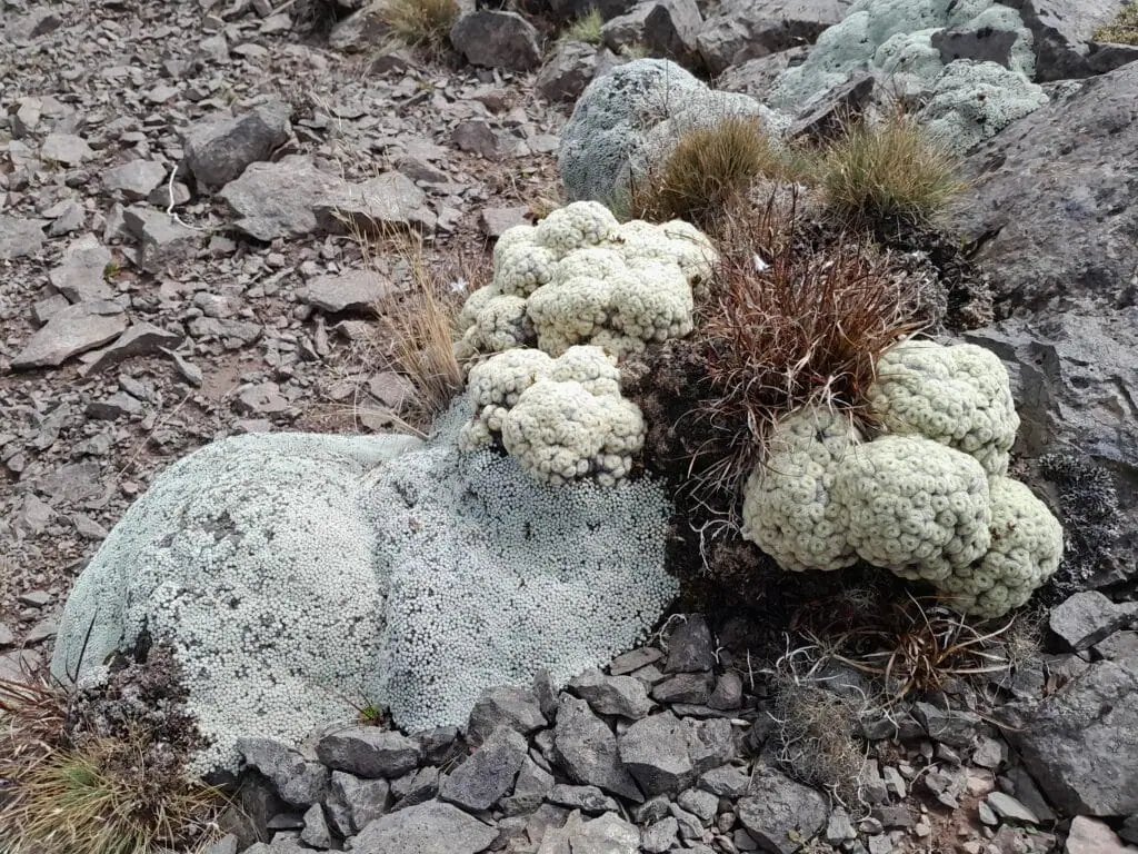
I enjoyed the vegetable sheep (raoulia) along the ridgeline. These alpine plants have always fascinated me by how intricate they are.
Geographically Embarrassed
The return trip from Wild Sheep Saddle into the valley informally called “Parakeet Valley” proved a bit more challenging. This section of the Lake Alexander route was rough, with significant windfall slowing our progress.

Near the end of what had been a long day, we hit a moment of confusion and what I call “geographical embarrassment.” My topo map suggested we had missed a junction and were heading east toward Pig Whare Saddle. After a few minutes of confusion, I remembered that Bernie had provided us with a paper map with the trails marked and some handwritten notes. I then realised that the track had been rerouted and the map I was using had not been updated.
Top Tip: The marked trail differs in a few places from what is shown on the digital topo map. Bernie can provide a map showing the correct marked trail. This happens about 300m away from the Pig Whare Saddle Junction. The track clearly crosses the creek and heads away from the creek before joining back up with it again.
The ‘Resort’
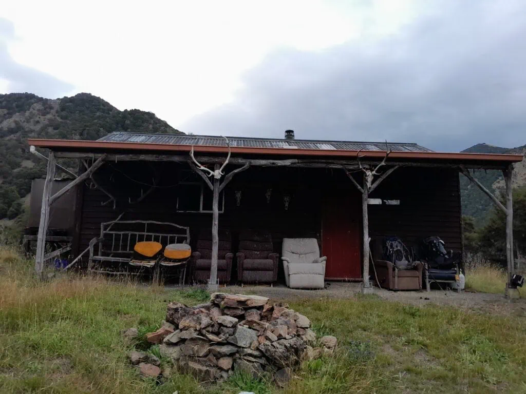
Confident we were moving in the correct direction, the track crossed by the DoC land boundary back onto Bernie’s property, passing a hunting hut before hitting a 4WD road. Bernie had mentioned a spot called “The Tummil Ridge Resort”—a private hut complete with solar power and gas, located just above the start of the DOC track. He had generously given us permission to use this. Exhausted but determined, we tackled one last hill to get there. Reading the hut book at “The Resort” was the perfect end to another rugged adventure in Ferny Gair Conservation Area.
Day 1: To Lake Alexander Hut via Lake Alexander Route from Avondale Road – 5hrs, 687m elevation, 13.7km
Day 2: Lake Alexander Hut to Penk Hut via Wild Sheep Saddle – 6-8hrs, 1,076m elevation, 8.67km
Day 3: Penk Hut to Tummil Hut (private) via Ferny Gair Peak – 10-11hrs, 1,556m elevation, 17km
Day 4: Tummil hut out to Avondale road – 1.5hrs, 95m elevation, 7km