
Fast Facts Planning Information
- Location: Kahurangi National Park
- Topo50 Map: BP 24 Takaka
- Duration: 2 days, 31.6km, 2,318m elevation gained
- Difficulty: Moderate due to off track navigation required beyond Lake Sylvester. However, there is a well-worn foot trail and plenty of rock cairns and the ridgeline from Iron Hill is easy to navigate especially since Diamond Lake is visible when descending towards it. The Diamond Lake Stream Trapline trail is also well marked. Stream crossings are all unbridged along the trapline.
The detour up Mt Lockett is advanced as it requires off track navigation and a far more technical scramble - Start / Finish: Cobb Dam Road (off SH 60 at Upper Tākaka)
- Road Access: The road is unsealed from the Cobb Power House. The road is narrow, has steep drop offs and can be difficult to pass another vehicle – care is required and 4WD is recommended in winter due to ice and or snow. The road is 28km.
- Direction: Can be walked in either direction but would recommend heading towards Lake Sylvester first to get the climbing and open ridgeline done while fresh
- Huts: Sylvester Hut (serviced, bookable, 12 bunk hut), Trilobite Hut (standard, 12 bunks)
- Camping: Plenty of camping spots around all the lake with multiple camping spots under the beech trees next to the outlet of Lake Lockett with a long drop toilet nearby. Plenty of camping next to the top end of the Cobb Reservoir with long drop toilets and no camping fees required
- Best Season: November – April due to warmer weather for swimming and longer daylight hours
- Dogs: No. National Park rules apply
- Other Trips in Kahurangi National Park: Matiri Range & 1000 Acre Plateau via the the Haystack & Needle; Mt Owen via Bulmer Lake
Our Route Overview
| Section | Time (hours) | Elevation Gained (m) | Distance (km) |
| Sylvester Lakes Track carpark → Lake Lockett | 7 | 1,342 | 17 |
| Lake Lockett → Sylvester Lakes Track carpark with trip up Mt Lockett | 6 | 976 | 14.6 |
Sylvester Hut and Lake Sylvester
The DOC track starts from the northern end of Cobb Valley at the Cobb Dam and it is an easy, non-technical 500-metre climb on the Sylvester Lakes Track through beech forest to Sylvester Hut. Anne and Lynsey were both wearing unicorn headbands—you never quite know what to expect on a club tramping trip!

Passing Sylvester Hut, we continued towards Lake Sylvester and its smaller sibling, Little Sylvester Lake. These were the first two of the seven lakes we would pass over the two-day Lake Sylvester & Lake Lockett Loop/Lockett Lakes Loop.
Iron Lake & Iron Hill
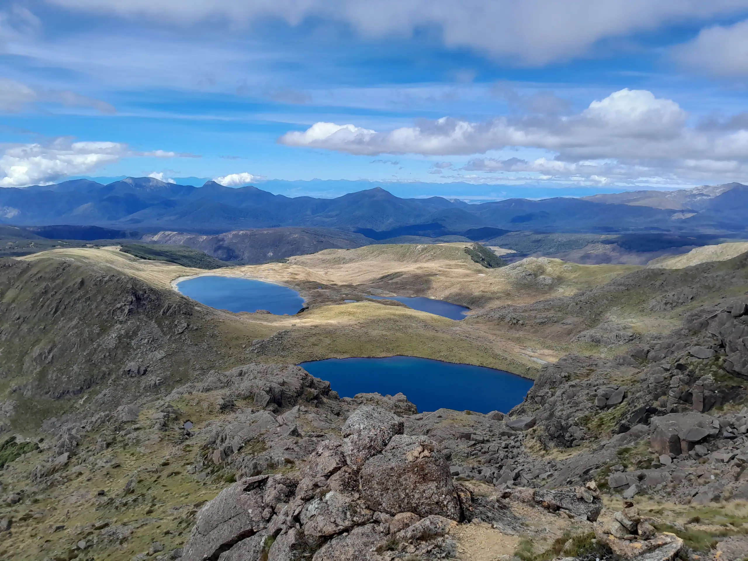
The official DOC track ends at Lake Sylvester, but a well-worn foot trail marked by rock cairns continues all the way up to the summit of Iron Hill. We stopped for lunch near the outlet of Iron Lake before continuing the climb towards Iron Hill. The view from the summit back down towards Lake Sylvester, Little Sylvester Lake, Iron Lake and the Cobb Valley was spectacular. This section would be well worth doing as a day trip in its own right.


Iron Hill to Diamond Lake
The ridgeline towards Point 1631 above Lake Lillie was a fun scramble. Nothing technical, but the narrower ridge required a little more concentration and made for an enjoyable section of the route.


A few of us continued further along the ridge to get a better view of Ruby Lake, before descending towards Diamond Lake.

This section was more awkward, with uneven terrain, thick tussock, spaniards and high vegetation making it difficult to see our feet – and sometimes even each other. The more usual route is to descend from Iron Hill towards Lake Lillie, before dropping down to Diamond Lake from there but we had followed the ridgeline further along to get a view of Ruby Lake.
⚠️ Route note: Descend down to the Lake Lillie outlet from the saddle between Iron Hill and point 1631. From Lake Lillie, sidle around above the bush until you are above Diamond Lake, then descend through the bush to the lake. Don’t drop down too soon, as you can end up below the lake. If you’re unsure, follow the edge of the bush around to the top of Diamond Lake and then follow the shoreline.


Diamond Lake to Lake Lockett
Once we reached Diamond Lake, we found a rough but faint trail circumnavigating the northern end of the lake. We met another group preparing to camp there for the night, while we continued along the well-marked trapline trail towards Lake Lockett.
⚠️ Route note: The first marker is on the true left 10-20m below Diamond Lake outlet. From here the trail is well marked and generally easy to follow.
We eventually reached Lake Lockett, where we found multiple fabulous campsites beneath the beech trees. The campsite is clearly a popular local one. It even has an open-air long drop toilet to help keep the area tidy.
Dinner was the usual club communal one. Anne had even organised a treat— deconstructed apple crumble, complete with unicorn and rainbow cake decorations. Tramping doesn’t get much better than that!

Lake Lockett and Mount Lockett (1,621m)
The following morning, the boys and I headed up from camp onto the ridge above Lake Lockett. This was a more technical scramble than the previous day’s ridge, and we all really enjoyed it.
At the summit of Mount Lockett, we split into two groups. One group headed back down the same way to camp, while three of us continued along the ridge.

It was cold and windy on the ridge above Lake Lockett, which gave us plenty of motivation to keep moving. As we descended towards the bush, we picked up a faint ground trail that led us towards the outlet of Lake Lockett.

Walking out on the Diamond Lake Stream Trapline
From Lake Lockett it was an easy walk down the valley on the trapline next to Diamond Lake Stream. Instead of the usual DOC orange markers, this section was well marked with red tin lids. This trail isn’t an official DOC trail but rather a trapline maintained by volunteers who are happy for people to use it at their own risk.
⚠️ Route warning: The Diamond Lake Stream Trapline crosses multiple stream crossings that could be impassable after heavy rain.
At Battery Creek the track begun an upward sidle to the quarry. Once at the quarry it was an easy 1.5km walk down the 4WD road to the carpark.
We were fortunate enough to get phone reception here so we could call the other club group. They came to pick us up so we could all spend the night at Trilobite Hut.

The Lake Sylvester & Lake Lockett loop was an easy and fun weekend trip with spectacular scenery including all 7 lakes and would be a trip I would highly recommend.