
Maitland Pass and the Ahuriri Valley will always be memorable for me because it’s the only time I have been deep in the New Zealand backcountry and been told to watch out for a llama.
“We thought the llama would be carrying your packs!”
I laughed at what seemed like a classic joke from some e-mountain bikers who passed us as we walked up the Ahuriri Valley. Half a minute later, the penny dropped: the joke was on me. There really was a llama out for a trek in the Southern Alps!
This unexpected encounter was just one highlight of an incredible 4-day tramping circuit over Maitland Pass and through the Temple & Ahuriri Valleys. If you are looking for an off track South Island adventure complete with stunning tarns, rugged boulder fields, wildlife and possibly a llama, Maitland Pass is the one.
Planning & FAQ
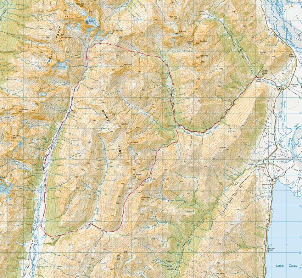
Topo50 Map: BZ14 Mount Barth
The best time would be summer-autumn due to unbridged river crossings and avalanche terrain on the passes. The Ahuriri Valley can get busy due to being shared use with horse riders and mountain bikers. Likewise, the Temple Valley can often be busy with people completing the Gunsight Pass Route. Take a tent as huts may be full. Route times, distances and climbing are embedded in the trip report.
The Ahuriri River can be impassable after heavy rain. It is safe to cross when the flow is 18 cubic metres per second (cumecs) or less. See flow here: Ahuriri River flow
Yes, you can camp at the DoC Temple Campsite at the start of the track. It is a basic campsite that requires no camping fees/bookings, has a long drop toilet, shelter for cooking, stream for water and plenty of space to camp. Dogs on leash only. Take sandfly repellent
There is plenty of parking at the start of the Temple Valley tracks. While it doesn’t have a reputation for been targeted by thieves, don’t leave valuables in cars.
Yes, plenty! Some are Gunsight Pass Loop; Dumb-bell Lake & Mt Sutton; Mt Gladwish & a loop in the Two Thumb Range from Mesopotamia over Brabazon Saddle, Inkerman Saddle, Alma Col and Balaclava Saddle
The Last-Minute Dash to Christchurch
After a postponed Stewart Island trip to the Tin Range and a gruelling week at work, I was desperate to get out into the mountains. I finished a late Friday shift and immediately booked a Sunday flight to Christchurch. I messaged my friend, Matt, at 1:00 AM
Luckily, Matt doesn’t mind stray dinosaurs—specifically a Sarahsaurus landing on short notice. He was flying back from Auckland that same Sunday, so I squeezed in a run around Mount Oxford before meeting him at the airport that night.
Day 1: Ohau Roadend to South Temple Hut
2 hr | 7.8 km | 378 m elevation gain
On Monday, we drove down to Ohau. It was humid with intermittent showers, and our packing at the Temple Campsite was thoroughly hurried along by a ravenous sandfly population.
We set off on the easy, two-hour walk to South Temple Hut. We were lucky enough to have the hut entirely to ourselves for the night. The highlight of the day was spotting a couple of riflemen (titipounamu) fluttering around the trees. Weighing just 7 grams, these tiny birds are one of New Zealand’s two surviving native wren species. Seeing them was a wonderful testament to the extensive predator trapping network we noticed all the way up the valley.
Top Tip: To get to South Temple Hut, the South Branch of the Temple Stream must be crossed. After heavy rain, this could be impassable as it is wide crossing with a fair amount of water in it.

Day 2: Over ‘Maitland Pass’ to the Spaniard Village
7- 8 hr | 11.6 km | 1,355 m elevation gain
The next morning, we backtracked to the stream just south of the hut and began climbing the grassy spur. My enthusiasm for a good climb led us a bit too high; we quickly realized that traversing would lead to getting bluffed out. Taking the sensible option, we dropped back down to the bushline and found an alternative route slightly lower down and some cairns.
Following rock cairns through the trees, we traced the stream up the valley under a blazing hot sun. The final scree climb up to the tarns tested our legs, though picking lines through the tussock made for an easier ascent.
The pass itself—nestled between points 2222 and 2090—is officially unnamed, but local trampers informally call it ‘Maitland Pass’ due to nearby Mount Maitland.
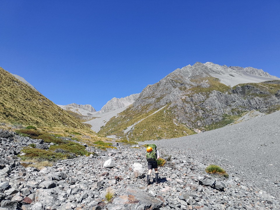
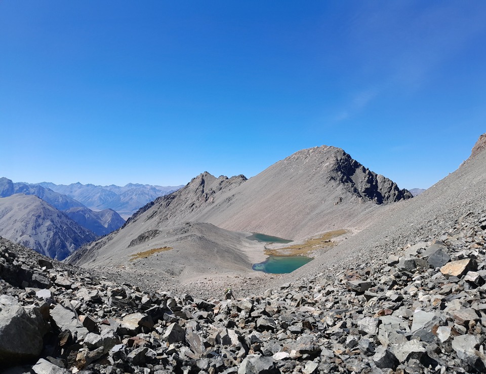
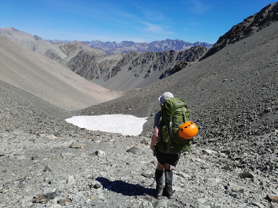
Reaching the top, we were rewarded with breathtaking views back down the valley. However, a biting alpine wind caught us on the other side. We went from t-shirts to multiple layers and gloves within minutes.
The descent was slow going over a massive boulder field that seemed endless. Finally, the boulders gave way, only to be replaced by dense “villages” of prickly spaniards (speargrass) and matagouri. Such fun!
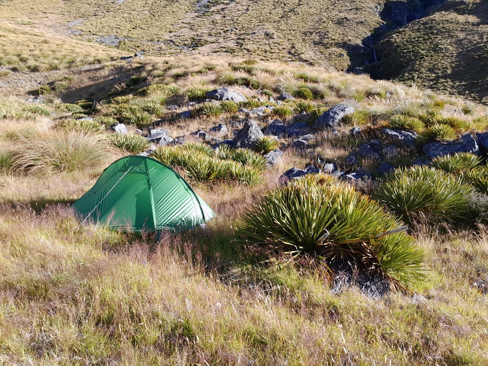
With time quickly ticking by, we decided to split the route into more relaxed days. We pitched camp at the 1,200-meter contour line. Ironically, my tent went up right next to a giant spaniard plant, which ended up providing excellent shelter from the wind filtering through the valley!
Day 3: Ahuriri Valley & The Search for the Llama
5 – 6 hr | 18 km | 301 m elevation gain
We woke to a freezing morning, but the sun finally found us as we hit Watson Stream and entered the bush, following it down on the true right. There was a bit of bush-bashing and we suspected there had probably been a bit of a foot trail here that we missed, as we later intersected one east of point 1003.
The tarn marked on the map northeast of this spot height was completely dried out, leaving only boggy ground. Shortly after, the bush opened up to an easy descent into the stunning Ahuriri Valley.
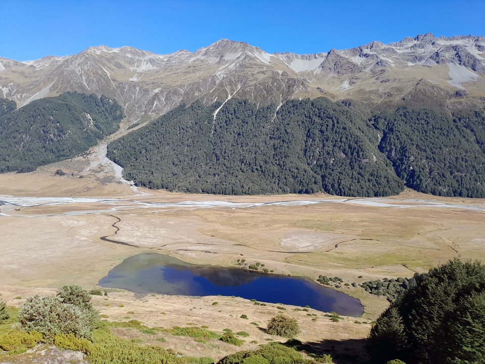
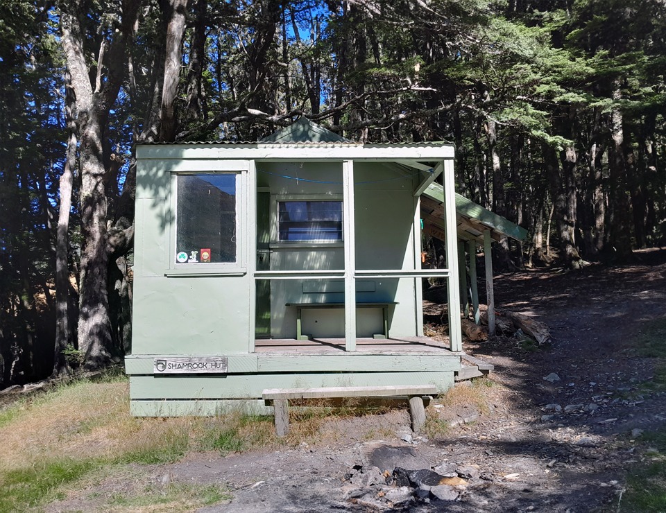
After admiring the reflections in the small lake, I convinced Matt to drop packs so we could check out the Shamrock Hut (with a name like that, how could I resist?). In the hut book, I discovered that the 2021 Cavalcade runners had come through this exact route over Maitland Pass—a neat coincidence, as I was heading to the Cavalcade right after this trip!
The Ahuriri Llama
As we resumed our walk up Ahuriri Valley Track, two e-mountain bikers passed us and dropped the comment about a llama. Apparently, someone was genuinely trekking with a llama further up the valley!
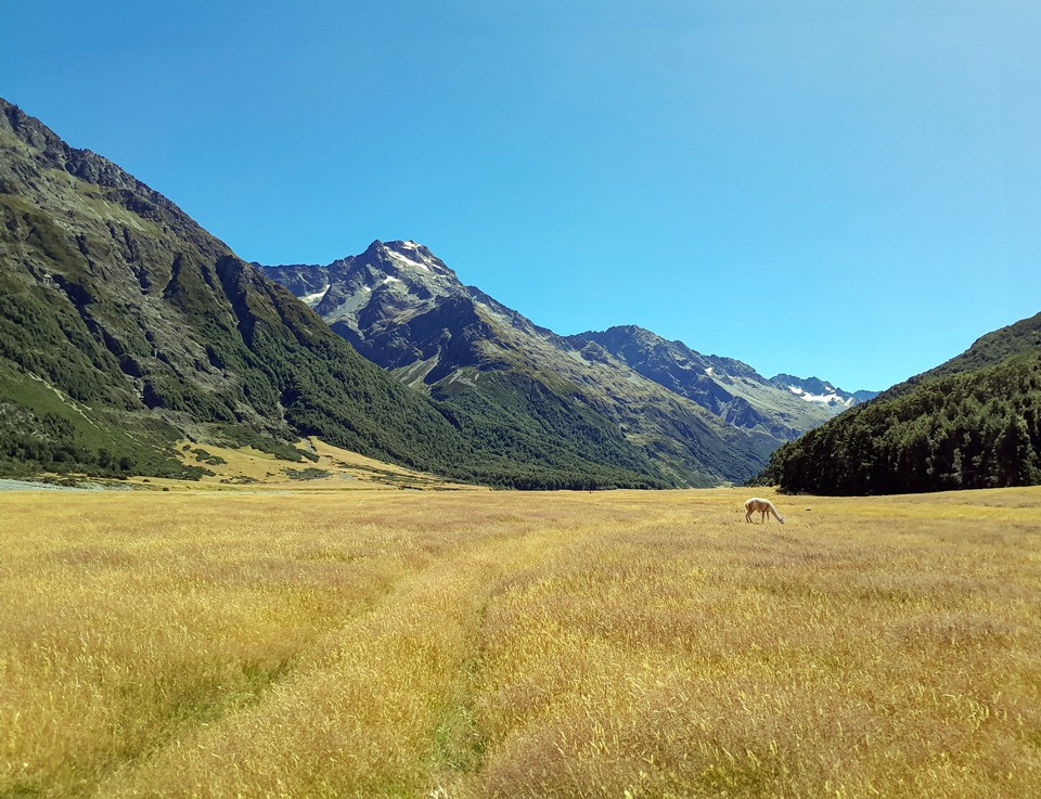
I spent the easy walk along the 4WD track toward Hagens Hut with my eyes peeled, utterly distracted by the prospect of a llama sighting. After lunch at Hagens Hut, we pushed on towards Top Hut as the 4WD track faded out next to the Ahuriri River.
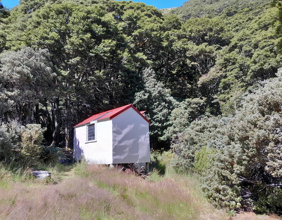
Top Hut is a charming, tiny 2-person bivvy. Expecting the mountain bikers to arrive, we planned to offer it to them and camp outside. However, when they arrived (having stashed their bikes when the pushing got too tedious), they declined as they wanted to sleep outside. So, the cute little bivvy was ours!
Still no llama though. I told Matt it would be the ultimate success if we woke up in the morning to find it simply standing in the designated horse paddock outside the hut.
Day 4 & 5: Stargazing, Banana Tarns & Temple Valley again
Day 4: 8 hr | 16 km | 1,040 m elevation gain
Day 5: 2 hr | 7.8 km | 58 m elevation gain
Unfortunately for me there was no llama in the morning, but the night had offered a spectacular, crystal-clear sky for stargazing.
We followed the river up to the head of the Ahuriri Valley. Just before the scree slopes under the towering Mount Huxley, we climbed a steep grassy spur. Realizing the Wilderness route guide was slightly off, we navigated our own way up the southernmost stream flowing from the tarns, finding reassuring rock cairns at the top.
Top Tip: If travelling in a group, be caution of the risk of moveable rocks here.
From the broad terraces, we looked across to Mount Huxley. I thought of Joe and his famous dog, Floyd. I had seen Joe and Floyd’s names in countless hut books across both the North and South Islands and joked that I was following them around the country. The book at Top Hut noted that Joe had been through in January on “Floyd’s last long trip,” retiring the legendary pup from major tramps at 12 years old.
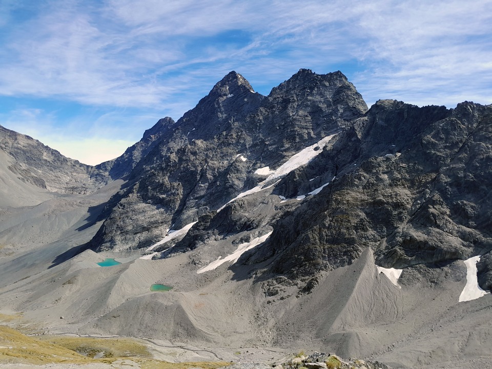
Looking down, we spotted the two tarns informally known as the Banana Tarns. They supposedly look like bananas depending on snow cover, though I couldn’t quite see the resemblance. We also could see across to the steep and intimidating V-Notch Pass—definitely a mission for the future.
Temple Valley
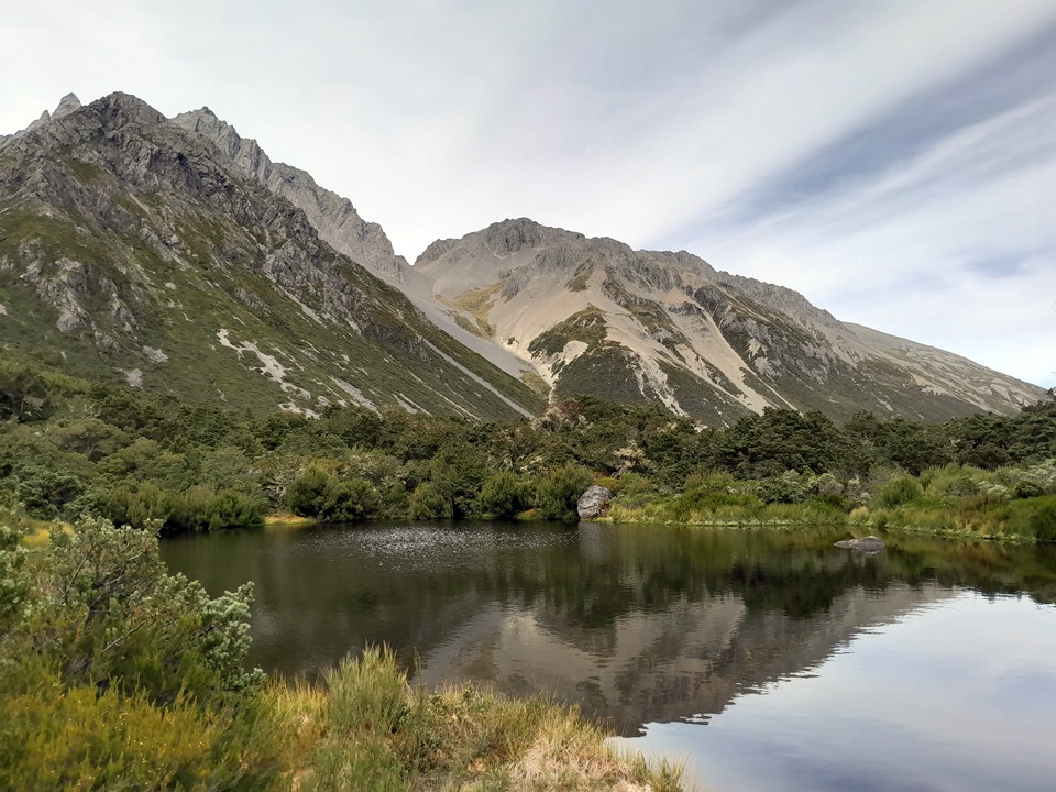
We reached our final pass (between pts 2058 and 2190) down into Temple Stream South Branch. From here, we peered up at Gunsight Pass (we’ve since returned and done this trip). We made the short detour to the small, lovely tarn hidden in the bush.
The boulder hopping down Temple Stream requires care. In heavy rain, this section would be completely impassable due to numerous required river crossings required. At one point, we had to lower ourselves and pass our heavy packs around a massive boulder.
Eventually, the riverbed gave way to the established track, bringing us safely back to South Temple Hut for our final night, leaving us with just a short, easy walk out to the car the next morning.
2 responses to “Maitland Pass – with a Llama & Bananas”
Hi Sarah, it’s Joe here.
Paul McCredie sent me this.
I’m so sorry, but I don’t recall meeting you -but I do have a rotten memory, so my bad!
Floyd does shorter trips with Casey these days. His final two big climbs were Hakatere Peak in the Arrowsmiths, and Mt Graf Spee up the Havelock.
But his finest climb, he reckons, was his summiting of Mt.Greenlaw via the E ridge two years ago. Pretty stressful for him, on a rarely climbed peak.
I think wants to take up golf now…
Cheers Sarah!
Joe & Floyd
I hope Floyd is working hard on his golf swing in his retirement! Maybe he could aim the golf balls into his Floyd Pond in the Tararua Range?
I’ve never actually met Floyd and you in person but I have really enjoyed following all the adventures you have had with Floyd & Sushi in all the different hut books. You popped up in all sorts of places! I’ve always enjoyed seeing the little pawprint in the hut books. Both Floyd & Sushi had impressive resumes as mountain dogs.
Thanks so much for your comment – it really made my day that you saw this and also the update on Floyd!
Say hi to Floyd from me 🙂