
A spectacular off-track 5 day loop in the Two Thumb Range from Mesopotamia over Brabazon Saddle, Inkerman Saddle, Alma Col and Balaclava Saddle.
The Two Thumb Range in Canterbury’s Te Kahui Kaupeka Conservation Area offers some rugged and remote tramping experiences through impressive, glacial valleys.

A rewarding stop at Mount Somers Village
Our recent mission started with a bit of unexpected drama at the airport—a dead rental car battery! Thankfully, after an upgrade to a hybrid, we were finally on our way towards Mesopotamia Station.
On our way, we stopped at Mount Somers Village for lunch. A few years ago, a station owner reached out to me after reading my Mt Potts trip report. They wanted to use one of my photos for a community project. Seeing my photo of Lake Clearwater on the new information sign was fantastic. I hope it inspires more people to explore this stunning area of the Canterbury high country and enjoy it as much as I do.

Mesopotamia and Bush Stream in the Two Thumb Range

At Bush Stream track carpark we came across two gentlemen prodding the matagouri bushes with sticks. They had hidden their keys in a bush and then promptly forgot where they had stashed the keys. We helped them in their search but had no luck. I suspect it was like looking for a needle in a haystack (there is a tramp where you can look for a needle in a haystack!)
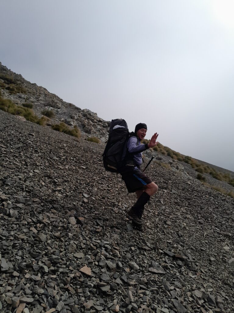
The route up Bush Stream follows a section of the Te Araroa Trail. As we followed the valley, occasionally crossing Bush Stream, we met a couple of thru-hikers.
Top Tip: You don’t need to criss-cross Bush Stream between every marker. The stream bed changes constantly so just pick the easiest route. In spring or during snow melt, time your crossings for the morning. Be prepared to wait if the levels are high. Even in low flows, the stream is relatively deep and can be mid-thigh in some areas.

We eventually found a perfect camp on a high river terrace. Surrounded by delightful tiny toadstools like from a fairytale and plenty of dead beech for a fire, we boiled the billy and toasted marshmallows as the sun dipped.

Crooked Spur Hut & Brabazon Saddle

As we climbed a steep ridge to bypass a gorge in Bush Stream, the clag started to roll in. The final climb through beech forest to Crooked Spur Hut was still used for mustering right up until 2009. We arrived at Crooked Spur Hut in a blanket of mist. It was a surprise to find the hut so tidy despite how busy it had been over the Te Araroa season.
Top Tip: The last crossing of Bush Stream requires care to find a safe place to cross. It may be necessary to cross either up or down from the orange track marker on the other side depending on river flow
Top Tip: There is no water tank at Crooked Spur Hut but there is a stream very close to the hut.


We climbed up to Brabazon Saddle in the clag, occasionally getting glimpses of the large, glaciated valley. A brocken spectre formed behind us. Once at Brabazon Saddle it was a fun descent down scree to Black Birch Creek. Anne and Matt had talked about sidling at the 1,200m contour line to avoid a gorge and some bluffs. However, we ended up following the stream down as it was easier walking with some animal trails. We did have to navigate through some bluffs and gullies lower down the valley but it was relatively easy and I would take the same way again.


A night in the Dog Kennel
We were pleasantly surprised by Dog Kennel Bivvy. Tony had described it as derelict on his last visit. Clearly it has since been refurbished and even featured four camp chairs. Perfect for our group! Matt decided he would make the Dog Kennel his home for the night! I don’t think he had misbehaved but he still ended up in there anyway……..

Inkerman Saddle & the Spikey Descent

Tony promised us that the next day the clag would be gone, replaced by sun. Initially it looked like his prediction was completely wrong but as we climbed to Inkerman Saddle the cloud started to clear, revealing another cloudy form – Cloudy Peak Range. We now had views right across to Brabazon Saddle where we had climbed through the previous day. It truly was spectacular country. The big valleys with towering peaks made me feel so small and awestruck by it. Tony described it as “like the Raglan Range on steroids.”

Top Tip: There was one gorge section in the stream that was a bit more challenging through. We passed packs to make it easier. However, I also saw afterwards we could have climbed up the stream next to it and circled around behind the bluff

The descent into Alma Stream was a battle through thick tussock and prickly spaniards (Aciphylla colensoi) while finding some mountain ribbonwood trees still with their beautiful white flowers.


The Midnight Kea Party & their Loot
The bush in Alma Stream was dense, so we had to camp out in the open on the stream bank. There were a few kea flying noisily around. I thought that they would not bother us because the valley was more remote with not many visitors. How wrong I was!
We woke up in the middle of the night to a cheeky kea causing absolute mayhem. It had boldly stuck its head under all our tents and secured a loot from each one of us. Shoes, socks, inner soles, crocs and sit pads were strewn all around our campsite. We had to spend time the next morning searching for the inner sole from one of Matt’s boots that the cheeky kea had pulled out and dragged away. Luckily, we recovered everything, and Matt’s tent only suffered a few beak holes as a parting gift from the cheeky kea.

Alma Col & the Greek Mythology Inspired Valley
Leaving Anne and Tony to take a shorter and more relaxed route, Matt and I pushed on toward Alma Col (2,139m). After navigating extensive and what felt like endless villages of spaniards, who were clearly having a fantastic summer (I deeply regretted my lack of gaiters!), we hit the final climb to the col. This part was really energy sapping with moveable boulders and scree although I managed to make it easier by sneaking up the permanent snow for some of it.
Top Tip: Heading up Alma Stream towards Alma Col, we found that the scree slope at the edge of the tussock and spaniards on the true right of the stream was much easier walking.


Reaching the Col at 2,139m was the highlight of the trip, offering panoramic views west towards Aoraki/Mt Cook and Mt Sibbald; and east towards the Rangitata River.

The descent into Trojan Stream was another “Boulder Bashing Olympics” session. We were soon going to be great at the Boulder Bashing Olympics like our friend Emily. We spent the afternoon identifying peaks, cols and basins with names from Greek mythology related to the Trojan War: Achilles, Cassandra, Iliad, Odyssey, Priam, Ajax, Tantalus, Athene and Electra.

We found a good campsite in North East Gorge Stream just under 1km from the confluence of Trojan and North East Gorge Streams. It was lovely watching the last of the sunlight (the “magic hour”) on Stag Saddle ridge that the Te Araroa follows and hearing the kea (no loot for them this night though!)

The Sisyphus Climb: Balaclava Saddle
Our final challenge was Balaclava Saddle. We got an early start knowing the wind was picking up gale-force winds later in the day. There were a number of moveable rocks in the stream and first part of the climb so we had to be careful of our lines. The climb itself was grueling—two steps up, one slide back down. It felt like the eternal punishment of Sisyphus, rolling a boulder uphill to near the top only to have it slide back down. The saddle seemed to be getting further away rather than closer…..I hoped having my footsteps to follow would make things a bit easier for Matt. However, I’m sure he, like me, was also rethinking his life choices about our route. Eventually we made it to what we thought was the obvious saddle, only to realise we were slightly to the east of it!


The Growler
The descent down the Growler Stream was easy travel until we came to a gorge 2km before the confluence of the Growler with the Havelock River. Luckily, we found a few rock cairns that guided us through a foot trail that climbed up around the gorge.
Top Tip: To bypass the gorge, stay on the true left of the Growler. It is marked sporadically by cairns and a ground trail


A Shortened Walk Out Thanks To Trail Magic
We arrived at Growler Hut to find it busy with tahr hunters for Easter weekend. With high winds and dust storms, we decided to push on all the way back to the car. It was going to be a very long walk along a 4WD road. Luckily, a ute passed us near Black Hut and kindly offered us a lift.

We eventually reunited with Anne and Tony, who were safely tucked away under the poplar trees back at the start of the Bush Stream Track. In the morning we woke up to a fiery sunrise and the forecasted rain started just as we got back to the car.
Another classic New Zealand back country adventure that has inspired me to return to explore the Two Thumb Range and Te Kahui Kaupeka Conservation Area more.

Trip completed in March/April 2026
Day 1:Bush Stream Track to campsite – 7.1km, 2hr, 198m elevation
Day 2: Bush Stream Campsite to Dog Kennel Biv via Brabazon Saddle – 13.3km, 6-8hr, 1,438m elevation
Day 3: Dog Kennel Biv to Alma Stream via Inkerman Saddle – 8.7km, 5-6hr, 761m elevation
Day 4: Alma Stream to North East Gorge Stream via Alma Col – 10.3km, 7hr, 1,198m elevation
Day 5: North East Gorge Stream, over Balaclava Saddle to just before Black Mountain Hut where picked up by ute – 19k, 7-8hr, 900m elevation