The Sawtooth Ridge has long been whispered about in New Zealand tramping circles as the “Broken Axe Pinnacles on steroids”—a jagged, formidable spine in the Ruahine Range that demands both respect and steady nerves. Eager to see if the reality matched the intimidating reputation, Anne and I set off on a weekend mission that began with 85km/hr winds nearly blowing us straight into Longview Hut. But as we moved from Daphne Ridge toward the infamous Sawtooth itself, we discovered that while the views were spectacular, the “beast” of the Ruahine Range might be more bark than bite.….
Sawtooth Ridge: Does the Ruahine’s Most Infamous Ridge Live Up to the Hype?
“Like the Broken Axe Pinnacles on steroids.” The Sawtooth Ridge in the Ruahine Range has always been a point of fascination in the tramping community, demanding attention from anyone who looks at a topo map. I remember reading it once described as the “Broken Axe Pinnacles on steroids.” Anne and I decided we would check out the infamous ridge ourselves to see if the reality matched the reputation that preceded it.
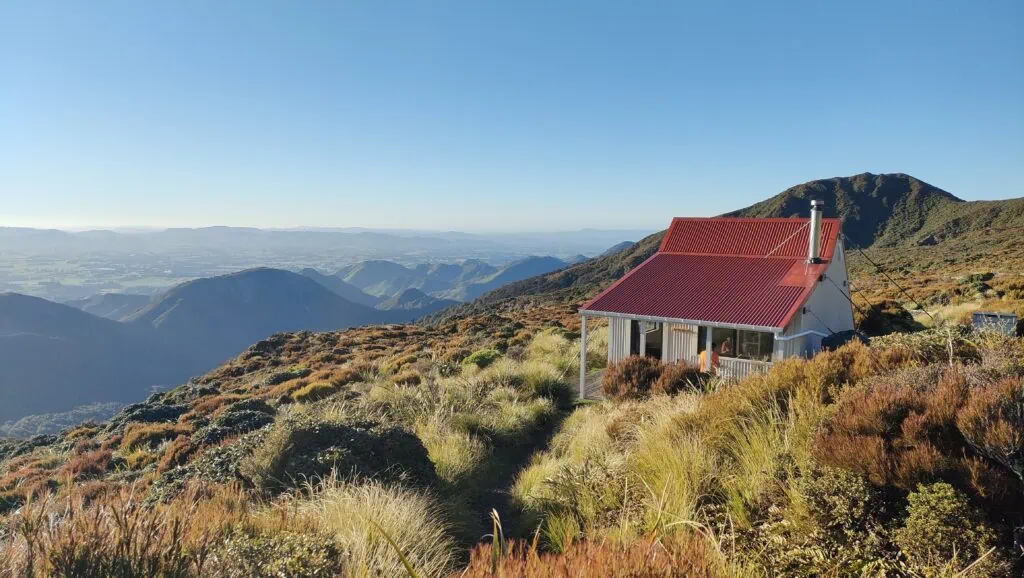
Battling 85km/hr Winds to Longview Hut
We walked up to Longview Hut on Saturday evening battling ferocious winds between 70–85km/hr. Anne joked that I could get out my bothy bag to use as a parachute and we would end up somewhere down in Napier. Eventually, the wind blew us right into the door of Longview Hut, much to the surprise of the hut’s only occupant. It turned out he was a volunteer from Ruahine Whio Protectors servicing the traps along the ridge. We had a chat about trapping in the Ruahine Range since I had been out a few weeks earlier on a Ruahine trapping trip. By the time we settled in, both our watches claimed we had done over 1,000 meters of elevation—clearly, the barometric pressure had changed with the gale and had skewed the readings!
From Otumore to Howletts Hut
After a windy night wondering if the hut would take flight despite being tied down, we woke to a very calm morning. It was a beautiful day with perfect visibility. We were on our way just after 7:00 am, starting the first climb towards Otumore, even managing to spot Mt Ruapehu and later, Mt Ngauruhoe.
It was a bit of a grovel through leatherwood on the climb to Taumatataua, but we were still very grateful for the route despite it being a bit overgrown. We stopped for an early lunch at Howletts Hut before starting along Daphne Ridge towards Tiraha. There was a good foot trail to follow, and we enjoyed the views over to Black Ridge, trying to spot where Tarn Biv would be.
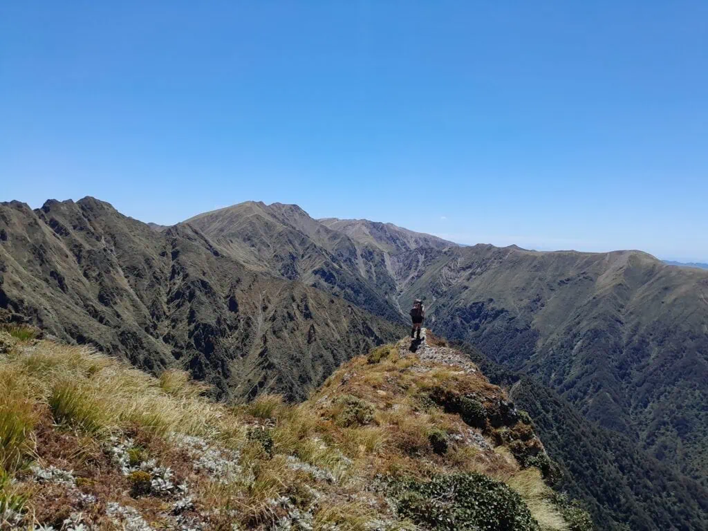
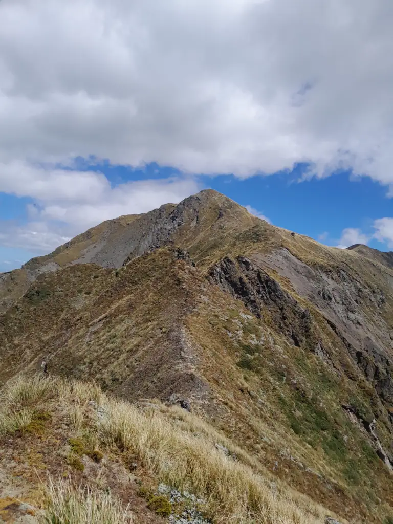
The Sawtooth Ridge: Reality vs. Reputation
I took us on what I thought might be a short cut up the climb to Tiraha. It turned out to be all “false economies” and we joked it gave us a warm up for Sawtooth Ridge since it involved a bit more scrambling.
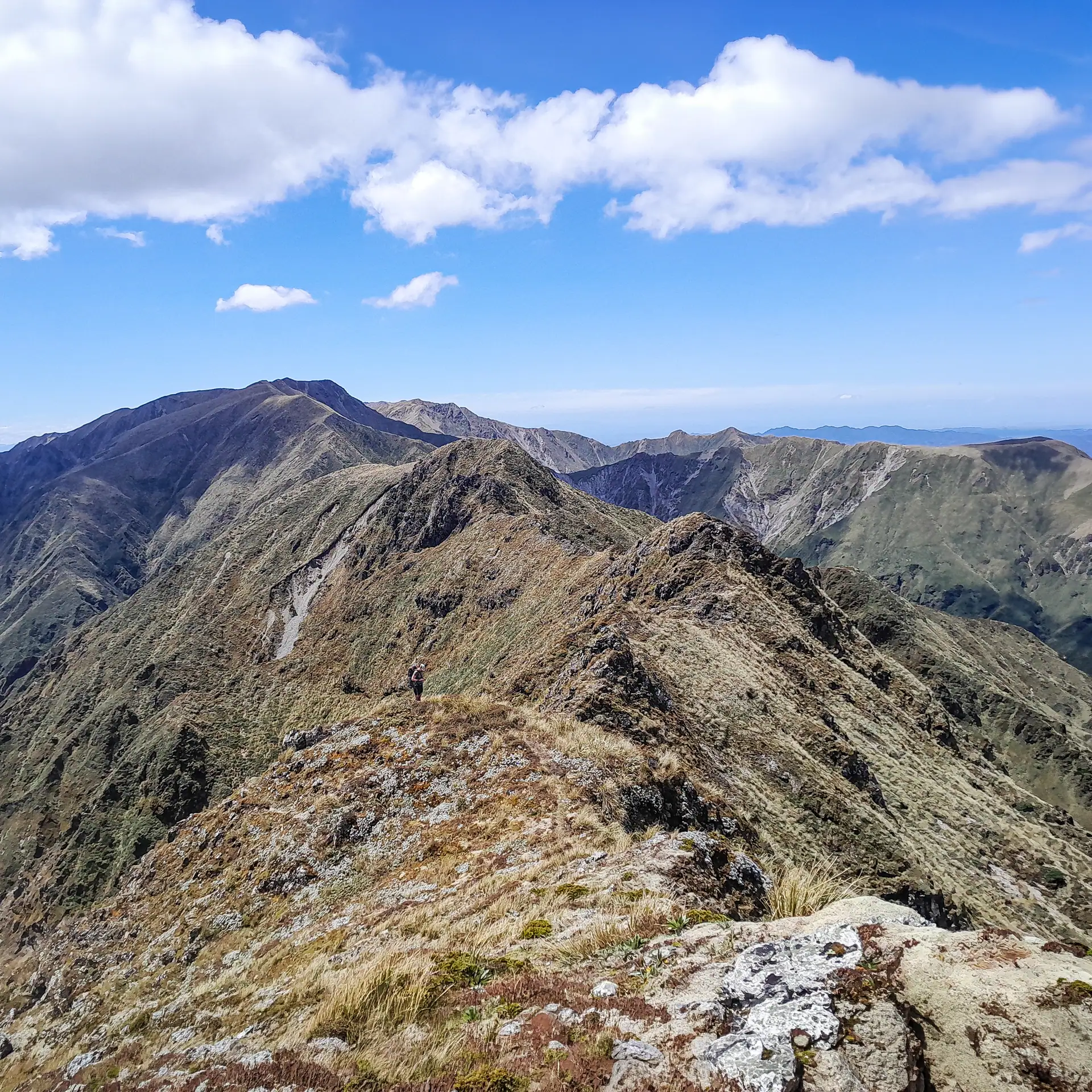
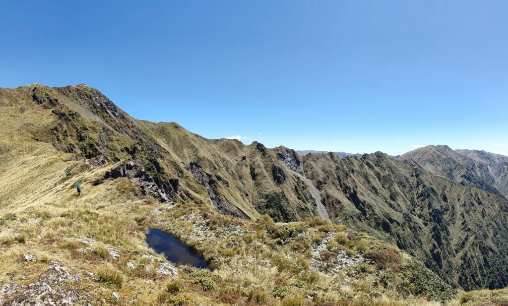
There were lots of small tarns around Tiraha and it would be a nice place to camp. We were now on Sawtooth Ridge as we started the descent from Tiraha. The ridge followed a well-established foot track, sidling around a few rocky outcrops and at the end of last one dropped down a small rocky gut. As we started the climb towards Ohuinga, we realized the Sawtooth Ridge was already behind us.
The Verdict: We both agreed that Sawtooth Ridge was a bit anti-climactic. It felt like any other ridge in the Ruahine Range. While there are a few narrow sections where those with a fear of exposure might hesitate, it was straightforward travel with a well-established trail.
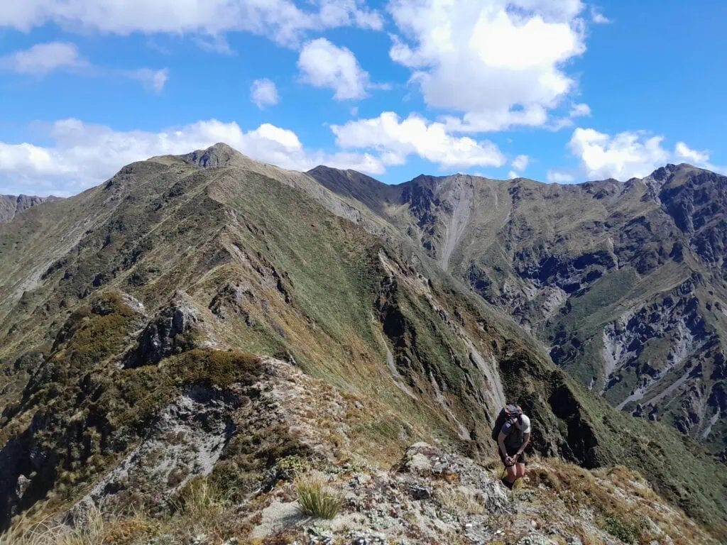
Descending to Black Ridge and Tarn Biv
I tried to sidle on the climb to Ohuinga but again ended up in a situation of “false economies” on the big slips. Anne, having wisened up to this trend, sensibly watched in amusement as I clambered up the slips to meet her.
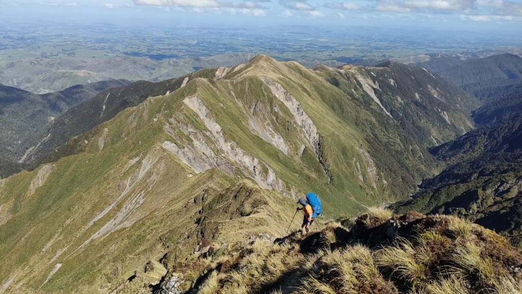
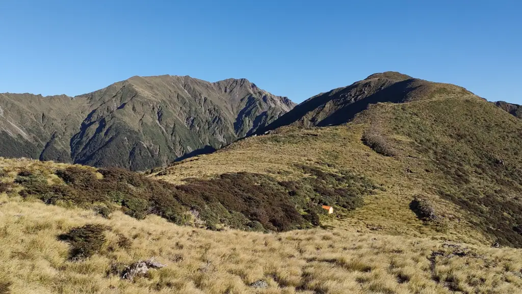
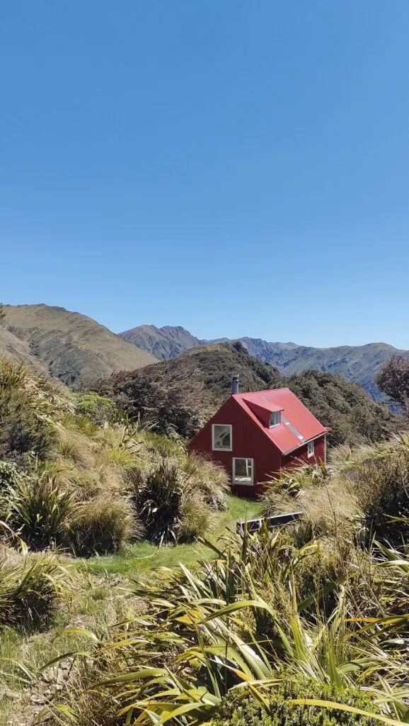
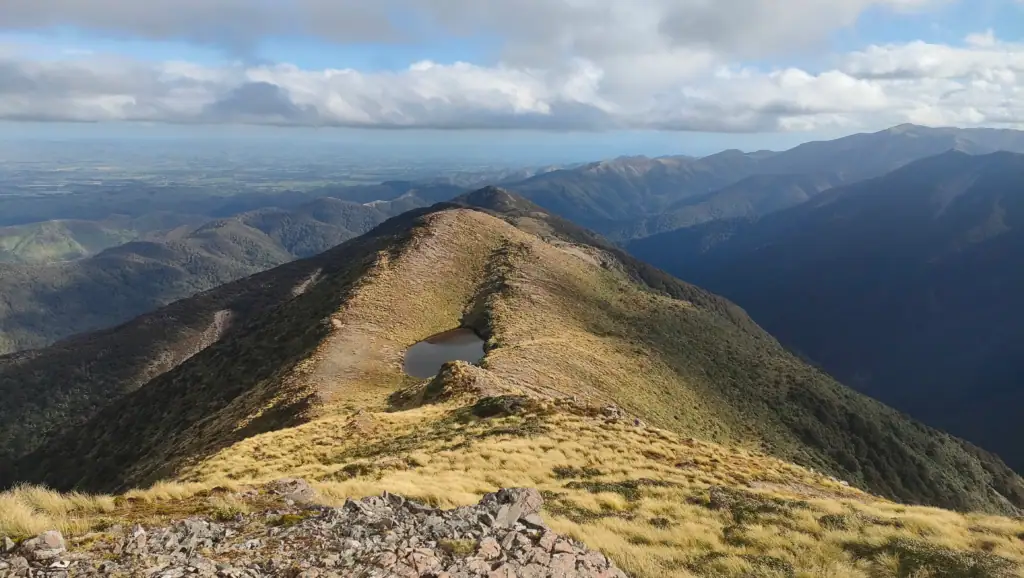
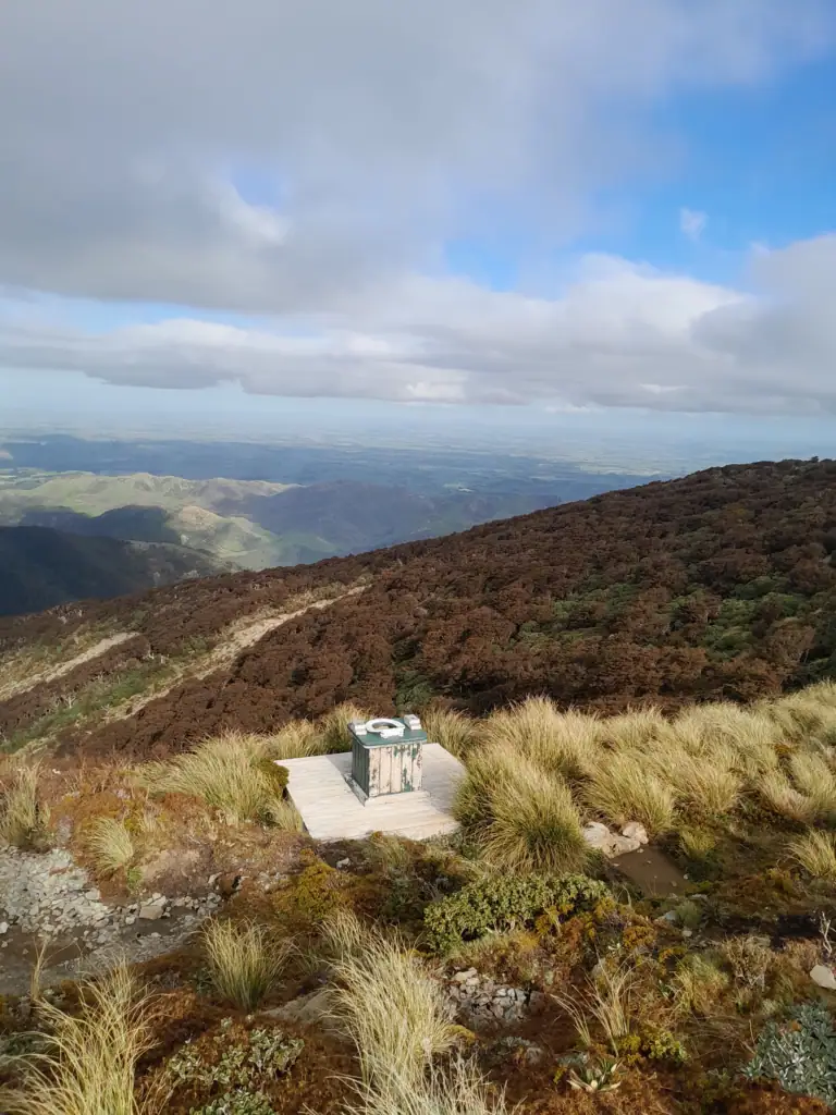
It was a steep descent onto Black Ridge with some eroded sections. The ridge eventually broadened out into a lovely big tarn about 400 meters before the Biv. Anne stopped for a swim while I promised to go ahead and get a hot drink waiting for her. Tarn Bivvy is easy to spot and hard to miss. It still features an “open-air” toilet with incredible views and plenty of ventilation! The clag rolled in as we had dinner, but cleared just in time for a game of Bananagrams under a beautiful starry sky.
The Return: Daphne Hut and the Tukituki River
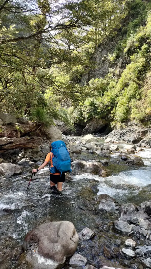
On Monday morning, we were back amongst the leatherwood before dropping down a steep and slippery track to Daphne Hut. We were hoping to spot a whio (blue duck) in the Tukituki river, but it wasn’t our lucky day. From the river, it was a final two-hour walk up and over the hill back to the car.
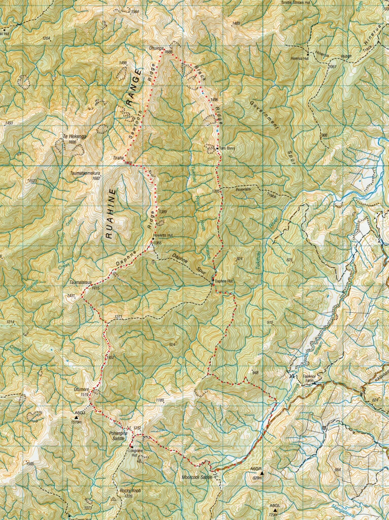
Including breaks:
- Kashmir Rd to Longview Hut: 1.25hr, 619m elevation, 4.3k
- Longview Hut Hut to Tarn Biv via Sawtooth and Black Ridge: 10.5hr, 1,818m elevation, 17.3km (Longview Hut to Howletts Hut 3hr)
- Tarn Biv to Kashmir Rd via Daphne Hut: 6hr, 774m elevation, 11.9km