Totara Flats is widely considered one of the Tararua Forest Park’s most idyllic places—a camper’s delight of grassy terraces, blooming rata, and deep swimming holes. But beneath the tranquil surface of these river flats lies a violent geological history. From ancient forests buried three meters deep to the massive tectonic shifts of the Wellington Fault that rerouted entire rivers, the landscape we enjoy today is a relatively new creation. To truly understand Totara Flats, we have to look back 400 years to a time when the mountains literally moved, reshaping the valley forever.
A Camper’s Paradise with a Hidden Past
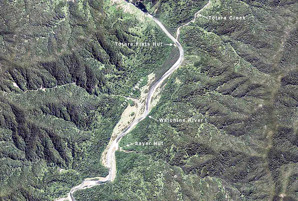
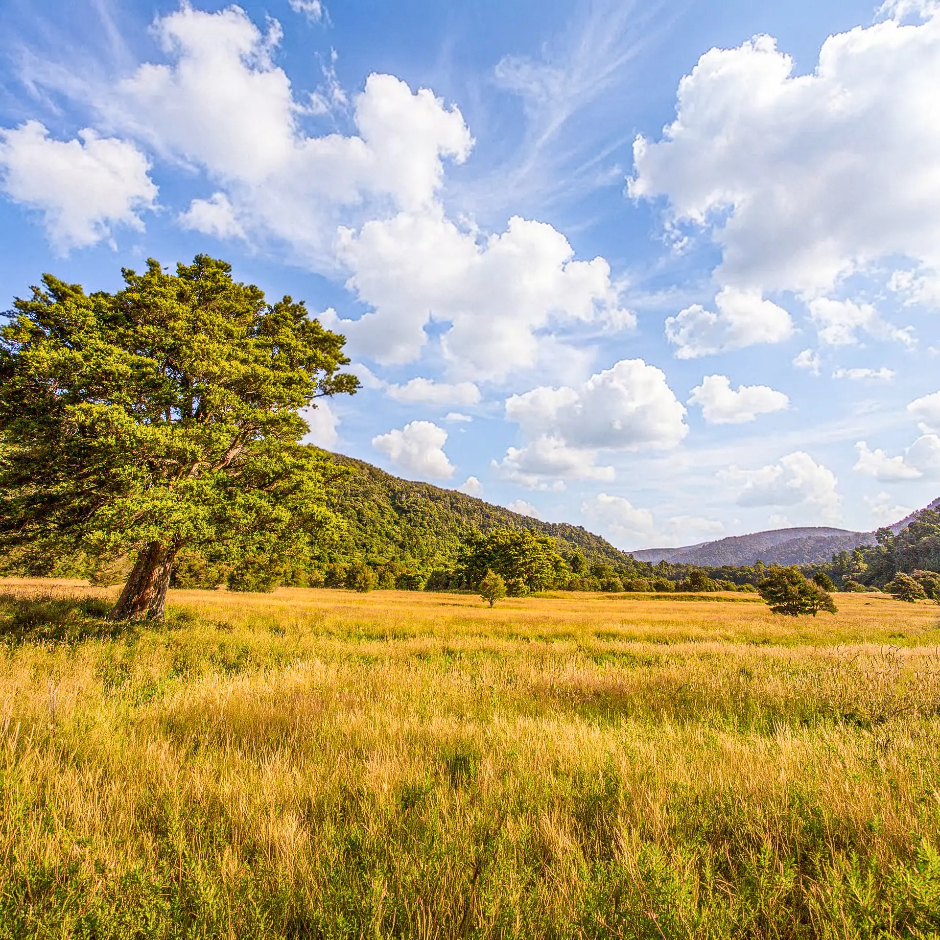
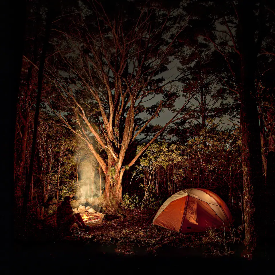
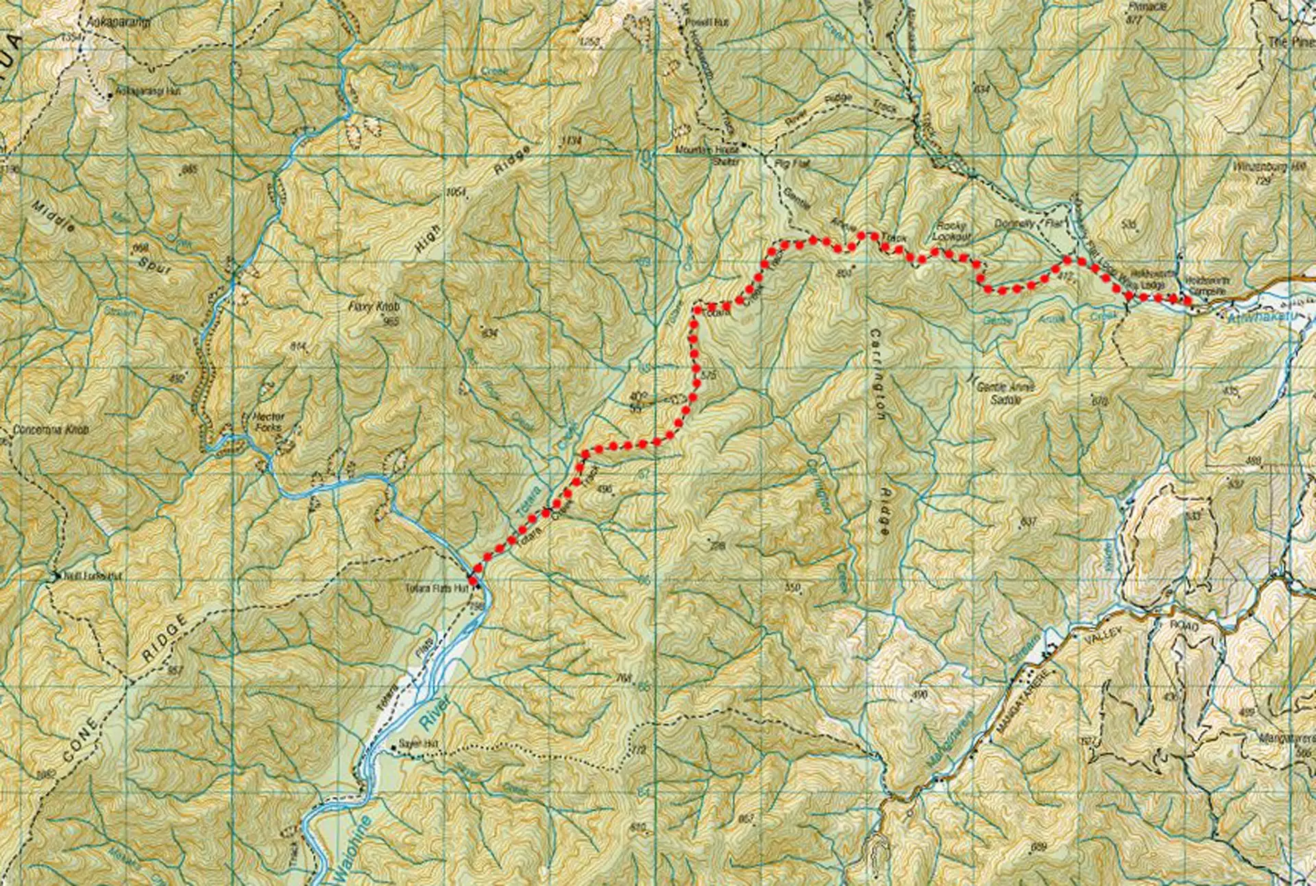
One of the nicest places in the Tararua Range for an easy tramp is Totara Flats. There are two good tracks to take you there, and the open river terrace with its stands of totara and manuka is a camper’s delight.
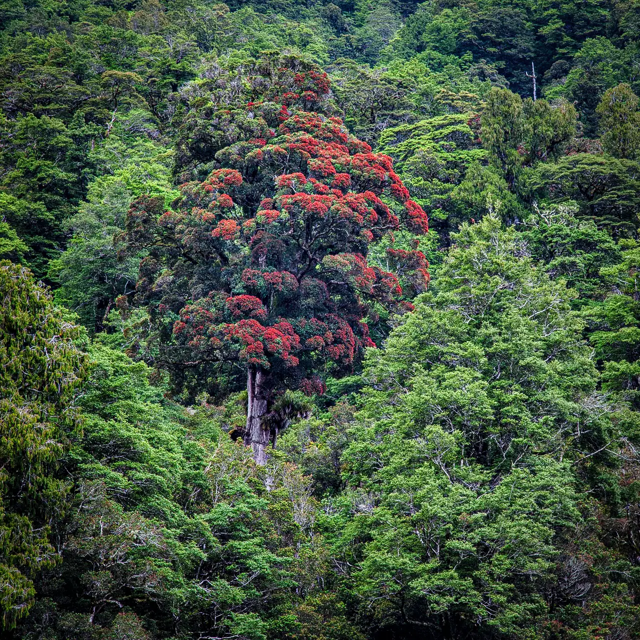
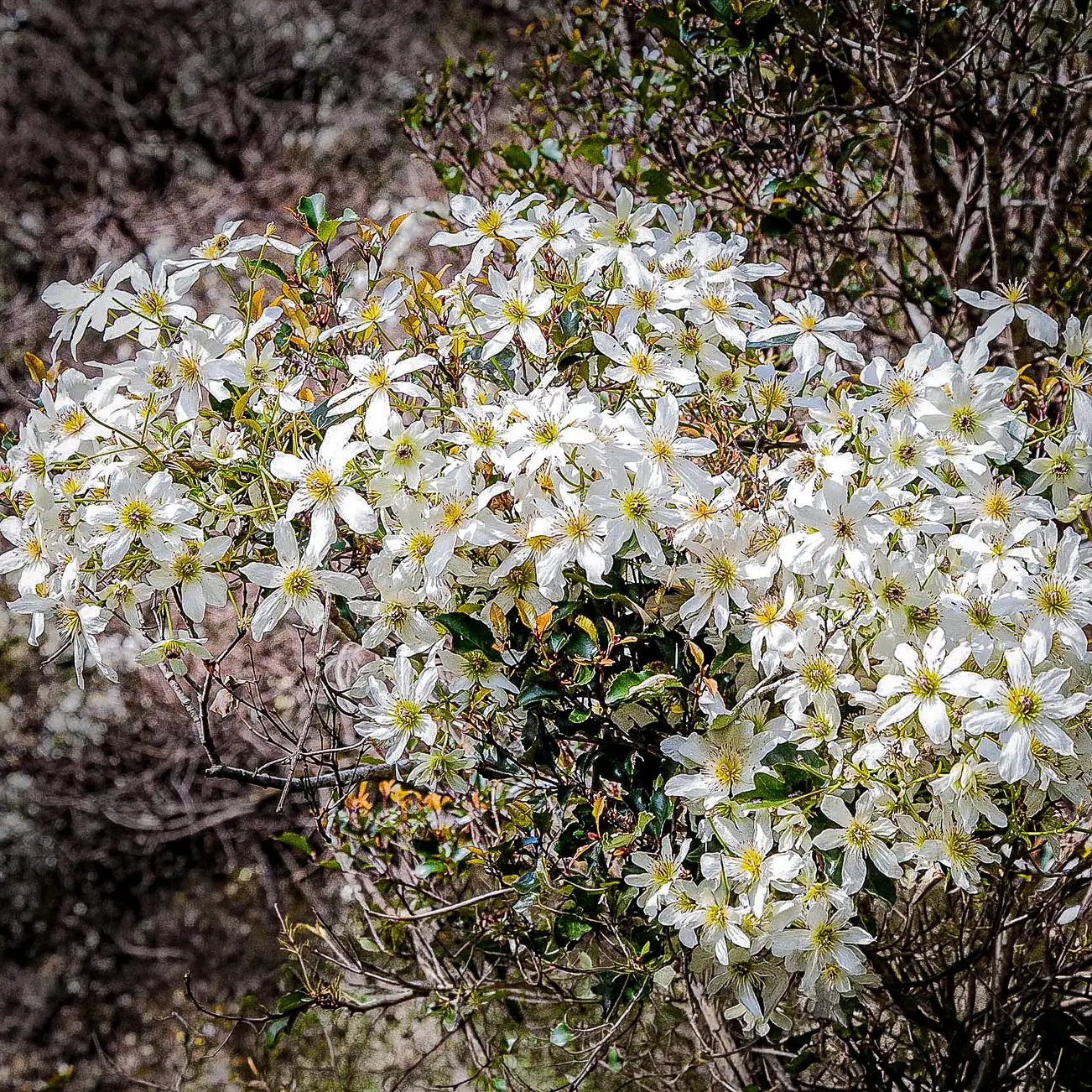
In early summer, rata trees bloom on the hillsides and native clematis covers the bushes with dainty white flowers. On a hot summer’s day, there are plenty of deep pools for swimming. In the evening, you can retire to the hut or pitch your tent, cook your tea on a campfire, and then lie back and listen to the moreporks calling across the valley.
And then, just occasionally, you may think to yourself—I wonder how this lovely place came to be here? It can’t always have been as good as this. Well, Totara Flats has a long and interesting story, so we will start at the beginning.
The Young Mountains: 150 Million Years in the Making
The New Zealand landforms that we know today, including the Tararua Range, are geologically very young. During the last ice age, only 15,000 or so years ago (hardly a blink in geological time), there were small glaciers in the Tararuas. The coastline around Wellington would have been unrecognizable—you could walk out to Kapiti Island, and rivers such as the Otaki and Manawatu had to flow an extra 40 km to reach the sea.
But well before this, the piece of continental crust that we now live on had been through some exciting times. For much of its geological history, New Zealand has been over a tectonic boundary—between the Australian and Pacific Plates, where one plate is subducting beneath the other . Over 150 million years, we have been pulled and pushed by tectonic forces, folded and faulted, lifted above the sea only to be eroded back to sea level. Then, beginning 24 million years ago, the latest in a series of mountain-building episodes gave us the landscape that we enjoy as trampers today.
The Wellington Fault: A Scar Visible from Space
Our mountains are mostly the result of uplift along a number of fault lines that traverse New Zealand, running generally south-north. One of the most significant branches of the Alpine Fault system comes ashore on Wellington’s south coast as the Wellington Fault. It carries on through Karori, under Parliament Buildings, along the western side of the Hutt Valley, and past Kaitoke (Wellington – Hutt Valley segment). From there, it takes a 2 km side-step to the east, runs up the Tauherenikau Valley, over Cone Saddle, and right through our lovely Totara Flats, and on to Putara (Tararua segment).
This fault is a defining feature of our landscape; it is obvious on aerial photos and can even be seen from space. When faults move, they cause severe ground shaking, often resulting in major landslides. At Totara Flats, it has been no different.
The Mystery of the Southward Kink at Totara Flats
After a few trips into the Tararuas, you may notice that most of the main rivers on the Wairarapa side start by running east, then suddenly turn south for about 7 km, before turning back again to the east. Have you ever wondered why?
Additionally, you may have noticed dead, weathered stumps sticking just above the grass at Totara Flats. The answer to these two observations explains exactly why the flats exist.
Geologists decipher clues left by fault movements to estimate last active dates. While the most recent movement of the Wellington Fault is well-documented—occurring approximately 400 years ago on the Wellington – Hutt Valley segment, and 240 years ago on the segment from Putara northward—the Tararua segment in between remained a mystery. However, recent boreholes sunk at Totara Flats have finally provided a clearer picture. We now know the most recent movement of this specific segment occurred approximately 1,000 to 1,150 years ago.
If you take a Tararua map, cut along the line of the Wellington Fault, and move the western piece about 7 km south, you will find many of the rivers join up again and run directly eastwards without that southward kink. This is because over the life of the fault, the western side has moved about 7 km north relative to the eastern side, forcing the rivers to “jog” along the fault line.
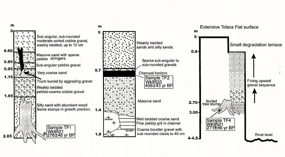
The Ghost Forest: Why Trees are Buried 3 m Deep at Totara Flats
If you were to dig a hole at Totara Flats about 3 meters down, you would find large tree stumps and roots in their original growing location. These are the remains of a healthy forest that was simply buried where it stood. Radiocarbon dating indicates these trees died about 400 years ago.
Putting it all together, we see that movements on the Wellington Fault over a million years caused the western Tararuas to shift north. The Waiohine River adjusted by flowing south along the fault, and on the terraces of this section, wide-open flats formed and became forested.
The last major rupture of the Wellington to Hutt Valley segment of the Wellington Fault 400 years ago caused massive landslides in the Tararua Ranges. The debris from one of these slides buried the original forest at Totara Flats under 3m of gravel. When the river stopped depositing sediment (aggrading), a new forest developed on the higher-level flats. The Totara Flats we know today are only about 400 years old—very young compared to the 13-million-year-old Tararua Range.
Gold, Fire, and the Future of the Flats
There is one final chapter to the story. In 1878, prospectors Sayer and Potts were fossicking for gold at Totara Flats. Their campfire flared out of control and burnt sections of the “new” forest, creating the even larger open grassy areas we see today.
The end result is the Totara Flats of today: river terraces formed from the gravel debris of ancient landslides, cleared further by human hands. But this is not the end. Fault movements won’t stop just because homo tramperus has appeared on the scene.
Enjoy Totara Flats while you can. Even if humans don’t destroy them first, nature eventually will—likely trashing what is there just as it did 400 years ago. But nature also ensures something else rises in its place, even if it’s hard to imagine anything quite as good as what we have right now.
Frequently Asked Questions: Totara Flats
1. Why are the flats so much “younger” than the mountains around them? While the Tararua Range began rising millions of years ago, the specific terraces we walk on today were created just 400 years ago. Massive landslides triggered by tectonic movement buried the old valley floor under three metres of gravel, essentially “resetting” the landscape and allowing a new forest to grow on top.
2. What happened to the forest that was there before the 400-year-old one? It is still there—under your feet! Geologists found ancient tree stumps and roots preserved in their original growing positions three metres below the current surface. These “ghost forests” were drowned in gravel so quickly that they didn’t have time to rot away before being sealed.
3. Why does the Waiohine River have that strange 7 km “kink”? The river is a victim of “tectonic transport.” Over a million years, the western side of the Wellington Fault has slid 7 km north. The river used to flow straight east, but as the land moved, it was forced to flow south along the fault line to find its original path out to the Wairarapa plains.
4. Are the open grassy areas entirely natural? Not quite. While the river terraces provided the flat foundation, the expansive clearings were significantly enlarged in 1878. Gold prospectors Sayer and Potts accidentally started a campfire that swept through the forest, clearing the way for the lush grass that makes it such a popular camping spot today.
5. How can I tell where the Wellington Fault is when I’m standing on the flats? While the fault scarp (the visible “step” in the land) is hidden by the forest about 500 metres to the west of the main flats, you can see its effects everywhere. The steep, unstable hillsides and the way the side streams enter the valley are all clues to the massive tectonic forces at work beneath the totara trees.